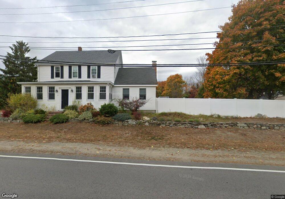
64 Ferry Rd Newburyport, MA 01950
Estimated Value: $1,116,000 - $1,424,000
4
Beds
2
Baths
2,128
Sq Ft
$575/Sq Ft
Est. Value
About This Home
This home is located at 64 Ferry Rd, Newburyport, MA 01950 and is currently estimated at $1,223,728, approximately $575 per square foot. 64 Ferry Rd is a home located in Essex County with nearby schools including Francis T. Bresnahan Elementary School, Edward G. Molin Elementary School, and Rupert A. Nock Middle School.
Create a Home Valuation Report for This Property
The Home Valuation Report is an in-depth analysis detailing your home's value as well as a comparison with similar homes in the area
Home Values in the Area
Average Home Value in this Area
Tax History Compared to Growth
Tax History
| Year | Tax Paid | Tax Assessment Tax Assessment Total Assessment is a certain percentage of the fair market value that is determined by local assessors to be the total taxable value of land and additions on the property. | Land | Improvement |
|---|---|---|---|---|
| 2025 | $9,478 | $989,400 | $400,600 | $588,800 |
| 2024 | $9,093 | $912,000 | $364,100 | $547,900 |
| 2023 | $8,955 | $833,800 | $316,600 | $517,200 |
| 2022 | $8,299 | $691,000 | $263,800 | $427,200 |
| 2021 | $7,930 | $627,400 | $239,900 | $387,500 |
| 2020 | $7,630 | $594,200 | $239,900 | $354,300 |
| 2019 | $7,772 | $594,200 | $239,900 | $354,300 |
| 2018 | $7,453 | $562,100 | $228,500 | $333,600 |
| 2017 | $7,169 | $533,000 | $217,600 | $315,400 |
| 2016 | $7,102 | $530,400 | $207,200 | $323,200 |
| 2015 | $7,076 | $530,400 | $207,200 | $323,200 |
Source: Public Records
Map
Nearby Homes
- 6 Boyd Dr
- 12 Roosevelt Place
- 30 Dorothy e Lucey Dr
- 8 Brown Ave
- 20 Cushing Ave
- 510 Merrimac St Unit 512
- 572 Merrimac St
- 6 Woodman Way Unit 402
- 6 Woodman Way Unit 122
- 10 Clipper Way
- 492 Merrimac St
- 61 Clipper Way
- 17 Alberta Ave
- 42 Myrtle Ave
- 19 Jefferson St
- 18 Hawkswood Estates
- 29 Columbus Ave
- 486 Main St
- 10 Rawson Hill Rd
- 138 Low St