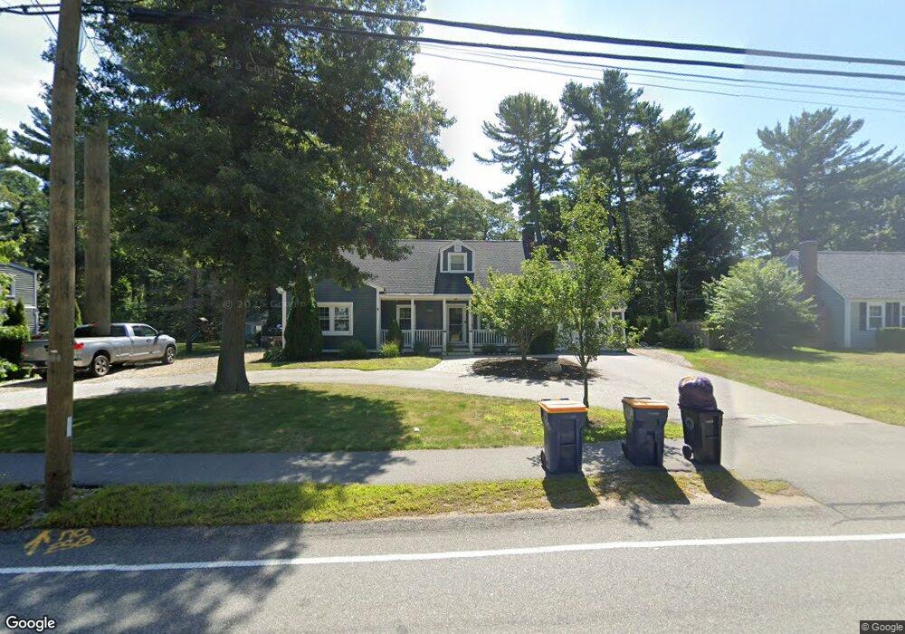
64 Grove St Norwell, MA 02061
Estimated Value: $701,000 - $787,156
3
Beds
2
Baths
1,932
Sq Ft
$385/Sq Ft
Est. Value
About This Home
This home is located at 64 Grove St, Norwell, MA 02061 and is currently estimated at $743,789, approximately $384 per square foot. 64 Grove St is a home located in Plymouth County with nearby schools including Grace Farrar Cole Elementary School, Norwell Middle School, and Norwell High School.
Ownership History
Date
Name
Owned For
Owner Type
Purchase Details
Closed on
Aug 3, 2022
Sold by
Stevens Paul and Stevens Jessica B
Bought by
Stevens Ft and Stevens
Current Estimated Value
Purchase Details
Closed on
Aug 20, 2010
Sold by
Bradeen Jessica and Stevens Jessica B
Bought by
Stevens Paul and Stevens Jessica B
Purchase Details
Closed on
May 24, 2004
Sold by
Murray William R
Bought by
Bradeen Jessica
Purchase Details
Closed on
Jul 16, 2001
Sold by
Shen Jian and Shou Qi
Bought by
Giuffre Rosemary and Giuffre Anthony
Purchase Details
Closed on
Jun 30, 1997
Sold by
Bouldry Mary A
Bought by
Shen Jian and Zhou Qi
Create a Home Valuation Report for This Property
The Home Valuation Report is an in-depth analysis detailing your home's value as well as a comparison with similar homes in the area
Home Values in the Area
Average Home Value in this Area
Purchase History
We collect this data history from publicly available records. To have your information removed, we recommend requesting removal directly through your county’s website.
| Date | Buyer | Sale Price | Title Company |
|---|---|---|---|
| Stevens Ft | -- | None Available | |
| Stevens Ft | -- | None Available | |
| Stevens Paul | -- | -- | |
| Stevens Paul | -- | -- | |
| Stevens Paul | -- | -- | |
| Bradeen Jessica | $345,000 | -- | |
| Bradeen Jessica | $345,000 | -- | |
| Giuffre Rosemary | $313,300 | -- | |
| Giuffre Rosemary | $313,300 | -- | |
| Shen Jian | $174,900 | -- | |
| Shen Jian | $174,900 | -- |
Source: Public Records
Mortgage History
We collect this data history from publicly available records. To have your information removed, we recommend requesting removal directly through your county’s website.
| Date | Status | Borrower | Loan Amount |
|---|---|---|---|
| Previous Owner | Shen Jian | $35,000 |
Source: Public Records
Tax History
| Year | Tax Paid | Tax Assessment Tax Assessment Total Assessment is a certain percentage of the fair market value that is determined by local assessors to be the total taxable value of land and additions on the property. | Land | Improvement |
|---|---|---|---|---|
| 2025 | $8,237 | $630,200 | $308,500 | $321,700 |
| 2024 | $8,089 | $601,000 | $307,300 | $293,700 |
| 2023 | $8,119 | $531,000 | $273,700 | $257,300 |
| 2022 | $7,396 | $445,000 | $216,300 | $228,700 |
| 2021 | $7,731 | $456,400 | $227,700 | $228,700 |
| 2020 | $7,379 | $443,700 | $227,700 | $216,000 |
| 2019 | $7,201 | $439,100 | $223,100 | $216,000 |
| 2018 | $6,873 | $420,600 | $207,000 | $213,600 |
| 2017 | $6,407 | $389,500 | $207,000 | $182,500 |
| 2016 | $6,369 | $386,000 | $207,000 | $179,000 |
| 2015 | $5,849 | $354,500 | $199,400 | $155,100 |
| 2014 | $5,599 | $342,000 | $188,900 | $153,100 |
Source: Public Records
Map
Nearby Homes
- 87 Franklin Rd
- 18 W End Way Unit 18W
- 3 Brattle Rd
- 214 Washington St Unit 28
- 239 Washington St Unit 20
- 1154 Main St
- 107 Pond St
- 251 Prospect St
- 16 Holly Ct
- 11 Duncan Dr
- 215 Prospect St
- 283 Pond St
- 9 Douglas Ave
- 295 Gardner St
- 192 Prospect St
- 6 Presidents Rd
- 15 Leigh Rd
- 183 Gardner St
- 19 Harvest Ln
- 443 Cushing St
Your Personal Tour Guide
Ask me questions while you tour the home.