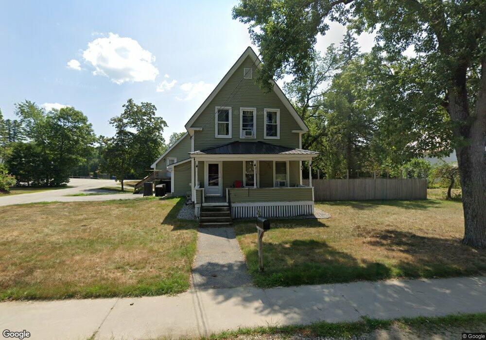
64 Main St Porter, ME 04068
Estimated Value: $218,000 - $380,000
4
Beds
2
Baths
1,664
Sq Ft
$170/Sq Ft
Est. Value
About This Home
This home is located at 64 Main St, Porter, ME 04068 and is currently estimated at $283,494, approximately $170 per square foot. 64 Main St is a home located in Oxford County.
Create a Home Valuation Report for This Property
The Home Valuation Report is an in-depth analysis detailing your home's value as well as a comparison with similar homes in the area
Home Values in the Area
Average Home Value in this Area
Tax History
| Year | Tax Paid | Tax Assessment Tax Assessment Total Assessment is a certain percentage of the fair market value that is determined by local assessors to be the total taxable value of land and additions on the property. | Land | Improvement |
|---|---|---|---|---|
| 2025 | $2,382 | $245,600 | $55,100 | $190,500 |
| 2024 | $2,698 | $226,739 | $41,183 | $185,556 |
| 2023 | $2,462 | $140,100 | $26,700 | $113,400 |
| 2022 | $2,326 | $140,115 | $26,739 | $113,376 |
| 2021 | $2,326 | $140,115 | $26,739 | $113,376 |
| 2020 | $2,281 | $140,115 | $26,739 | $113,376 |
| 2019 | $2,361 | $140,115 | $26,739 | $113,376 |
| 2018 | $2,361 | $140,115 | $26,739 | $113,376 |
| 2017 | $2,326 | $140,115 | $26,739 | $113,376 |
| 2016 | $2,116 | $140,115 | $26,739 | $113,376 |
| 2014 | $1,791 | $132,645 | $44,705 | $87,940 |
| 2013 | $1,791 | $132,645 | $44,705 | $87,940 |
Source: Public Records
Map
Nearby Homes
- 12 Main St
- 122 Ossipee Trail
- 272 Tripptown Rd
- 490 S Hiram Rd
- 0 Durgintown Rd
- R3-32 Ossipee Trail
- 42AC Ben Gilpatrick Rd
- 00 Brownfield Rd
- 761 Pendexter Rd
- 62 Eastman Hill Rd
- 96 Maple St
- 9 Roberts Ln
- 35 Mudgett Rd
- Lot #8 Jordan Heights Rd
- Lot #2 Jordan Heights Rd
- Lot #3 Jordan Heights Rd
- 20 Main St
- 4 Bridge St
- Lot #4 Jordan Heights Rd
- 289 Pratt Rd
Your Personal Tour Guide
Ask me questions while you tour the home.