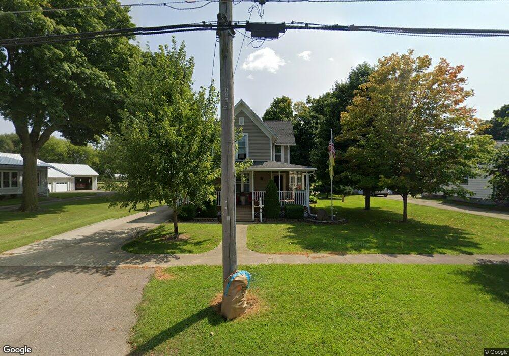
64 N Main St Quincy, MI 49082
Estimated Value: $133,000 - $172,000
2
Beds
1
Bath
1,910
Sq Ft
$82/Sq Ft
Est. Value
About This Home
This home is located at 64 N Main St, Quincy, MI 49082 and is currently estimated at $156,642, approximately $82 per square foot. 64 N Main St is a home located in Branch County with nearby schools including Jennings Elementary School, Quincy Middle School, and Quincy High School.
Ownership History
Date
Name
Owned For
Owner Type
Purchase Details
Closed on
Mar 18, 2011
Sold by
Hemker Mark L and Hemker Cerinnda L
Bought by
Hemker Mark L and Hemker Cerinnda L
Current Estimated Value
Purchase Details
Closed on
Aug 31, 2007
Sold by
Hemker Mark and Hemker Cerinnda
Bought by
Deklein Peter J and Deklein Rebecca J
Purchase Details
Closed on
Nov 22, 2005
Sold by
Tuttle Melinda J
Bought by
Weber Lauren
Create a Home Valuation Report for This Property
The Home Valuation Report is an in-depth analysis detailing your home's value as well as a comparison with similar homes in the area
Home Values in the Area
Average Home Value in this Area
Purchase History
| Date | Buyer | Sale Price | Title Company |
|---|---|---|---|
| Hemker Mark L | -- | None Available | |
| Deklein Peter J | -- | Branch County Abstract & Tit | |
| Hemker Mark | $47,000 | Branch County Abstract & Tit | |
| Weber Lauren | $30,000 | Branch County Abstract & Tit |
Source: Public Records
Tax History Compared to Growth
Tax History
| Year | Tax Paid | Tax Assessment Tax Assessment Total Assessment is a certain percentage of the fair market value that is determined by local assessors to be the total taxable value of land and additions on the property. | Land | Improvement |
|---|---|---|---|---|
| 2025 | $983 | $71,981 | $0 | $0 |
| 2024 | $854 | $70,871 | $0 | $0 |
| 2023 | $789 | $69,212 | $0 | $0 |
| 2022 | $789 | $59,467 | $0 | $0 |
| 2021 | -- | $55,748 | $0 | $0 |
| 2020 | -- | $54,040 | $0 | $0 |
| 2019 | -- | $43,144 | $0 | $0 |
| 2018 | -- | $26,649 | $0 | $0 |
| 2017 | -- | $27,751 | $0 | $0 |
| 2016 | -- | $26,671 | $0 | $0 |
| 2015 | -- | $26,874 | $0 | $0 |
| 2014 | -- | $23,906 | $0 | $0 |
| 2013 | -- | $22,719 | $0 | $0 |
Source: Public Records
Map
Nearby Homes
- 69 N Main St
- 1014 Aguadero Pkwy
- 9 Cole St
- 34 Park St
- 42 W Chicago St
- 46 W Chicago St
- 34 W Liberty St
- 78 Taylor St
- 44 Berry St
- 1085 E Chicago Rd Unit B
- 1085 E Chicago Rd Unit A
- 1085 E Chicago Rd
- 424 Doris St
- 912 Beckwith Shore
- 988 Williams Dr
- 216 Sandalwood Dr
- 0 Wildwood Rd
- 732 Cambridge Dr
- 4251 Squires Rd
- 808 Rolling Meadows Dr