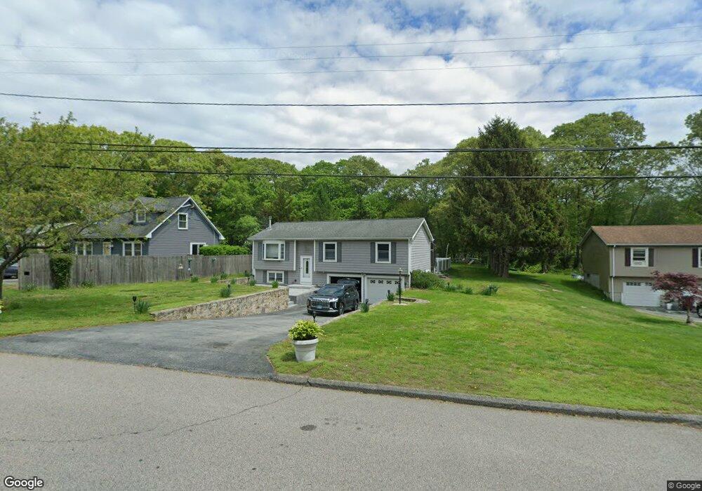
64 Old Farm Rd Groton, CT 06340
Estimated Value: $451,000 - $464,149
3
Beds
2
Baths
2,026
Sq Ft
$227/Sq Ft
Est. Value
About This Home
This home is located at 64 Old Farm Rd, Groton, CT 06340 and is currently estimated at $459,037, approximately $226 per square foot. 64 Old Farm Rd is a home located in New London County with nearby schools including Catherine Kolnaski STEAM Magnet School, Groton Middle School, and Robert E. Fitch High School.
Ownership History
Date
Name
Owned For
Owner Type
Purchase Details
Closed on
Nov 9, 1987
Sold by
Ponlos Peter
Bought by
Beachaup Irving
Current Estimated Value
Home Financials for this Owner
Home Financials are based on the most recent Mortgage that was taken out on this home.
Original Mortgage
$118,000
Interest Rate
10.97%
Create a Home Valuation Report for This Property
The Home Valuation Report is an in-depth analysis detailing your home's value as well as a comparison with similar homes in the area
Home Values in the Area
Average Home Value in this Area
Purchase History
| Date | Buyer | Sale Price | Title Company |
|---|---|---|---|
| Beachaup Irving | $132,500 | -- |
Source: Public Records
Mortgage History
| Date | Status | Borrower | Loan Amount |
|---|---|---|---|
| Open | Beachaup Irving | $99,209 | |
| Closed | Beachaup Irving | $60,000 | |
| Closed | Beachaup Irving | $119,000 | |
| Closed | Beachaup Irving | $118,000 |
Source: Public Records
Tax History Compared to Growth
Tax History
| Year | Tax Paid | Tax Assessment Tax Assessment Total Assessment is a certain percentage of the fair market value that is determined by local assessors to be the total taxable value of land and additions on the property. | Land | Improvement |
|---|---|---|---|---|
| 2025 | $6,800 | $235,200 | $114,415 | $120,785 |
| 2024 | $6,325 | $235,200 | $114,415 | $120,785 |
| 2023 | $6,068 | $235,200 | $62,650 | $172,550 |
| 2022 | $5,868 | $235,200 | $62,650 | $172,550 |
| 2021 | $5,327 | $175,910 | $41,790 | $134,120 |
| 2020 | $5,174 | $175,910 | $41,790 | $134,120 |
| 2019 | $5,008 | $175,910 | $41,790 | $134,120 |
| 2018 | $5,057 | $175,910 | $41,790 | $134,120 |
| 2017 | $5,075 | $175,910 | $41,790 | $134,120 |
| 2016 | $4,765 | $175,420 | $50,890 | $124,530 |
| 2015 | $4,704 | $175,420 | $50,890 | $124,530 |
| 2014 | $4,377 | $175,420 | $50,890 | $124,530 |
Source: Public Records
Map
Nearby Homes
- 41 Joe Ave
- 108 Warner St
- 55 Virginia Ave Unit C
- 43 George Ave Unit B
- 43 George Ave Unit 1
- 42 Godfrey St
- 33 George Ave Unit B
- 3 George Ave
- 63 Johl Dr
- 70 Lorraine Rd
- 12 Burgess Place
- 21 Chicago Ave
- 42 A St
- 34 D St
- 120 B St
- 1042 Poquonnock Rd Unit LOT 23
- 1042 Poquonnock Rd Unit 19
- 174 D St
- 28 Courtland Dr
- 10 Courtland Dr Unit 10