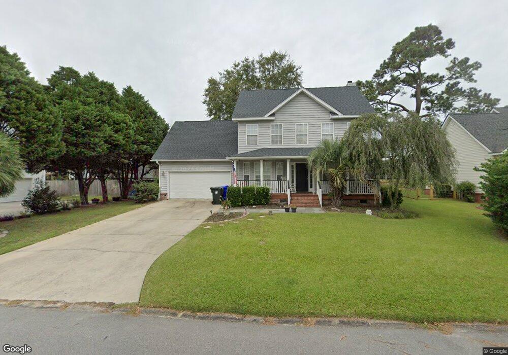
64 Oyster Point Row Charleston, SC 29412
James Island NeighborhoodEstimated Value: $699,060 - $750,000
3
Beds
3
Baths
2,131
Sq Ft
$344/Sq Ft
Est. Value
About This Home
This home is located at 64 Oyster Point Row, Charleston, SC 29412 and is currently estimated at $732,265, approximately $343 per square foot. 64 Oyster Point Row is a home located in Charleston County with nearby schools including Harbor View Elementary School, Camp Road Middle, and James Island Charter High School.
Ownership History
Date
Name
Owned For
Owner Type
Purchase Details
Closed on
May 14, 2014
Sold by
Aldret Shelly
Bought by
Mclaughlin Lance
Current Estimated Value
Purchase Details
Closed on
Feb 15, 2008
Sold by
Welch Erik N
Bought by
Mclaughlin Lance and Aldret Shelly
Home Financials for this Owner
Home Financials are based on the most recent Mortgage that was taken out on this home.
Original Mortgage
$33,500
Interest Rate
5.47%
Mortgage Type
Credit Line Revolving
Purchase Details
Closed on
Nov 29, 1999
Sold by
Joe Ford Construction
Bought by
Demarse George B and Demarse Sharon E
Create a Home Valuation Report for This Property
The Home Valuation Report is an in-depth analysis detailing your home's value as well as a comparison with similar homes in the area
Home Values in the Area
Average Home Value in this Area
Purchase History
| Date | Buyer | Sale Price | Title Company |
|---|---|---|---|
| Mclaughlin Lance | -- | -- | |
| Mclaughlin Lance | $335,000 | Attorney | |
| Demarse George B | $213,000 | -- |
Source: Public Records
Mortgage History
| Date | Status | Borrower | Loan Amount |
|---|---|---|---|
| Previous Owner | Mclaughlin Lance | $33,500 | |
| Previous Owner | Mclaughlin Lance | $268,000 |
Source: Public Records
Tax History Compared to Growth
Tax History
| Year | Tax Paid | Tax Assessment Tax Assessment Total Assessment is a certain percentage of the fair market value that is determined by local assessors to be the total taxable value of land and additions on the property. | Land | Improvement |
|---|---|---|---|---|
| 2024 | $2,290 | $15,240 | $0 | $0 |
| 2023 | $2,031 | $15,240 | $0 | $0 |
| 2022 | $1,885 | $15,240 | $0 | $0 |
| 2021 | $1,976 | $15,240 | $0 | $0 |
| 2020 | $2,048 | $15,240 | $0 | $0 |
| 2019 | $1,824 | $13,250 | $0 | $0 |
| 2017 | $1,761 | $13,250 | $0 | $0 |
| 2016 | $1,688 | $13,250 | $0 | $0 |
| 2015 | $1,744 | $13,250 | $0 | $0 |
| 2014 | $1,495 | $0 | $0 | $0 |
| 2011 | -- | $0 | $0 | $0 |
Source: Public Records
Map
Nearby Homes
- 35 Rivers Point Row Unit A
- 13 Maplecrest Dr
- 31 Maplecrest Dr
- 17 S Anderson Ave Unit A,B,C, D
- 21 Rivers Point Row Unit 5A
- 21 Rivers Point Row Unit 3C
- 21 Rivers Point Row Unit 10C
- 1 S Anderson Ave
- 50 Held Cir Unit 50c
- 6 Commercial Row
- 55 Held Cir
- 930 Julia St
- 8 Brockman Dr
- 10 Bass Ln Unit D
- 10 Bass Ln Unit A
- 1416 Camp Rd
- 1418 Kentwood Cir
- 27 Brockman Dr Unit 27C
- 27 Brockman Dr Unit 27B
- 1734 Combahee St
- 64 Oyster Point
- 60 Oyster Point Row
- 60 Oyster Point
- 19 Meander Row
- 21 Meander Row
- 72 Oyster Point Row
- 23 Meander Row
- 25 Meander Row
- 32 Abeam Way
- 27 Meander Row
- 59 Oyster Point Row
- 63 Oyster Point Row
- 29 Meander Row Unit 6
- 76 Oyster Point Row
- 71 Oyster Point Row
- 49 Oyster Point Row
- 49 Oyster Point
- 67 Oyster Point Row
- 18 Meander Row
- 11 Poets Corner