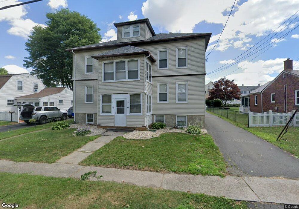
64 Park Ave Unit 66 Wethersfield, CT 06109
Estimated Value: $457,086 - $552,000
4
Beds
2
Baths
2,688
Sq Ft
$189/Sq Ft
Est. Value
About This Home
This home is located at 64 Park Ave Unit 66, Wethersfield, CT 06109 and is currently estimated at $508,272, approximately $189 per square foot. 64 Park Ave Unit 66 is a home located in Hartford County with nearby schools including Charles Wright School, Silas Deane Middle School, and Wethersfield High School.
Ownership History
Date
Name
Owned For
Owner Type
Purchase Details
Closed on
Feb 6, 2020
Sold by
Caminero Gabriel E
Bought by
Aurora Investments Llc
Current Estimated Value
Purchase Details
Closed on
Sep 9, 2009
Sold by
Lim Properties Llc
Bought by
Caminero Gabriel
Home Financials for this Owner
Home Financials are based on the most recent Mortgage that was taken out on this home.
Original Mortgage
$258,500
Interest Rate
5.36%
Mortgage Type
VA
Purchase Details
Closed on
Jul 12, 2005
Sold by
Garrey Robert
Bought by
Lim Jeffrey A
Purchase Details
Closed on
Dec 1, 2000
Sold by
Dicioccio Patrick and Hanson Amelia
Bought by
Garrey Robert
Purchase Details
Closed on
Apr 5, 1990
Sold by
Es Ruggiero Antonia
Bought by
Macdonald Maureen
Create a Home Valuation Report for This Property
The Home Valuation Report is an in-depth analysis detailing your home's value as well as a comparison with similar homes in the area
Home Values in the Area
Average Home Value in this Area
Purchase History
| Date | Buyer | Sale Price | Title Company |
|---|---|---|---|
| Aurora Investments Llc | -- | None Available | |
| Caminero Gabriel | $258,500 | -- | |
| Lim Jeffrey A | $260,000 | -- | |
| Garrey Robert | $175,000 | -- | |
| Macdonald Maureen | $48,333 | -- |
Source: Public Records
Mortgage History
| Date | Status | Borrower | Loan Amount |
|---|---|---|---|
| Previous Owner | Macdonald Maureen | $232,500 | |
| Previous Owner | Macdonald Maureen | $258,500 |
Source: Public Records
Tax History
| Year | Tax Paid | Tax Assessment Tax Assessment Total Assessment is a certain percentage of the fair market value that is determined by local assessors to be the total taxable value of land and additions on the property. | Land | Improvement |
|---|---|---|---|---|
| 2025 | $11,843 | $287,310 | $70,690 | $216,620 |
| 2024 | $7,321 | $169,380 | $64,400 | $104,980 |
| 2023 | $7,077 | $169,380 | $64,400 | $104,980 |
| 2022 | $6,958 | $169,380 | $64,400 | $104,980 |
| 2021 | $6,889 | $169,380 | $64,400 | $104,980 |
| 2020 | $6,892 | $169,380 | $64,400 | $104,980 |
| 2019 | $6,901 | $169,380 | $64,400 | $104,980 |
| 2018 | $7,096 | $174,000 | $63,300 | $110,700 |
| 2017 | $6,920 | $174,000 | $63,300 | $110,700 |
| 2016 | $6,706 | $174,000 | $63,300 | $110,700 |
| 2015 | $6,645 | $174,000 | $63,300 | $110,700 |
| 2014 | $6,393 | $174,000 | $63,300 | $110,700 |
Source: Public Records
Map
Nearby Homes
- 192 Wolcott Hill Rd
- 219-221 Jordan Ln
- 23 Hillcrest Ave
- 107 Harmund Place
- 55 Rutledge Rd
- 317-319 Garden St
- 1 Fernwood St
- 1 Brussels Ave
- 19 Albert Ave
- 1 Bristol St
- 31 Somerset St
- 269 Pine Ln
- 91 Somerset St
- 144 Brown St
- 64 Cromwell St
- 28 Bolton St
- 95 Garden St
- 295 Ridge Rd Unit 8
- 51 Hanmer St
- 493 Main St
Your Personal Tour Guide
Ask me questions while you tour the home.