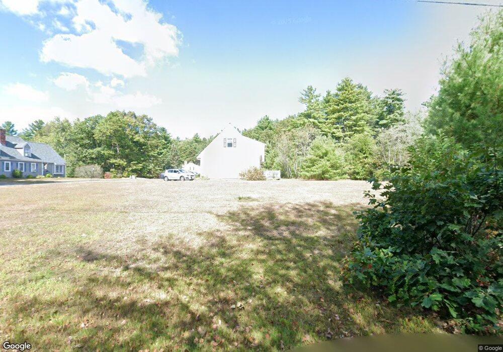
64 Peabody Rd Unit G Shirley, MA 01464
Estimated Value: $386,000 - $405,000
2
Beds
2
Baths
1,433
Sq Ft
$276/Sq Ft
Est. Value
About This Home
This home is located at 64 Peabody Rd Unit G, Shirley, MA 01464 and is currently estimated at $395,872, approximately $276 per square foot. 64 Peabody Rd Unit G is a home located in Middlesex County with nearby schools including Page Hilltop School, Lura A. White Elementary School, and Ayer Shirley Regional Middle School.
Ownership History
Date
Name
Owned For
Owner Type
Purchase Details
Closed on
Sep 30, 2025
Sold by
First Timothy W
Bought by
Dixon Susan K
Current Estimated Value
Home Financials for this Owner
Home Financials are based on the most recent Mortgage that was taken out on this home.
Original Mortgage
$299,250
Outstanding Balance
$298,952
Interest Rate
5.99%
Mortgage Type
New Conventional
Estimated Equity
$96,920
Purchase Details
Closed on
Feb 24, 2025
Sold by
Sec Of Hsng & Urban Dev
Bought by
First Timothy W
Purchase Details
Closed on
Feb 27, 2024
Sold by
Sargent Marie L and Crews Cynthia M
Bought by
Hud
Purchase Details
Closed on
Jun 1, 1998
Sold by
Whitney Phil A
Bought by
Sargent Merrill E and Sargent Marie L
Home Financials for this Owner
Home Financials are based on the most recent Mortgage that was taken out on this home.
Original Mortgage
$88,000
Interest Rate
7.12%
Mortgage Type
Purchase Money Mortgage
Create a Home Valuation Report for This Property
The Home Valuation Report is an in-depth analysis detailing your home's value as well as a comparison with similar homes in the area
Home Values in the Area
Average Home Value in this Area
Purchase History
| Date | Buyer | Sale Price | Title Company |
|---|---|---|---|
| Dixon Susan K | $399,000 | -- | |
| Dixon Susan K | $399,000 | -- | |
| First Timothy W | $230,000 | None Available | |
| First Timothy W | $230,000 | None Available | |
| First Timothy W | $230,000 | None Available | |
| First Timothy W | $230,000 | None Available | |
| Hud | $178,553 | None Available | |
| Hud | $178,553 | None Available | |
| Hud | $178,553 | None Available | |
| Hud | $178,553 | None Available | |
| Hud | $178,553 | None Available | |
| Hud | $178,553 | None Available | |
| Sargent Merrill E | $110,000 | -- | |
| Sargent Merrill E | $110,000 | -- | |
| Sargent Merrill E | $110,000 | -- | |
| Sargent Merrill E | $110,000 | -- |
Source: Public Records
Mortgage History
| Date | Status | Borrower | Loan Amount |
|---|---|---|---|
| Open | Dixon Susan K | $299,250 | |
| Previous Owner | Sargent Merrill E | $88,000 |
Source: Public Records
Tax History Compared to Growth
Tax History
| Year | Tax Paid | Tax Assessment Tax Assessment Total Assessment is a certain percentage of the fair market value that is determined by local assessors to be the total taxable value of land and additions on the property. | Land | Improvement |
|---|---|---|---|---|
| 2025 | $4,188 | $322,900 | $0 | $322,900 |
| 2024 | $4,128 | $304,200 | $0 | $304,200 |
| 2023 | $3,561 | $251,100 | $0 | $251,100 |
| 2022 | $3,469 | $224,100 | $0 | $224,100 |
| 2021 | $3,656 | $221,200 | $0 | $221,200 |
| 2020 | $3,726 | $231,300 | $0 | $231,300 |
| 2019 | $3,259 | $202,700 | $0 | $202,700 |
| 2018 | $3,351 | $204,100 | $0 | $204,100 |
| 2017 | $3,397 | $205,600 | $0 | $205,600 |
| 2016 | $2,912 | $176,400 | $0 | $176,400 |
| 2015 | $3,074 | $177,600 | $0 | $177,600 |
Source: Public Records
Map
Nearby Homes
- 83 Clark Rd Unit 41
- 45 Clark Rd
- 40 Ayer Rd
- 30 Ayer Rd
- 3 Ambrose Way Unit 3
- 6 Ambrose Way Unit 3
- 9 Ambrose Way Unit 9
- 1 Ambrose Way Unit 1
- 7 Ambrose Way Unit 5
- 4 Ambrose Way Unit 4
- 5 Ambrose Way Unit 5
- 13 Ambrose Way Unit 13
- 25 Front St
- 184 W Main St Unit B2
- 124 Hazen Rd
- 3 Mill St
- 31 Independence Dr
- 14 Brook St
- 0ABC Park St
- 0 Lot D Park St
- 64 Peabody Rd Unit K2
- 64 Peabody Rd Unit K1
- 64 Peabody Rd Unit I2
- 64 Peabody Rd Unit I1
- 64 Peabody Rd Unit H2
- 64 Peabody Rd Unit H1
- 64 Peabody Rd Unit G2
- 64 Peabody Rd Unit G1
- 64 Peabody Rd Unit C
- 64 Peabody Rd Unit G1
- 64 Peabody Rd Unit 64C
- 64 Peabody Rd Unit H, 64
- 64 Peabody Rd Unit 64 F
- 64 Peabody Rd Unit A
- 64 Peabody Rd Unit 11
- 70 Peabody Rd
- 200 Ayer Rd
- 72 Peabody Rd
- 64 C Peabody Rd Unit C 64
- 64 D Peabody Rd Unit 64D