Estimated Value: $114,171 - $185,000
--
Bed
1
Bath
1,452
Sq Ft
$112/Sq Ft
Est. Value
About This Home
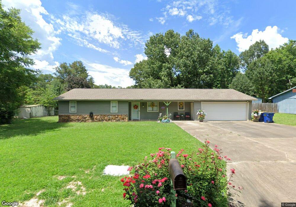
This home is located at 64 Pear St, Cabot, AR 72023 and is currently estimated at $163,293, approximately $112 per square foot. 64 Pear St is a home located in Lonoke County with nearby schools including Central Elementary School, Cabot Middle School South, and Cabot Junior High South.
Ownership History
Date
Name
Owned For
Owner Type
Purchase Details
Closed on
Jan 29, 2024
Sold by
Jolley Marilyn Gonzaga and Jolley Michael R
Bought by
Marilyn Gonzaga Jolley Revocable Living Trust and Jolley
Current Estimated Value
Purchase Details
Closed on
Jul 30, 2007
Sold by
Mckee Kenneth L
Bought by
Jolley Michael R and Jolley Marilyn G
Home Financials for this Owner
Home Financials are based on the most recent Mortgage that was taken out on this home.
Original Mortgage
$77,779
Interest Rate
6.69%
Purchase Details
Closed on
Jun 21, 1991
Bought by
Mckee
Purchase Details
Closed on
Nov 12, 1987
Bought by
Hud
Purchase Details
Closed on
Nov 3, 1987
Bought by
Bright Mtg Co
Purchase Details
Closed on
Sep 13, 1984
Bought by
Sutterfield
Purchase Details
Closed on
Oct 5, 1981
Bought by
Jones
Create a Home Valuation Report for This Property
The Home Valuation Report is an in-depth analysis detailing your home's value as well as a comparison with similar homes in the area
Home Values in the Area
Average Home Value in this Area
Purchase History
| Date | Buyer | Sale Price | Title Company |
|---|---|---|---|
| Marilyn Gonzaga Jolley Revocable Living Trust | -- | None Listed On Document | |
| Marilyn Gonzaga Jolley Revocable Living Trust | -- | None Listed On Document | |
| Jolley Michael R | -- | -- | |
| Jolley Michael R | -- | -- | |
| Mckee | -- | -- | |
| Hud | -- | -- | |
| Bright Mtg Co | -- | -- | |
| Sutterfield | $40,500 | -- | |
| Sutterfield | $40,500 | -- | |
| Jones | $39,000 | -- |
Source: Public Records
Mortgage History
| Date | Status | Borrower | Loan Amount |
|---|---|---|---|
| Previous Owner | Jolley Michael R | $77,779 |
Source: Public Records
Tax History Compared to Growth
Tax History
| Year | Tax Paid | Tax Assessment Tax Assessment Total Assessment is a certain percentage of the fair market value that is determined by local assessors to be the total taxable value of land and additions on the property. | Land | Improvement |
|---|---|---|---|---|
| 2025 | $476 | $17,700 | $2,000 | $15,700 |
| 2024 | $476 | $17,700 | $2,000 | $15,700 |
| 2023 | $476 | $17,700 | $2,000 | $15,700 |
| 2022 | $520 | $17,700 | $2,000 | $15,700 |
| 2021 | $480 | $17,700 | $2,000 | $15,700 |
| 2020 | $439 | $15,990 | $2,000 | $13,990 |
| 2019 | $439 | $15,990 | $2,000 | $13,990 |
| 2018 | $440 | $15,990 | $2,000 | $13,990 |
| 2017 | $734 | $15,990 | $2,000 | $13,990 |
| 2016 | $440 | $15,990 | $2,000 | $13,990 |
| 2015 | $711 | $15,480 | $2,000 | $13,480 |
| 2014 | $415 | $15,480 | $2,000 | $13,480 |
Source: Public Records
Map
Nearby Homes
- 65 Oak Meadows Dr
- 69 Sycamore Cir
- 30 Meadowlark Dr
- 23 Robinson St
- 40 Bent Tree Dr
- 34 Bent Tree Dr
- 23 Alexis Dr
- 18 Sycamore St
- 509 E Myrtle St
- 511 S Grant St
- 00 Kerr Station Rd
- 00 Plaza Blvd
- 97 S Pine St
- 308 N Madison St
- 12 Raspberry Ln
- 213 Pin Oak Dr
- Lot 5&6 N Adams St
- Lots 5 & 6 N Adams St
- 1401 E Main St
- 107 Forrest Loop