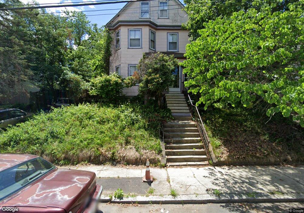
64 Perham St West Roxbury, MA 02132
West Roxbury NeighborhoodEstimated Value: $918,641 - $1,117,000
4
Beds
3
Baths
2,408
Sq Ft
$413/Sq Ft
Est. Value
About This Home
This home is located at 64 Perham St, West Roxbury, MA 02132 and is currently estimated at $994,660, approximately $413 per square foot. 64 Perham St is a home located in Suffolk County with nearby schools including St Theresa School, Holy Name Parish School, and Catholic Memorial School.
Create a Home Valuation Report for This Property
The Home Valuation Report is an in-depth analysis detailing your home's value as well as a comparison with similar homes in the area
Home Values in the Area
Average Home Value in this Area
Tax History
| Year | Tax Paid | Tax Assessment Tax Assessment Total Assessment is a certain percentage of the fair market value that is determined by local assessors to be the total taxable value of land and additions on the property. | Land | Improvement |
|---|---|---|---|---|
| 2025 | $8,222 | $710,000 | $280,700 | $429,300 |
| 2024 | $8,540 | $783,500 | $323,000 | $460,500 |
| 2023 | $8,014 | $746,200 | $307,600 | $438,600 |
| 2022 | $7,382 | $678,500 | $279,700 | $398,800 |
| 2021 | $6,902 | $646,900 | $274,200 | $372,700 |
| 2020 | $6,476 | $613,300 | $221,100 | $392,200 |
| 2019 | $6,138 | $582,400 | $187,900 | $394,500 |
| 2018 | $5,652 | $539,300 | $187,900 | $351,400 |
| 2017 | $5,597 | $528,500 | $187,900 | $340,600 |
| 2016 | $5,644 | $513,100 | $187,900 | $325,200 |
| 2015 | $5,313 | $438,700 | $179,200 | $259,500 |
| 2014 | $5,207 | $413,900 | $179,200 | $234,700 |
Source: Public Records
Map
Nearby Homes
- 73 Dent St Unit 2
- 183 Temple St
- 340 Baker St Unit 2
- 425 Lagrange St Unit 203
- 1216 Vfw Pkwy Unit 40
- 116 Spring St Unit D2
- 348 Lagrange St
- 15 Cass St Unit 3
- 17 Cass St Unit 4
- 76 Lasell St
- 37 Hastings St Unit 201
- 68 Carroll St
- 17 Hastings St Unit 5
- 23 Atlantis St
- 17-31 Charles Park Rd Unit 196
- 2231 Centre St
- 205 Park St Unit 2
- 78 Howitt Rd
- 72 Redlands Rd
- 55 Redlands Rd
Your Personal Tour Guide
Ask me questions while you tour the home.