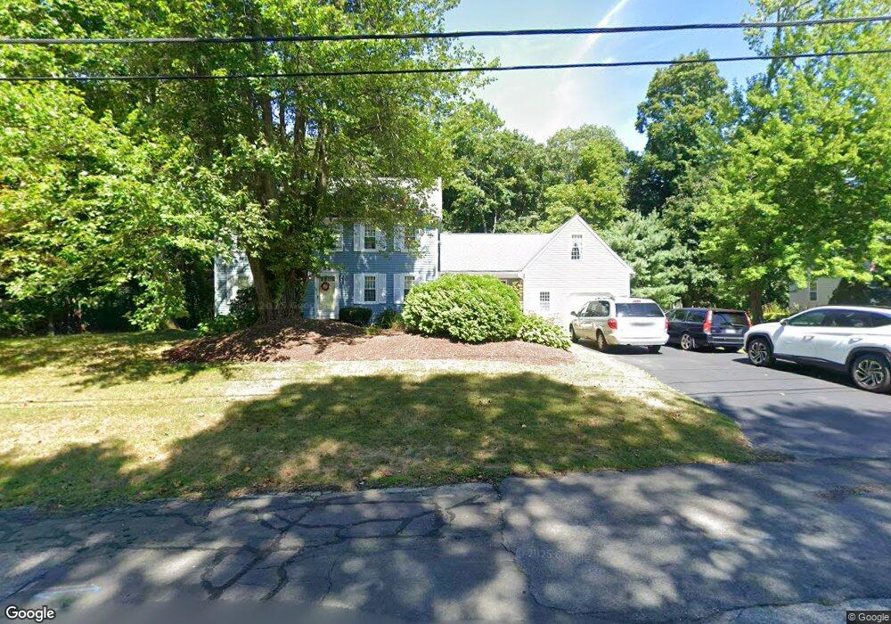
64 Ryder Cir North Attleboro, MA 02760
North Attleboro NeighborhoodEstimated Value: $599,000 - $804,000
4
Beds
2
Baths
1,872
Sq Ft
$369/Sq Ft
Est. Value
About This Home
This home is located at 64 Ryder Cir, North Attleboro, MA 02760 and is currently estimated at $691,610, approximately $369 per square foot. 64 Ryder Cir is a home located in Bristol County with nearby schools including North Attleboro High School.
Ownership History
Date
Name
Owned For
Owner Type
Purchase Details
Closed on
Aug 4, 2023
Sold by
Clinton Lisa A and Clinton Randel J
Bought by
Randel & Lisa Clinton Ret and Clinton
Current Estimated Value
Purchase Details
Closed on
Feb 5, 1997
Sold by
Rocha Louis C and Rocha Mae E
Bought by
Clinton Randal J and Clinton Lisa A
Create a Home Valuation Report for This Property
The Home Valuation Report is an in-depth analysis detailing your home's value as well as a comparison with similar homes in the area
Home Values in the Area
Average Home Value in this Area
Purchase History
| Date | Buyer | Sale Price | Title Company |
|---|---|---|---|
| Randel & Lisa Clinton Ret | -- | None Available | |
| Clinton Randal J | $188,000 | -- |
Source: Public Records
Mortgage History
| Date | Status | Borrower | Loan Amount |
|---|---|---|---|
| Previous Owner | Clinton Randal J | $195,000 | |
| Previous Owner | Clinton Randal J | $12,000 | |
| Previous Owner | Clinton Randal J | $160,000 |
Source: Public Records
Tax History Compared to Growth
Tax History
| Year | Tax Paid | Tax Assessment Tax Assessment Total Assessment is a certain percentage of the fair market value that is determined by local assessors to be the total taxable value of land and additions on the property. | Land | Improvement |
|---|---|---|---|---|
| 2025 | $6,213 | $527,000 | $147,800 | $379,200 |
| 2024 | $6,187 | $536,100 | $147,800 | $388,300 |
| 2023 | $5,956 | $465,700 | $147,800 | $317,900 |
| 2022 | $5,663 | $406,500 | $147,800 | $258,700 |
| 2021 | $5,758 | $403,500 | $147,800 | $255,700 |
| 2020 | $5,684 | $396,100 | $147,800 | $248,300 |
| 2019 | $5,433 | $381,500 | $134,400 | $247,100 |
| 2018 | $4,893 | $366,800 | $134,400 | $232,400 |
| 2017 | $4,849 | $366,800 | $134,400 | $232,400 |
| 2016 | $4,720 | $357,000 | $149,200 | $207,800 |
| 2015 | $4,528 | $344,600 | $149,200 | $195,400 |
| 2014 | $4,322 | $326,400 | $131,000 | $195,400 |
Source: Public Records
Map
Nearby Homes
- 64 Smith St
- 34 Hawthorne St
- 35-R Whiting St
- 2 Franklin Ave
- 271 N Washington St
- 194 Smith St
- 45 Moran St
- 157 Fisher St
- 835 Mt Hope St Unit 39
- 39 Columbia St
- 633 E Washington St Unit 17
- 12 Houde St
- 0 Landry 2nd Unit 73350867
- 68 N Washington St Unit 210
- 19 Church St Unit C9
- 711 Mount Hope St Unit 13
- 711 Mount Hope St Unit 8
- 711 Mount Hope St Unit 11
- 711 Mount Hope St Unit 12
- 711 Mount Hope St Unit 15