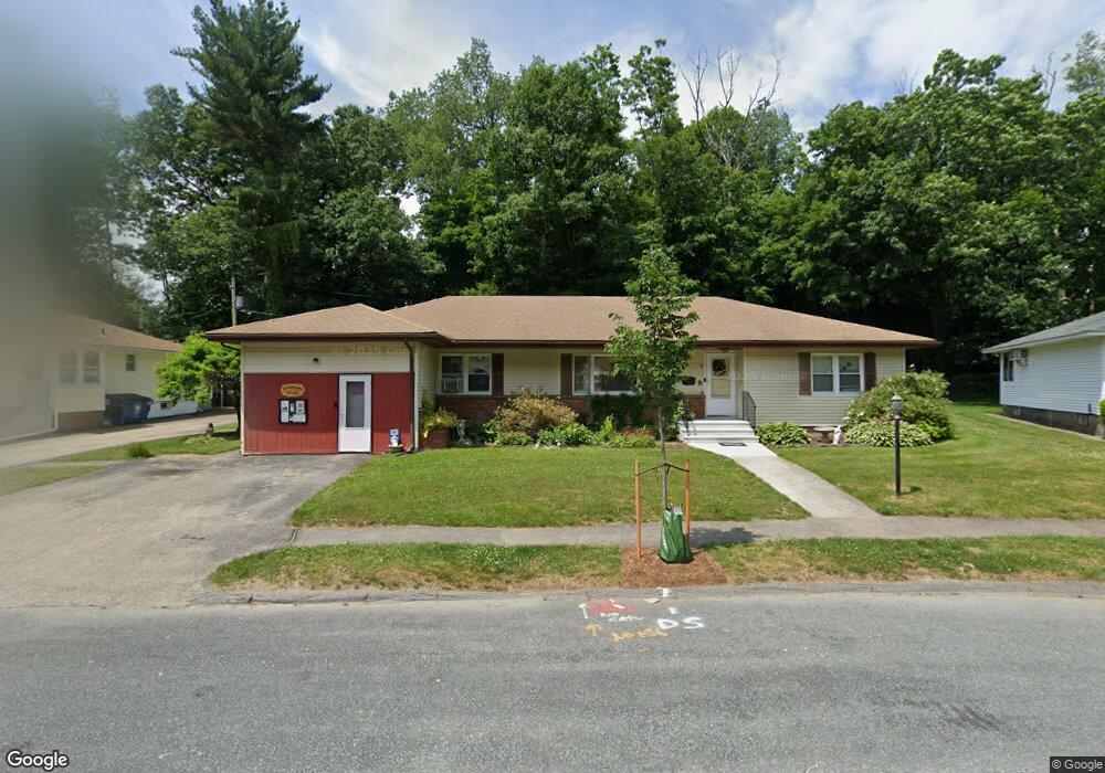
64 S Flagg St Worcester, MA 01602
Newton Square NeighborhoodEstimated Value: $572,000 - $620,000
4
Beds
3
Baths
2,625
Sq Ft
$229/Sq Ft
Est. Value
About This Home
This home is located at 64 S Flagg St, Worcester, MA 01602 and is currently estimated at $601,018, approximately $228 per square foot. 64 S Flagg St is a home located in Worcester County with nearby schools including Chandler Magnet, Jacob Hiatt Magnet School, and Midland Street.
Create a Home Valuation Report for This Property
The Home Valuation Report is an in-depth analysis detailing your home's value as well as a comparison with similar homes in the area
Home Values in the Area
Average Home Value in this Area
Tax History
| Year | Tax Paid | Tax Assessment Tax Assessment Total Assessment is a certain percentage of the fair market value that is determined by local assessors to be the total taxable value of land and additions on the property. | Land | Improvement |
|---|---|---|---|---|
| 2025 | $7,501 | $568,700 | $118,700 | $450,000 |
| 2024 | $7,266 | $528,400 | $118,700 | $409,700 |
| 2023 | $7,098 | $495,000 | $103,200 | $391,800 |
| 2022 | $6,330 | $416,200 | $82,600 | $333,600 |
| 2021 | $6,527 | $400,900 | $66,100 | $334,800 |
| 2020 | $6,186 | $363,900 | $66,100 | $297,800 |
| 2019 | $5,796 | $322,000 | $59,500 | $262,500 |
| 2018 | $5,550 | $293,500 | $59,500 | $234,000 |
| 2017 | $5,887 | $306,300 | $59,500 | $246,800 |
| 2016 | $5,952 | $288,800 | $43,700 | $245,100 |
| 2015 | $5,796 | $288,800 | $43,700 | $245,100 |
| 2014 | $5,874 | $300,600 | $43,700 | $256,900 |
Source: Public Records
Map
Nearby Homes
- 73 Moore Ave
- 19 Kenilworth Rd
- 16 Sherwood Rd
- 31 Lenox St
- 12 Cardinal Rd
- 18 Hadwen Ln
- 24 Hadwen Rd
- 47R Yarnie Unit 3A
- 47R Yarnie Unit 1B
- 47R Yarnie Unit 2B
- 47R Yarnie Unit 4B
- 47R Yarnie Unit 8B
- 47R Yarnie Unit 5A
- 47R Yarnie Unit 6B
- 47R Yarnie Unit 4A
- 47R Yarnie Unit 1A
- 47R Yarnie Unit 9
- 47R Yarnie Unit 8A
- 47R Yarnie Unit 6A
- 47R Yarnie Unit 7A
Your Personal Tour Guide
Ask me questions while you tour the home.