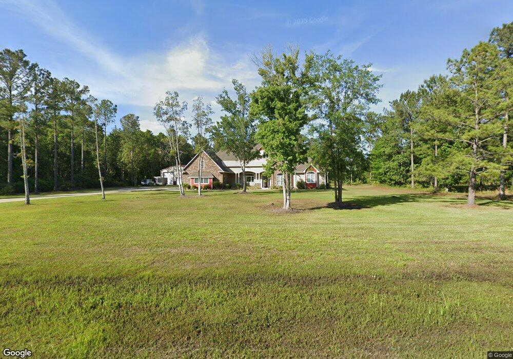
64 Sandy Bottom Ct Kingsland, GA 31548
Estimated Value: $490,000 - $717,986
3
Beds
2
Baths
2,814
Sq Ft
$227/Sq Ft
Est. Value
About This Home
This home is located at 64 Sandy Bottom Ct, Kingsland, GA 31548 and is currently estimated at $638,329, approximately $226 per square foot. 64 Sandy Bottom Ct is a home with nearby schools including Kingsland Elementary School, Camden Middle School, and Camden County High School.
Ownership History
Date
Name
Owned For
Owner Type
Purchase Details
Closed on
Jul 17, 2019
Sold by
Hollen Ray
Bought by
Hollen Ray L and Hollen Lisa A
Current Estimated Value
Home Financials for this Owner
Home Financials are based on the most recent Mortgage that was taken out on this home.
Original Mortgage
$305,000
Outstanding Balance
$267,097
Interest Rate
3.8%
Estimated Equity
$371,232
Purchase Details
Closed on
Jul 27, 2006
Sold by
Not Provided
Bought by
Royal Oaks Development Venture
Purchase Details
Closed on
Jul 26, 2006
Sold by
Not Provided
Bought by
Royal Oaks Development Venture
Create a Home Valuation Report for This Property
The Home Valuation Report is an in-depth analysis detailing your home's value as well as a comparison with similar homes in the area
Home Values in the Area
Average Home Value in this Area
Purchase History
| Date | Buyer | Sale Price | Title Company |
|---|---|---|---|
| Hollen Ray L | -- | -- | |
| Royal Oaks Development Venture | -- | -- | |
| Royal Oaks Development Venture | -- | -- |
Source: Public Records
Mortgage History
| Date | Status | Borrower | Loan Amount |
|---|---|---|---|
| Open | Hollen Ray L | $305,000 |
Source: Public Records
Tax History Compared to Growth
Tax History
| Year | Tax Paid | Tax Assessment Tax Assessment Total Assessment is a certain percentage of the fair market value that is determined by local assessors to be the total taxable value of land and additions on the property. | Land | Improvement |
|---|---|---|---|---|
| 2024 | $1,583 | $284,110 | $20,000 | $264,110 |
| 2023 | $1,852 | $223,010 | $14,000 | $209,010 |
| 2022 | $2,074 | $211,134 | $14,000 | $197,134 |
| 2021 | $2,221 | $170,303 | $10,000 | $160,303 |
| 2020 | $2,633 | $169,703 | $8,000 | $161,703 |
| 2019 | $3,277 | $97,974 | $8,000 | $89,974 |
| 2018 | $484 | $16,110 | $8,000 | $8,110 |
| 2017 | $767 | $25,065 | $25,065 | $0 |
| 2016 | $174 | $11,795 | $11,795 | $0 |
| 2015 | $157 | $5,308 | $5,308 | $0 |
| 2014 | $133 | $5,308 | $5,308 | $0 |
Source: Public Records
Map
Nearby Homes
- 752 Catfish Landing Cir
- 0 Ashton Ln Unit 1650886
- 216 Landing Blvd
- 100 Hollow Point Trail
- 31.17 Ac Hollow Point Trail
- 524 Hide Away Lake Loop
- 524 Hide-A-way Lake Loop
- 522 Hide-A-way Lake Loop
- 240 Hide Away Lake Dr
- 508 Hide-A-way Lake Loop
- 231 Hide Away Lake Dr
- 233 S Sheffield St
- 246 W Peach Ave
- 145 W Woodhaven Dr
- 195 W Magnolia Ave
- 114 Pineneedle Ct
- 213 Merriwood Cir
- 135 W Woodhaven Dr
- 208 Foxwood Dr
- 232 Woodbridge Rd
- 116 Sandy Bottom Ct
- 0 Catfish Landing Cir Unit 8419412
- 0 Catfish Landing Cir Unit 70 8405607
- 0 Catfish Landing Cir Unit 8392369
- 0 Catfish Landing Cir Unit 68 8300195
- 0 Catfish Landing Cir Unit 70 8300240
- 0 Catfish Landing Cir Unit 54 7548654
- 0 Catfish Landing Cir Unit 55 8007455
- 0 Catfish Landing Cir Unit 36 8008954
- 0 Catfish Landing Cir Unit 11 8008938
- 0 Catfish Landing Cir Unit 70 8012816
- 0 Catfish Landing Cir Unit 59 8012798
- 0 Catfish Landing Cir Unit 66 8012807
- 0 Catfish Landing Cir Unit 68 8012810
- 0 Catfish Landing Cir Unit 60 8012801
- 0 Catfish Landing Cir Unit 46 8012622
- 0 Catfish Landing Cir Unit 67 8012808
- 0 Catfish Landing Cir Unit 71 8012820
- 0 Catfish Landing Cir Unit 57 8012789
- 0 Catfish Landing Cir Unit 47 8012627