Estimated Value: $154,740 - $178,000
Studio
2
Baths
1,392
Sq Ft
$120/Sq Ft
Est. Value
About This Home
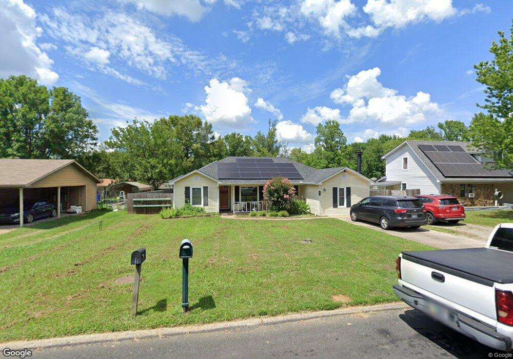
This home is located at 64 Sycamore Cir, Cabot, AR 72023 and is currently estimated at $167,185, approximately $120 per square foot. 64 Sycamore Cir is a home located in Lonoke County with nearby schools including Central Elementary School, Cabot Middle School South, and Cabot Junior High South.
Ownership History
Date
Name
Owned For
Owner Type
Purchase Details
Closed on
Jul 29, 2009
Sold by
Reid Andrea C
Bought by
Johnson Evelyn
Current Estimated Value
Home Financials for this Owner
Home Financials are based on the most recent Mortgage that was taken out on this home.
Original Mortgage
$112,750
Outstanding Balance
$73,588
Interest Rate
5.31%
Estimated Equity
$93,597
Purchase Details
Closed on
Feb 18, 2005
Bought by
Reid and Reid Wf
Purchase Details
Closed on
Feb 14, 2005
Bought by
Reid and Reid Wf
Purchase Details
Closed on
Jul 15, 1992
Bought by
Fleeman and Wife Terry
Purchase Details
Closed on
Feb 12, 1992
Bought by
Bostic
Purchase Details
Closed on
Feb 24, 1989
Bought by
Underwood Const
Purchase Details
Closed on
May 18, 1988
Bought by
First State Bank
Create a Home Valuation Report for This Property
The Home Valuation Report is an in-depth analysis detailing your home's value as well as a comparison with similar homes in the area
Purchase History
| Date | Buyer | Sale Price | Title Company |
|---|---|---|---|
| Johnson Evelyn | -- | Grand Prairie Title Co Inc | |
| Reid | $96,000 | -- | |
| Reid | $96,000 | -- | |
| Fleeman | $54,000 | -- | |
| Bostic | $6,000 | -- | |
| Underwood Const | -- | -- | |
| First State Bank | -- | -- |
Source: Public Records
Mortgage History
| Date | Status | Borrower | Loan Amount |
|---|---|---|---|
| Open | Johnson Evelyn | $112,750 |
Source: Public Records
Tax History
| Year | Tax Paid | Tax Assessment Tax Assessment Total Assessment is a certain percentage of the fair market value that is determined by local assessors to be the total taxable value of land and additions on the property. | Land | Improvement |
|---|---|---|---|---|
| 2025 | $565 | $19,450 | $2,000 | $17,450 |
| 2024 | $565 | $19,450 | $2,000 | $17,450 |
| 2023 | $565 | $19,450 | $2,000 | $17,450 |
| 2022 | $615 | $19,450 | $2,000 | $17,450 |
| 2021 | $615 | $19,450 | $2,000 | $17,450 |
| 2020 | $616 | $19,470 | $2,000 | $17,470 |
| 2019 | $616 | $19,470 | $2,000 | $17,470 |
| 2018 | $612 | $19,470 | $2,000 | $17,470 |
| 2017 | $894 | $19,470 | $2,000 | $17,470 |
| 2016 | $612 | $19,470 | $2,000 | $17,470 |
| 2015 | $911 | $19,840 | $2,000 | $17,840 |
| 2014 | $630 | $19,840 | $2,000 | $17,840 |
Source: Public Records
Map
Nearby Homes
- 57 Meadowlark Dr
- 49 Oak Meadows Dr
- 92 Sycamore Cir
- 34 Bent Tree Dr
- 40 Bent Tree Dr
- 51 Meadowlark Dr
- 37 Pond St
- 16 Meadowlark Dr
- 23 Robinson St
- 19 Sycamore St
- 00 Plaza Blvd
- 00 Kerr Station Rd
- 509 E Myrtle St
- 113 Walnut St
- 110 N Monroe St
- 20 Paige Ave
- 109 Pin Oak Dr
- 28 Pheasant Run Dr
- 211 N Jackson St
- 35 Warren St
Your Personal Tour Guide
Ask me questions while you tour the home.