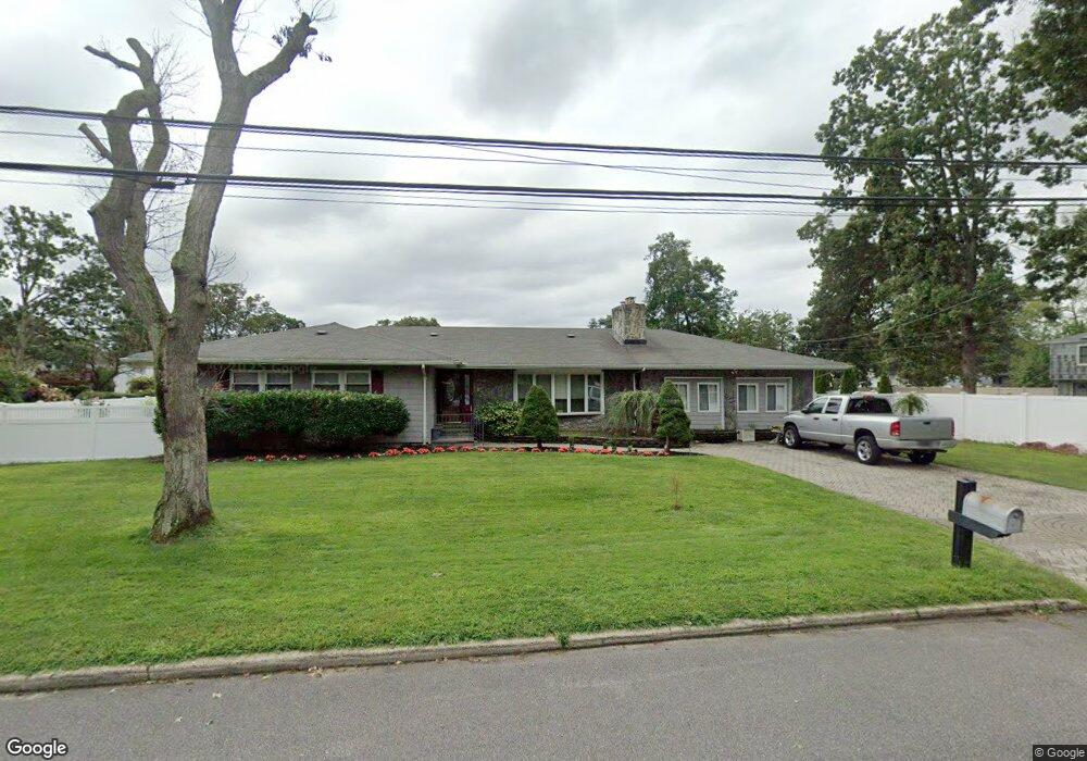
64 The Blvd Amityville, NY 11701
Estimated Value: $635,548 - $768,000
--
Bed
--
Bath
2,610
Sq Ft
$262/Sq Ft
Est. Value
About This Home
This home is located at 64 The Blvd, Amityville, NY 11701 and is currently estimated at $683,637, approximately $261 per square foot. 64 The Blvd is a home located in Suffolk County with nearby schools including Northeast Elementary School, Northwest Elementary School, and Park Avenue Memorial Elementary School.
Ownership History
Date
Name
Owned For
Owner Type
Purchase Details
Closed on
Apr 15, 2014
Sold by
Robinson Diane and Robinson Thomas B
Bought by
Mccrae Jamie
Current Estimated Value
Purchase Details
Closed on
Mar 27, 2013
Sold by
Robinson Thomas B
Bought by
Robinson Thomas B and Robinson Diane
Purchase Details
Closed on
Apr 13, 2001
Sold by
Robinson Thomas B and Robinson Diane
Bought by
Robinson Thomas B
Home Financials for this Owner
Home Financials are based on the most recent Mortgage that was taken out on this home.
Original Mortgage
$180,000
Interest Rate
9.25%
Create a Home Valuation Report for This Property
The Home Valuation Report is an in-depth analysis detailing your home's value as well as a comparison with similar homes in the area
Home Values in the Area
Average Home Value in this Area
Purchase History
| Date | Buyer | Sale Price | Title Company |
|---|---|---|---|
| Mccrae Jamie | -- | -- | |
| Robinson Thomas B | -- | -- | |
| Robinson Thomas B | -- | Fidelity National Title Ins |
Source: Public Records
Mortgage History
| Date | Status | Borrower | Loan Amount |
|---|---|---|---|
| Previous Owner | Robinson Thomas B | $180,000 |
Source: Public Records
Tax History Compared to Growth
Tax History
| Year | Tax Paid | Tax Assessment Tax Assessment Total Assessment is a certain percentage of the fair market value that is determined by local assessors to be the total taxable value of land and additions on the property. | Land | Improvement |
|---|---|---|---|---|
| 2024 | $11,481 | $4,160 | $420 | $3,740 |
| 2023 | $11,481 | $3,830 | $420 | $3,410 |
| 2022 | $9,072 | $3,830 | $420 | $3,410 |
| 2021 | $9,072 | $3,830 | $420 | $3,410 |
| 2020 | $9,742 | $3,830 | $420 | $3,410 |
| 2019 | $9,742 | $0 | $0 | $0 |
| 2018 | -- | $3,830 | $420 | $3,410 |
| 2017 | $8,847 | $3,830 | $420 | $3,410 |
| 2016 | $9,048 | $3,830 | $420 | $3,410 |
| 2015 | -- | $3,830 | $420 | $3,410 |
| 2014 | -- | $3,830 | $420 | $3,410 |
Source: Public Records
Map
Nearby Homes
- 55 Glenmalure St
- 85 Williams Ave
- 57 Benburb St
- 45 Ronald Dr E
- 700 Broadway Unit 47
- 700 Broadway Unit 5
- 700 Broadway Unit 22
- 700 Broadway Unit 28
- 13 Ronald Dr S
- 615 Broadway Unit 11
- 615 Broadway Unit 21
- 615 Broadway Unit 76
- 615 Broadway Unit 63
- 20 Lupidia St
- 15 Harrison Ave Unit 15
- 15 Harrison Ave Unit 39E
- 31 Melody Ln
- 5 Evelyn Ct
- 1 Emily St
- 6 Winter Ln