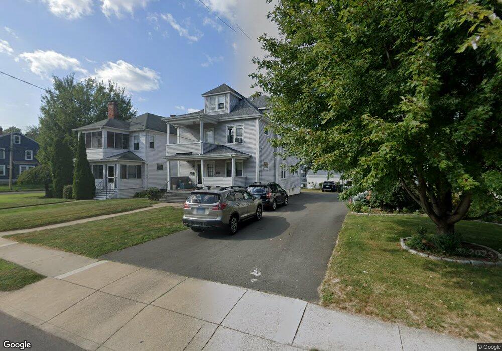
64 Whitman Ave West Hartford, CT 06107
Estimated Value: $678,000 - $752,639
6
Beds
1
Bath
2,425
Sq Ft
$293/Sq Ft
Est. Value
About This Home
This home is located at 64 Whitman Ave, West Hartford, CT 06107 and is currently estimated at $710,160, approximately $292 per square foot. 64 Whitman Ave is a home located in Hartford County with nearby schools including Braeburn School, Sedgwick Middle School, and Conard High School.
Ownership History
Date
Name
Owned For
Owner Type
Purchase Details
Closed on
Nov 14, 2011
Sold by
Mcintyre Daniel J
Bought by
Essex Family Lp
Current Estimated Value
Home Financials for this Owner
Home Financials are based on the most recent Mortgage that was taken out on this home.
Original Mortgage
$237,300
Outstanding Balance
$23,985
Interest Rate
4.01%
Estimated Equity
$686,175
Create a Home Valuation Report for This Property
The Home Valuation Report is an in-depth analysis detailing your home's value as well as a comparison with similar homes in the area
Home Values in the Area
Average Home Value in this Area
Purchase History
| Date | Buyer | Sale Price | Title Company |
|---|---|---|---|
| Essex Family Lp | $339,000 | -- |
Source: Public Records
Mortgage History
| Date | Status | Borrower | Loan Amount |
|---|---|---|---|
| Open | Essex Family Lp | $237,300 | |
| Previous Owner | Essex Family Lp | $75,000 |
Source: Public Records
Tax History Compared to Growth
Tax History
| Year | Tax Paid | Tax Assessment Tax Assessment Total Assessment is a certain percentage of the fair market value that is determined by local assessors to be the total taxable value of land and additions on the property. | Land | Improvement |
|---|---|---|---|---|
| 2025 | $14,444 | $322,560 | $136,500 | $186,060 |
| 2024 | $13,660 | $322,560 | $136,500 | $186,060 |
| 2023 | $13,199 | $322,560 | $136,500 | $186,060 |
| 2022 | $13,122 | $322,560 | $136,500 | $186,060 |
| 2021 | $12,296 | $289,870 | $132,720 | $157,150 |
| 2020 | $11,420 | $273,210 | $128,730 | $144,480 |
| 2019 | $11,420 | $273,210 | $128,730 | $144,480 |
| 2018 | $11,202 | $273,210 | $128,730 | $144,480 |
| 2017 | $11,213 | $273,210 | $128,730 | $144,480 |
| 2016 | $8,756 | $221,620 | $97,020 | $124,600 |
| 2015 | $8,490 | $221,620 | $97,020 | $124,600 |
| 2014 | $8,282 | $221,620 | $97,020 | $124,600 |
Source: Public Records
Map
Nearby Homes
- 183 Loomis Dr Unit 109
- 1006A Trout Brook Dr Unit 1006A
- 132 N Main St
- 2 Arapahoe Rd Unit 313
- 2 Arapahoe Rd Unit 308
- 2 Arapahoe Rd Unit 611
- 2 Arapahoe Rd Unit 601
- 2 Arapahoe Rd Unit 510
- 2 Arapahoe Rd Unit 505
- 2 Arapahoe Rd Unit 604
- 2 Arapahoe Rd Unit 609
- 2 Arapahoe Rd Unit 607
- 2 Arapahoe Rd Unit 312
- 2 Arapahoe Rd Unit 603
- 2 Arapahoe Rd Unit 605
- 2 Arapahoe Rd Unit 613
- 2 Arapahoe Rd Unit 612
- 2 Arapahoe Rd Unit 310
- 2 Arapahoe Rd Unit 515
- 2 Arapahoe Rd Unit 606
- 66 Whitman Ave
- 60 Whitman Ave
- 68 Whitman Ave
- 98 Brunswick Ave
- 58 Whitman Ave
- 100 Brunswick Ave
- 97 Arundel Ave
- 52 Whitman Ave
- 76 Whitman Ave
- 63 Whitman Ave
- 101 Arundel Ave
- 59 Whitman Ave
- 67 Whitman Ave
- 69 Whitman Ave
- 67 Whitman Ave Unit 2nd
- 69 Whitman Ave Unit 2nd f
- 67 Whitman Ave Unit 2
- 102 Brunswick Ave
- 80 Whitman Ave
- 55 Whitman Ave