Estimated Value: $694,000 - $770,000
3
Beds
2
Baths
1,722
Sq Ft
$418/Sq Ft
Est. Value
About This Home
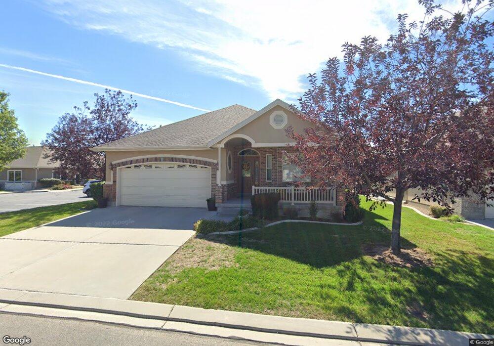
This home is located at 640 E 3280 N, Lehi, UT 84043 and is currently estimated at $720,103, approximately $418 per square foot. 640 E 3280 N is a home located in Utah County with nearby schools including Eaglecrest Elementary School, Lehi Junior High School, and Skyridge High School.
Ownership History
Date
Name
Owned For
Owner Type
Purchase Details
Closed on
Jan 17, 2008
Sold by
Smith Mark B and Smith Pauline S
Bought by
Smith Mark B and Smith Pauline S
Current Estimated Value
Purchase Details
Closed on
Sep 4, 2007
Sold by
Smith John Edward and The John Edward Smith Trust
Bought by
Smith Mark B and Smith Pauline S
Purchase Details
Closed on
Mar 26, 2004
Sold by
Brookhaven Investments Llc
Bought by
Smith John Edward and Smith Gloria B
Home Financials for this Owner
Home Financials are based on the most recent Mortgage that was taken out on this home.
Original Mortgage
$200,581
Interest Rate
5.64%
Mortgage Type
Purchase Money Mortgage
Create a Home Valuation Report for This Property
The Home Valuation Report is an in-depth analysis detailing your home's value as well as a comparison with similar homes in the area
Home Values in the Area
Average Home Value in this Area
Purchase History
| Date | Buyer | Sale Price | Title Company |
|---|---|---|---|
| Smith Mark B | -- | None Available | |
| Smith Mark B | -- | None Available | |
| Smith John Edward | -- | Affiliated First Title Comp |
Source: Public Records
Mortgage History
| Date | Status | Borrower | Loan Amount |
|---|---|---|---|
| Previous Owner | Smith John Edward | $200,581 |
Source: Public Records
Tax History
| Year | Tax Paid | Tax Assessment Tax Assessment Total Assessment is a certain percentage of the fair market value that is determined by local assessors to be the total taxable value of land and additions on the property. | Land | Improvement |
|---|---|---|---|---|
| 2025 | $2,778 | $371,745 | -- | -- |
| 2024 | $2,778 | $325,160 | $0 | $0 |
| 2023 | $2,511 | $319,055 | $0 | $0 |
| 2022 | $2,687 | $330,935 | $0 | $0 |
| 2021 | $2,386 | $444,400 | $151,200 | $293,200 |
| 2020 | $2,249 | $414,000 | $140,000 | $274,000 |
| 2019 | $2,163 | $414,000 | $140,000 | $274,000 |
| 2018 | $2,261 | $409,000 | $135,000 | $274,000 |
| 2017 | $2,253 | $216,700 | $0 | $0 |
| 2016 | $2,336 | $208,450 | $0 | $0 |
| 2015 | $2,401 | $203,390 | $0 | $0 |
| 2014 | $2,136 | $179,850 | $0 | $0 |
Source: Public Records
Map
Nearby Homes
- 3239 N 620 E
- 532 E 3270 N
- 3368 N 700 E
- 878 E 3050 N
- 173 E Forehand Ln
- 975 E 2850 N
- 242 W Glenbrittle Dr
- 4272 Braiken Ridge Dr Unit 105
- 4233 N 325 E Unit 1415
- 1602 E Center Pointe Dr
- 1610 E Center Pointe Dr
- 1618 E Center Pointe Dr
- 389 W 3200 N
- 4137 Conic Hill Dr Unit 133
- 4142 Horton Way Unit 161
- 4142 E Horton Way
- 4132 Horton Way Unit 160
- 4164 Horton Way Unit 162
- 5344 N Trail Side Ct
- 10365 N 6960 W
Your Personal Tour Guide
Ask me questions while you tour the home.