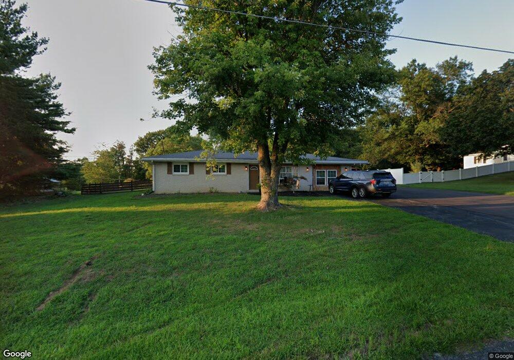
640 Georgetown Rd Littlestown, PA 17340
Estimated Value: $288,984 - $321,000
3
Beds
1
Bath
1,204
Sq Ft
$253/Sq Ft
Est. Value
About This Home
This home is located at 640 Georgetown Rd, Littlestown, PA 17340 and is currently estimated at $304,746, approximately $253 per square foot. 640 Georgetown Rd is a home located in Adams County with nearby schools including Rolling Acres El School, Maple Avenue Middle School, and Littlestown Senior High School.
Ownership History
Date
Name
Owned For
Owner Type
Purchase Details
Closed on
Oct 5, 2023
Sold by
Bompard Thierry and Bompard Lisa M
Bought by
Harrell John and Harrell Trudy
Current Estimated Value
Home Financials for this Owner
Home Financials are based on the most recent Mortgage that was taken out on this home.
Original Mortgage
$260,200
Outstanding Balance
$255,189
Interest Rate
7.23%
Mortgage Type
FHA
Estimated Equity
$49,557
Purchase Details
Closed on
Aug 22, 2011
Sold by
Fowler Mary F
Bought by
Fowler Mary F and Fowler Bruce A
Create a Home Valuation Report for This Property
The Home Valuation Report is an in-depth analysis detailing your home's value as well as a comparison with similar homes in the area
Home Values in the Area
Average Home Value in this Area
Purchase History
| Date | Buyer | Sale Price | Title Company |
|---|---|---|---|
| Harrell John | $265,000 | None Listed On Document | |
| Fowler Mary F | -- | None Available |
Source: Public Records
Mortgage History
| Date | Status | Borrower | Loan Amount |
|---|---|---|---|
| Open | Harrell John | $260,200 |
Source: Public Records
Tax History Compared to Growth
Tax History
| Year | Tax Paid | Tax Assessment Tax Assessment Total Assessment is a certain percentage of the fair market value that is determined by local assessors to be the total taxable value of land and additions on the property. | Land | Improvement |
|---|---|---|---|---|
| 2025 | $3,672 | $194,000 | $55,300 | $138,700 |
| 2024 | $3,530 | $194,000 | $55,300 | $138,700 |
| 2023 | $3,205 | $179,700 | $55,300 | $124,400 |
| 2022 | $3,164 | $179,700 | $55,300 | $124,400 |
| 2021 | $3,051 | $179,700 | $55,300 | $124,400 |
| 2020 | $3,007 | $179,700 | $55,300 | $124,400 |
| 2019 | $2,943 | $179,700 | $55,300 | $124,400 |
| 2018 | $2,855 | $179,700 | $55,300 | $124,400 |
| 2017 | $2,766 | $179,700 | $55,300 | $124,400 |
| 2016 | -- | $179,700 | $55,300 | $124,400 |
| 2015 | -- | $179,700 | $55,300 | $124,400 |
| 2014 | -- | $179,700 | $55,300 | $124,400 |
Source: Public Records
Map
Nearby Homes
- 15 Yorktowne Ct Unit 97
- 1024 Frederick Pike Unit 6
- 161 Cemetery St
- 6120 Baltimore Pike
- 141 W King St
- 22 Rita Marie Ave
- 22 Cemetery St
- 117 Charles St
- 115 Charles St
- 2238 Harney Rd Unit 3
- 2226 Harney Rd Unit 2
- 2199 Blacks School House Rd
- 2100 Blacks School House Rd
- 161 Stoners Cir
- 106 E King St
- 620 Saint Johns Rd
- 52 N Gala Unit 394
- 21 Johnamac N Unit 384
- 440 N Queen St
- 61 Stoners Cir
- 654 Georgetown Rd
- 624 Georgetown Rd Unit 3
- 625 Georgetown Rd
- 659 Georgetown Rd
- 614 Georgetown Rd
- 670 Georgetown Rd
- 690 Georgetown Rd
- 656 Mengus Mill Rd Unit 10
- 607 Georgetown Rd
- 716 Georgetown Rd
- 697 Georgetown Rd
- 721 Georgetown Rd
- 737 Georgetown Rd
- 699 Georgetown Rd
- 600 Mengus Mill Rd Unit 9
- 645 Mengus Mill Rd Unit 2
- 765 Georgetown Rd
- 4 LOT # Georgetown Rd
- 772 Georgetown Rd
- 591 Mengus Mill Rd