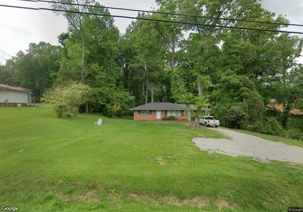
640 Highway 53 W Dawsonville, GA 30534
Estimated Value: $264,000 - $329,000
3
Beds
1
Bath
1,025
Sq Ft
$281/Sq Ft
Est. Value
About This Home
This home is located at 640 Highway 53 W, Dawsonville, GA 30534 and is currently estimated at $288,222, approximately $281 per square foot. 640 Highway 53 W is a home located in Dawson County with nearby schools including Robinson Elementary School, Dawson County Junior High School, and Dawson County Middle School.
Ownership History
Date
Name
Owned For
Owner Type
Purchase Details
Closed on
Sep 14, 1999
Sold by
Mcginnis Randy L
Bought by
Mcginnis Xarissa Leb
Current Estimated Value
Purchase Details
Closed on
Nov 22, 1995
Sold by
Howington Wm and Howington Melin
Bought by
Mcginnis Randy L
Purchase Details
Closed on
Dec 29, 1986
Sold by
Howington William L
Bought by
Howington Wm and Howington Melin
Purchase Details
Closed on
Aug 23, 1984
Sold by
Hamby Richard E and Hamby Le
Bought by
Howington William L
Purchase Details
Closed on
Nov 14, 1979
Bought by
Hamby Richard E and Hamby Le
Create a Home Valuation Report for This Property
The Home Valuation Report is an in-depth analysis detailing your home's value as well as a comparison with similar homes in the area
Home Values in the Area
Average Home Value in this Area
Purchase History
| Date | Buyer | Sale Price | Title Company |
|---|---|---|---|
| Mcginnis Xarissa Leb | -- | -- | |
| Mcginnis Randy L | $48,500 | -- | |
| Howington Wm | -- | -- | |
| Howington William L | $10,000 | -- | |
| Hamby Richard E | $25,000 | -- |
Source: Public Records
Tax History Compared to Growth
Tax History
| Year | Tax Paid | Tax Assessment Tax Assessment Total Assessment is a certain percentage of the fair market value that is determined by local assessors to be the total taxable value of land and additions on the property. | Land | Improvement |
|---|---|---|---|---|
| 2024 | $1,657 | $100,500 | $14,400 | $86,100 |
| 2023 | $1,634 | $105,700 | $14,400 | $91,300 |
| 2022 | $1,364 | $63,684 | $14,400 | $49,284 |
| 2021 | $1,180 | $52,156 | $14,400 | $37,756 |
| 2020 | $1,215 | $51,356 | $14,400 | $36,956 |
| 2019 | $1,036 | $43,396 | $14,400 | $28,996 |
| 2018 | $1,038 | $43,396 | $14,400 | $28,996 |
| 2017 | $689 | $28,798 | $12,000 | $16,798 |
| 2016 | $538 | $22,488 | $6,000 | $16,488 |
| 2015 | $555 | $22,488 | $6,000 | $16,488 |
| 2014 | $476 | $18,677 | $5,100 | $13,577 |
| 2013 | -- | $15,592 | $4,200 | $11,392 |
Source: Public Records
Map
Nearby Homes
- 129 Trace Bluff
- 76 Trace Bluff
- Burke Plan at Villas at Dawsonville
- Arlington Plan at Villas at Dawsonville
- Dillon Plan at Villas at Dawsonville
- Clayton Plan at Villas at Dawsonville
- Edinburg Plan at Villas at Dawsonville
- Elijah Plan at Villas at Dawsonville - Townhomes
- Ellerbe Plan at Villas at Dawsonville
- 139 Trace Bluff
- 68 Trace Bluff
- 62 Trace Bluff
- 54 Trace Bluff
- 50 Trace Bluff
- 151 Trace Bluff
- 159 Trace Bluff
- 46 Creekstone Ln
- 27 Maple Terrace
- 175 River Mill Ln
- 217 River Mill Ln
- 616 Highway 53 W
- 0 Highway 53 W Unit 8298760
- 0 Highway 53 W Unit 5910200
- 0 Highway 53 W Unit 7253138
- 0 Highway 53 W Unit 3136472
- 0 Highway 53 W Unit B 7549876
- 0 Highway 53 W Unit A 7549875
- 0 Highway 53 W
- 0 Highway 53 W
- 0 Highway 53 W Unit 9022362
- 0 Highway 53 W Unit 8659071
- 0 Highway 53 W Unit 4283576
- 0 Highway 53 W Unit 8707332
- 0 Highway 53 W Unit 8047323
- 0 Highway 53 W Unit 8409881
- 0 Highway 53 W Unit 8661308
- 0 Highway 53 W Unit 5086224
- 0 Highway 53 W Unit 8602194
- 0 Highway 53 W Unit 8494289
- 0 Highway 53 W Unit 8491814