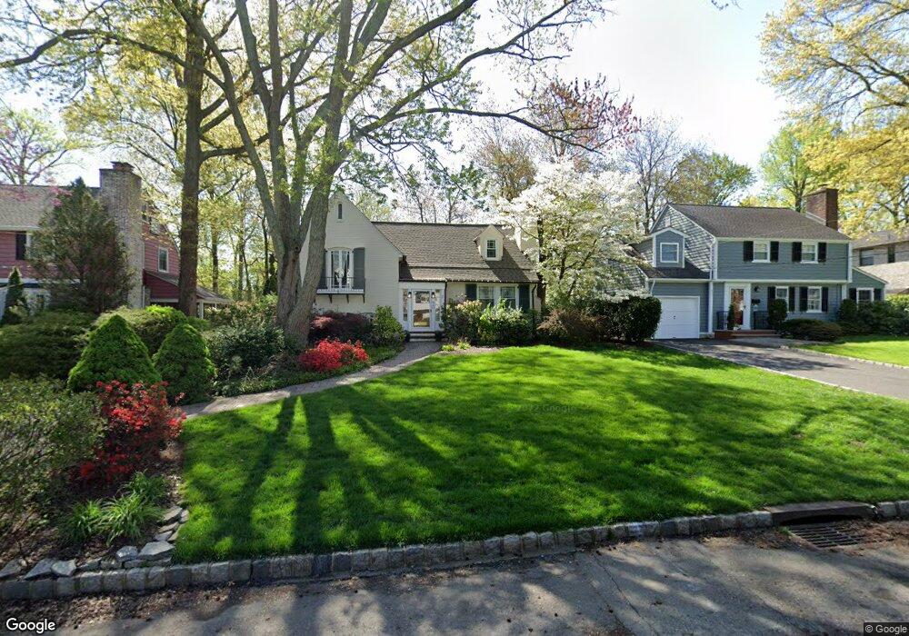
640 Hillcrest Ave Westfield, NJ 07090
Estimated Value: $840,000 - $1,005,000
--
Bed
--
Bath
1,683
Sq Ft
$568/Sq Ft
Est. Value
About This Home
This home is located at 640 Hillcrest Ave, Westfield, NJ 07090 and is currently estimated at $955,175, approximately $567 per square foot. 640 Hillcrest Ave is a home located in Union County with nearby schools including Washington Elementary School, Roosevelt Intermediate School, and Westfield Senior High School.
Ownership History
Date
Name
Owned For
Owner Type
Purchase Details
Closed on
May 13, 1997
Sold by
Love James D and Love Linda H
Bought by
Cleary Eileen J
Current Estimated Value
Home Financials for this Owner
Home Financials are based on the most recent Mortgage that was taken out on this home.
Original Mortgage
$220,000
Outstanding Balance
$29,146
Interest Rate
7.62%
Estimated Equity
$926,029
Create a Home Valuation Report for This Property
The Home Valuation Report is an in-depth analysis detailing your home's value as well as a comparison with similar homes in the area
Home Values in the Area
Average Home Value in this Area
Purchase History
| Date | Buyer | Sale Price | Title Company |
|---|---|---|---|
| Cleary Eileen J | $275,000 | -- |
Source: Public Records
Mortgage History
| Date | Status | Borrower | Loan Amount |
|---|---|---|---|
| Open | Cleary Eileen J | $220,000 |
Source: Public Records
Tax History Compared to Growth
Tax History
| Year | Tax Paid | Tax Assessment Tax Assessment Total Assessment is a certain percentage of the fair market value that is determined by local assessors to be the total taxable value of land and additions on the property. | Land | Improvement |
|---|---|---|---|---|
| 2025 | $14,998 | $666,000 | $457,900 | $208,100 |
| 2024 | $14,692 | $666,000 | $457,900 | $208,100 |
| 2023 | $14,692 | $666,000 | $457,900 | $208,100 |
| 2022 | $14,386 | $666,000 | $457,900 | $208,100 |
| 2021 | $14,406 | $666,000 | $457,900 | $208,100 |
| 2020 | $14,372 | $666,000 | $457,900 | $208,100 |
| 2019 | $14,319 | $666,000 | $457,900 | $208,100 |
| 2018 | $15,758 | $169,500 | $77,400 | $92,100 |
| 2017 | $15,672 | $169,500 | $77,400 | $92,100 |
| 2016 | $15,304 | $169,500 | $77,400 | $92,100 |
| 2015 | $14,999 | $169,500 | $77,400 | $92,100 |
| 2014 | $14,504 | $169,500 | $77,400 | $92,100 |
Source: Public Records
Map
Nearby Homes
- 529 Benson Place
- 629 Tremont Ave
- 105 Chestnut Ct Unit 3
- 519 3rd Ave
- 500 Maple Ct Unit 500
- 764 Fairacres Ave
- 806 Saint Marks Ave
- 565 Willow Ave
- 7 Folkstone Dr
- 534 E Broad St
- 410 Lenox Ave
- 401 Brookside Place
- 131 Wells St
- 112 Linden Ave
- 339 2nd Ave
- 820 E Broad St
- 112 Windsor Ave
- 305 Cedar St
- 4 Cedar St
- 343 South Ave
- 646 Hillcrest Ave
- 634 Hillcrest Ave
- 626 Hillcrest Ave
- 654 Hillcrest Ave
- 622 Hillcrest Ave
- 612 S Chestnut St
- 656 Hillcrest Ave
- 5 Brandt
- 641 Hillcrest Ave
- 614 S Chestnut St
- 23 Cornwall Dr
- 645 Hillcrest Ave
- 639 Hillcrest Ave
- 649 Hillcrest Ave
- 3 Brandt
- 653 Hillcrest Ave
- 620 Hillcrest Ave
- 664 Hillcrest Ave
- 631 Hillcrest Ave
- 655 Hillcrest Ave