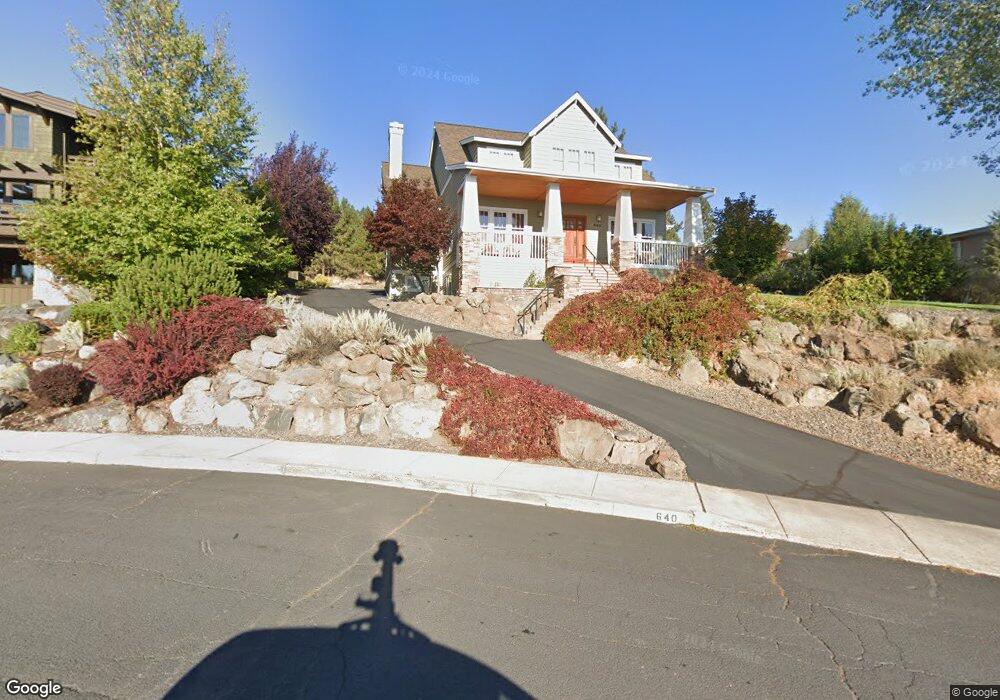
640 NW Powell Butte Loop Bend, OR 97701
Awbrey Butte NeighborhoodEstimated Value: $1,370,062 - $2,271,000
3
Beds
3
Baths
4,086
Sq Ft
$414/Sq Ft
Est. Value
About This Home
This home is located at 640 NW Powell Butte Loop, Bend, OR 97701 and is currently estimated at $1,693,516, approximately $414 per square foot. 640 NW Powell Butte Loop is a home located in Deschutes County with nearby schools including North Star Elementary School, Pacific Crest Middle School, and Summit High School.
Ownership History
Date
Name
Owned For
Owner Type
Purchase Details
Closed on
Jul 19, 2023
Sold by
Thomason Tom S and Thomason Stephanie M
Bought by
Tom And Stephanie Thomason Joint Trust and Thomason
Current Estimated Value
Purchase Details
Closed on
Jul 8, 2013
Sold by
Thomason Tom S
Bought by
Thomason Tom S and Thomason Stephanie M
Home Financials for this Owner
Home Financials are based on the most recent Mortgage that was taken out on this home.
Original Mortgage
$415,000
Interest Rate
3.57%
Mortgage Type
New Conventional
Purchase Details
Closed on
May 17, 2010
Sold by
Thomason Lori
Bought by
Thomason Tom S
Home Financials for this Owner
Home Financials are based on the most recent Mortgage that was taken out on this home.
Original Mortgage
$417,000
Interest Rate
5.21%
Mortgage Type
New Conventional
Create a Home Valuation Report for This Property
The Home Valuation Report is an in-depth analysis detailing your home's value as well as a comparison with similar homes in the area
Home Values in the Area
Average Home Value in this Area
Purchase History
| Date | Buyer | Sale Price | Title Company |
|---|---|---|---|
| Tom And Stephanie Thomason Joint Trust | -- | None Listed On Document | |
| Thomason Tom S | -- | Deschutes County Title Co | |
| Thomason Tom S | -- | Deschutes County Title Co |
Source: Public Records
Mortgage History
| Date | Status | Borrower | Loan Amount |
|---|---|---|---|
| Previous Owner | Thomason Tom S | $415,000 | |
| Previous Owner | Thomason Tom S | $417,000 |
Source: Public Records
Tax History
| Year | Tax Paid | Tax Assessment Tax Assessment Total Assessment is a certain percentage of the fair market value that is determined by local assessors to be the total taxable value of land and additions on the property. | Land | Improvement |
|---|---|---|---|---|
| 2025 | $10,314 | $610,450 | -- | -- |
| 2024 | $9,923 | $592,670 | -- | -- |
| 2023 | $9,199 | $575,410 | $0 | $0 |
| 2022 | $8,583 | $542,390 | $0 | $0 |
| 2021 | $8,596 | $526,600 | $0 | $0 |
| 2020 | $8,155 | $526,600 | $0 | $0 |
| 2019 | $7,928 | $511,270 | $0 | $0 |
| 2018 | $7,704 | $496,380 | $0 | $0 |
| 2017 | $7,478 | $481,930 | $0 | $0 |
| 2016 | $7,131 | $467,900 | $0 | $0 |
| 2015 | $6,934 | $454,280 | $0 | $0 |
| 2014 | $6,730 | $441,050 | $0 | $0 |
Source: Public Records
Map
Nearby Homes
- 664 NW Powell Butte Loop
- 2545 NW Awbrey Rd
- 625 NW Compass Ln
- 2580 N West Awbrey Point Cir Unit 1&2
- 2627 NW Awbrey Point Cir
- 2850 NW Lucus Ct
- 2903 NW Fairway Heights Dr
- 2975 NW Lucus Ct
- 2980 NW Lucus Ct
- 520 NW Divot Dr
- 3061 NW Jewell Way
- 2984 NW Hidden Ridge Dr
- 3031 NW Hidden Ridge Dr
- 1166 NW Redfield Cir
- 3025 NW Fairway Heights Dr
- 3057 NW Colonial Dr
- 2582 NW 1st St
- 3039 NW Craftsman Dr
- 3419 NW Fairway Heights Dr
- 3385 NW Eighteenth Fairway Place
- 2601 NW Pilot View Ct
- 646 NW Powell Butte Loop
- 0 N West Pilot View Ct
- 2613 NW Pilot View Ct
- 652 NW Powell Butte Loop
- 2412 N West Wyeth Place
- 2412 NW Wyeth Place
- 647 NW Powell Butte Loop
- 2390 NW Wyeth Place
- 2602 NW Pilot View Ct
- 658 NW Powell Butte Loop
- 2625 NW Pilot View Ct
- 629 NW Powell Butte Loop
- 2438 NW Wyeth Place
- 2438 N West Wyeth Place
- 665 NW Powell Butte Loop
- 624 NW Powell Butte Loop
- 625 NW Powell Butte Loop
- 2626 NW Pilot View Ct
Your Personal Tour Guide
Ask me questions while you tour the home.