Estimated Value: $309,000 - $335,000
4
Beds
3
Baths
2,088
Sq Ft
$156/Sq Ft
Est. Value
About This Home
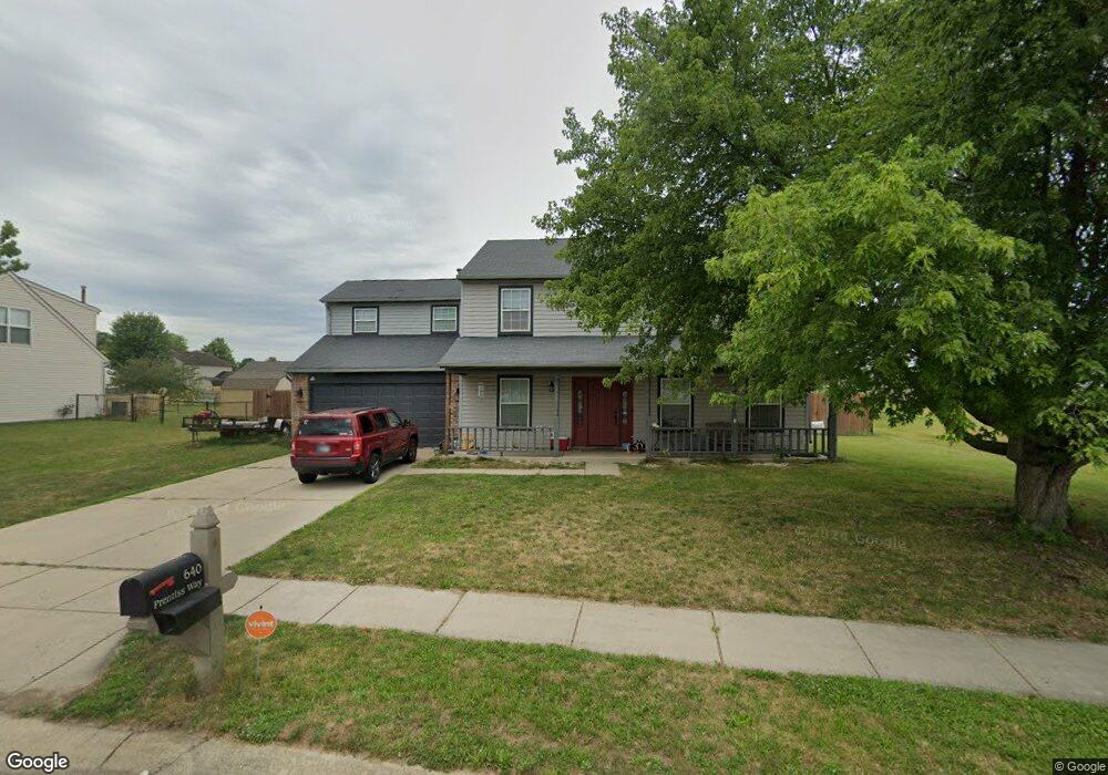
This home is located at 640 Prentiss Way, Avon, IN 46123 and is currently estimated at $325,846, approximately $156 per square foot. 640 Prentiss Way is a home located in Hendricks County with nearby schools including Maple Elementary School, White Oak Elementary School, and Avon Middle School North.
Ownership History
Date
Name
Owned For
Owner Type
Purchase Details
Closed on
Jul 3, 2025
Sold by
Jeffries Marie R
Bought by
Stephany Marie R
Current Estimated Value
Home Financials for this Owner
Home Financials are based on the most recent Mortgage that was taken out on this home.
Original Mortgage
$75,000
Outstanding Balance
$74,874
Interest Rate
6.89%
Mortgage Type
Credit Line Revolving
Estimated Equity
$250,972
Purchase Details
Closed on
Jul 17, 2009
Sold by
Jeffries Richard D
Bought by
Jeffries Marie R
Create a Home Valuation Report for This Property
The Home Valuation Report is an in-depth analysis detailing your home's value as well as a comparison with similar homes in the area
Home Values in the Area
Average Home Value in this Area
Purchase History
| Date | Buyer | Sale Price | Title Company |
|---|---|---|---|
| Stephany Marie R | -- | None Listed On Document | |
| Jeffries Marie R | -- | None Available |
Source: Public Records
Mortgage History
| Date | Status | Borrower | Loan Amount |
|---|---|---|---|
| Open | Stephany Marie R | $75,000 |
Source: Public Records
Tax History Compared to Growth
Tax History
| Year | Tax Paid | Tax Assessment Tax Assessment Total Assessment is a certain percentage of the fair market value that is determined by local assessors to be the total taxable value of land and additions on the property. | Land | Improvement |
|---|---|---|---|---|
| 2024 | $2,977 | $265,100 | $46,600 | $218,500 |
| 2023 | $2,595 | $235,500 | $40,500 | $195,000 |
| 2022 | $2,439 | $217,700 | $37,500 | $180,200 |
| 2021 | $2,140 | $186,700 | $35,000 | $151,700 |
| 2020 | $1,976 | $175,500 | $35,000 | $140,500 |
| 2019 | $1,785 | $163,000 | $32,500 | $130,500 |
| 2018 | $1,800 | $156,300 | $32,500 | $123,800 |
| 2017 | $1,513 | $151,300 | $30,900 | $120,400 |
| 2016 | $1,487 | $148,700 | $30,900 | $117,800 |
| 2014 | $1,350 | $135,000 | $27,800 | $107,200 |
Source: Public Records
Map
Nearby Homes
- 9936 Nightsong Ln
- 10194 Buell Dr
- 694 Crystal Farms Dr
- 9917 Countryside Ct
- 9447 Jackson Way
- 569 Dalton Way
- 9397 Villa Woods Dr Unit 213
- 10586 Jacks Way
- Riverton Plan at Brookstone - Crossings
- Fifth Avenue Plan at Brookstone - Landings
- Park Place Plan at Brookstone - Landings
- Greenfield Plan at Brookstone - Crossings
- Boardwalk Plan at Brookstone - Landings
- Hilltop Plan at Brookstone - Crossings
- Westchester Plan at Brookstone - Crossings
- 257 Strand Ln Unit C
- 898 Justine Cir W
- 256 Strand Ln Unit C
- 474 Glenn Villa Ln Unit 140
- 9407 Avon Creek Unit A
- 624 Prentiss Way
- 602 Prentiss Way
- 637 Sunmeadow Ln
- 613 Prentiss Way
- 627 Sunmeadow Ln
- 9991 Ellsworth Ln
- 589 Yorktown Ln
- 647 Sunmeadow Ln
- 9985 Ellsworth Ln
- 617 Sunmeadow Ln
- 599 Prentiss Way
- 9956 Cedarstone Ln
- 605 Sunmeadow Ln
- 9973 Ellsworth Ln
- 581 Yorktown Ln
- 10135 Stillwell Dr
- 587 Prentiss Way
- 580 Prentiss Way
- 9946 Cedarstone Ln
- 10143 Stillwell Dr