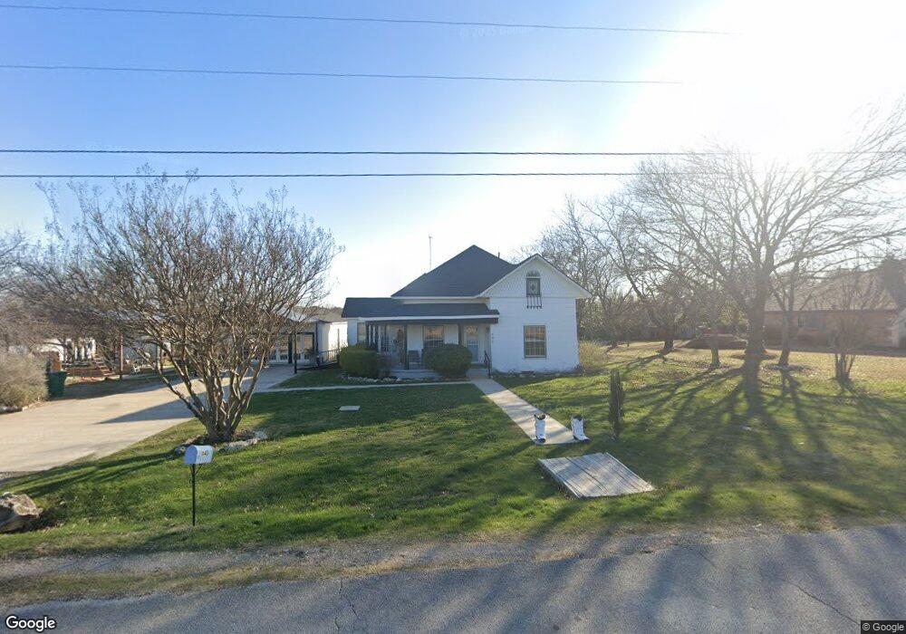
640 S Loop Dr Cedar Hill, TX 75104
Estimated Value: $298,000 - $392,000
5
Beds
2
Baths
2,566
Sq Ft
$137/Sq Ft
Est. Value
About This Home
This home is located at 640 S Loop Dr, Cedar Hill, TX 75104 and is currently estimated at $352,471, approximately $137 per square foot. 640 S Loop Dr is a home located in Dallas County with nearby schools including Plummer Elementary School, W.S. Permenter Middle School, and Cedar Hill High School.
Ownership History
Date
Name
Owned For
Owner Type
Purchase Details
Closed on
Feb 27, 2020
Sold by
Lehmann Aaron and Lehmann Keri
Bought by
Carter Brentton and Rodriguez Carter Maria
Current Estimated Value
Home Financials for this Owner
Home Financials are based on the most recent Mortgage that was taken out on this home.
Original Mortgage
$295,260
Outstanding Balance
$261,988
Interest Rate
3.6%
Mortgage Type
VA
Estimated Equity
$90,483
Purchase Details
Closed on
Mar 15, 2002
Sold by
Mason Melissa Jane
Bought by
Lehmann Aaron and Lehmann Keri
Home Financials for this Owner
Home Financials are based on the most recent Mortgage that was taken out on this home.
Original Mortgage
$79,373
Interest Rate
7.01%
Mortgage Type
FHA
Purchase Details
Closed on
Feb 8, 1999
Sold by
Singleton Steve R
Bought by
Bryan Alvis
Create a Home Valuation Report for This Property
The Home Valuation Report is an in-depth analysis detailing your home's value as well as a comparison with similar homes in the area
Purchase History
| Date | Buyer | Sale Price | Title Company |
|---|---|---|---|
| Carter Brentton | -- | Itc | |
| Lehmann Aaron | -- | -- | |
| Bryan Alvis | -- | -- |
Source: Public Records
Mortgage History
| Date | Status | Borrower | Loan Amount |
|---|---|---|---|
| Open | Carter Brentton | $295,260 | |
| Previous Owner | Lehmann Aaron | $79,373 |
Source: Public Records
Tax History
| Year | Tax Paid | Tax Assessment Tax Assessment Total Assessment is a certain percentage of the fair market value that is determined by local assessors to be the total taxable value of land and additions on the property. | Land | Improvement |
|---|---|---|---|---|
| 2025 | $5,484 | $268,110 | $90,270 | $177,840 |
| 2024 | $5,484 | $312,300 | $80,240 | $232,060 |
| 2023 | $5,484 | $330,900 | $60,180 | $270,720 |
| 2022 | $6,690 | $263,680 | $60,180 | $203,500 |
| 2021 | $6,582 | $257,940 | $16,050 | $241,890 |
| 2020 | $6,735 | $257,940 | $16,050 | $241,890 |
| 2019 | $3,018 | $110,570 | $16,050 | $94,520 |
| 2018 | $3,175 | $110,570 | $16,050 | $94,520 |
| 2017 | $2,360 | $82,230 | $16,050 | $66,180 |
| 2016 | $2,360 | $82,230 | $16,050 | $66,180 |
| 2015 | $2,037 | $82,230 | $16,050 | $66,180 |
| 2014 | $2,037 | $82,230 | $16,050 | $66,180 |
Source: Public Records
Map
Nearby Homes
- 1307 Hayes St
- 532 Prince St
- 408 Payne St
- 1306 Newton Dr
- 831 Parkside Dr
- 503 Evergreen Trail
- 812 Passive Dr
- 1206 Saturn Dr
- 1223 Venus St
- 1222 Saturn Dr
- 1109 Neptune Dr
- 355 Evergreen Trail
- 1207 Mars Dr
- 213 Rainsong Dr
- 1315 Saturn Dr
- 935 S Clark Rd
- 713 Azalea Ln
- 313 Simmons Dr
- 1006 S Clark Rd
- 500 High Dr
Your Personal Tour Guide
Ask me questions while you tour the home.