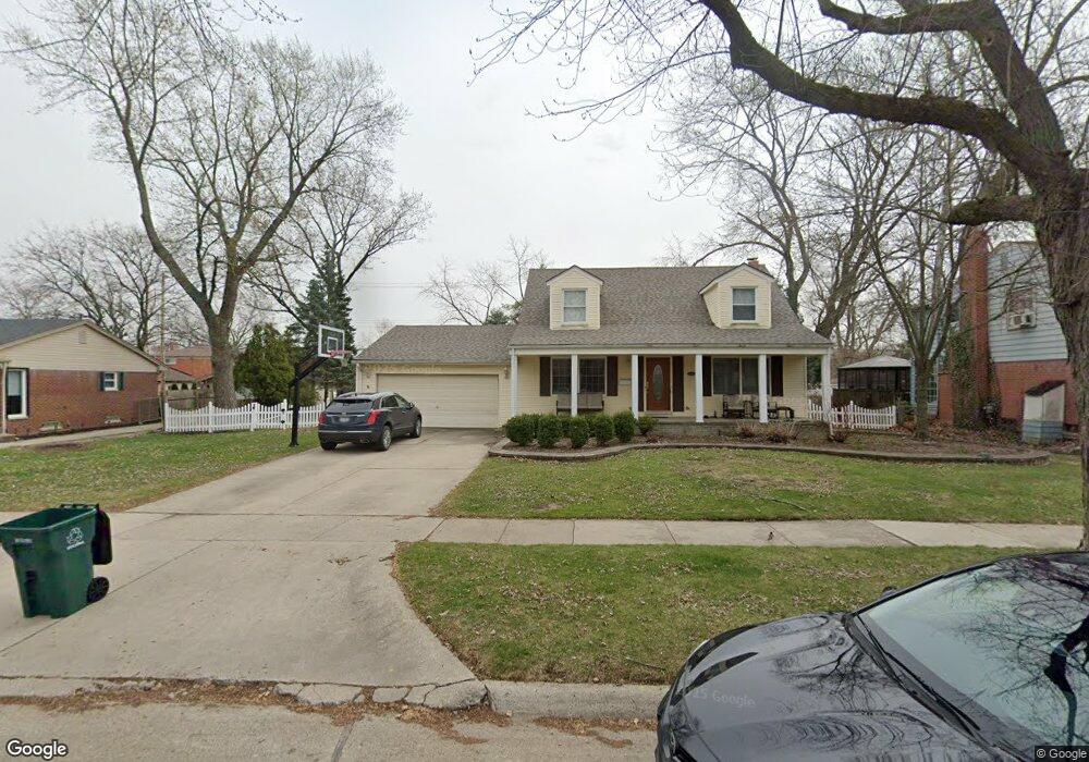
640 Shenandoah Dr Clawson, MI 48017
Estimated Value: $428,000 - $476,000
3
Beds
2
Baths
2,055
Sq Ft
$217/Sq Ft
Est. Value
About This Home
This home is located at 640 Shenandoah Dr, Clawson, MI 48017 and is currently estimated at $446,659, approximately $217 per square foot. 640 Shenandoah Dr is a home located in Oakland County with nearby schools including Clawson High School, Japhet School, and Guardian Angels School.
Ownership History
Date
Name
Owned For
Owner Type
Purchase Details
Closed on
Sep 2, 2015
Sold by
Williams Kimberly C
Bought by
Kozak Andrea M
Current Estimated Value
Home Financials for this Owner
Home Financials are based on the most recent Mortgage that was taken out on this home.
Original Mortgage
$270,655
Outstanding Balance
$211,704
Interest Rate
3.87%
Mortgage Type
FHA
Estimated Equity
$234,955
Purchase Details
Closed on
Nov 15, 2001
Sold by
Wilson Shirley and Wilson Frank
Bought by
Williams Kimberly C
Create a Home Valuation Report for This Property
The Home Valuation Report is an in-depth analysis detailing your home's value as well as a comparison with similar homes in the area
Home Values in the Area
Average Home Value in this Area
Purchase History
| Date | Buyer | Sale Price | Title Company |
|---|---|---|---|
| Kozak Andrea M | $280,000 | Devonshire Title Agency | |
| Williams Kimberly C | -- | Devonshire Title Agency | |
| Williams Kimberly C | -- | First American Title Ins Co |
Source: Public Records
Mortgage History
| Date | Status | Borrower | Loan Amount |
|---|---|---|---|
| Open | Williams Kimberly C | $270,655 |
Source: Public Records
Tax History Compared to Growth
Tax History
| Year | Tax Paid | Tax Assessment Tax Assessment Total Assessment is a certain percentage of the fair market value that is determined by local assessors to be the total taxable value of land and additions on the property. | Land | Improvement |
|---|---|---|---|---|
| 2024 | $8,266 | $190,090 | $0 | $0 |
| 2023 | $7,963 | $179,160 | $0 | $0 |
| 2022 | $7,260 | $166,160 | $0 | $0 |
| 2021 | $7,588 | $157,360 | $0 | $0 |
| 2020 | $6,604 | $148,960 | $0 | $0 |
| 2019 | $7,739 | $143,490 | $0 | $0 |
| 2018 | $6,297 | $130,180 | $0 | $0 |
| 2017 | $6,259 | $126,400 | $0 | $0 |
| 2016 | $6,312 | $118,980 | $0 | $0 |
| 2015 | -- | $109,120 | $0 | $0 |
| 2014 | -- | $94,460 | $0 | $0 |
| 2011 | -- | $85,600 | $0 | $0 |
Source: Public Records
Map
Nearby Homes
- 846 Phillips Ave
- 496 Langley Blvd
- 908 W Elmwood Ave
- Fairfax Plan at The Village at Clawson Park
- Penrose Plan at The Village at Clawson Park
- 1823 Torquay Ave
- 4921 N Crooks Rd Unit N-10
- 1092 Shenandoah Dr
- 4909 Crooks Rd Unit C7
- 4909 Crooks Rd Unit 4
- 4909 Coventry St Unit 287
- 1806 Torquay Ave
- 2134 Wickham St
- 1936 Torquay Ave Unit 205
- 609 John M Ave
- 4921 Crooks Rd Unit M-10
- 4952 Coventry St Unit 315
- 1226 Shenandoah Dr
- 351 W Baker Ave
- 232 S Manitou Ave
- 634 Shenandoah Dr
- 628 Shenandoah Dr
- 1046 W Selfridge Blvd
- 666 Shenandoah Dr
- 664 Shenandoah Dr
- 1066 W Selfridge Blvd
- 1008 W Selfridge Blvd
- 643 Shenandoah Dr
- 655 Shenandoah Dr
- 1060 W Selfridge Blvd
- 633 Shenandoah Dr
- 608 Shenandoah Dr
- 555 N Selfridge Blvd
- 669 Shenandoah Dr
- 1106 W Selfridge Blvd
- 621 Shenandoah Dr
- 683 Shenandoah Dr
- 605 N Selfridge Blvd
- 688 Shenandoah Dr
- 598 Shenandoah Dr