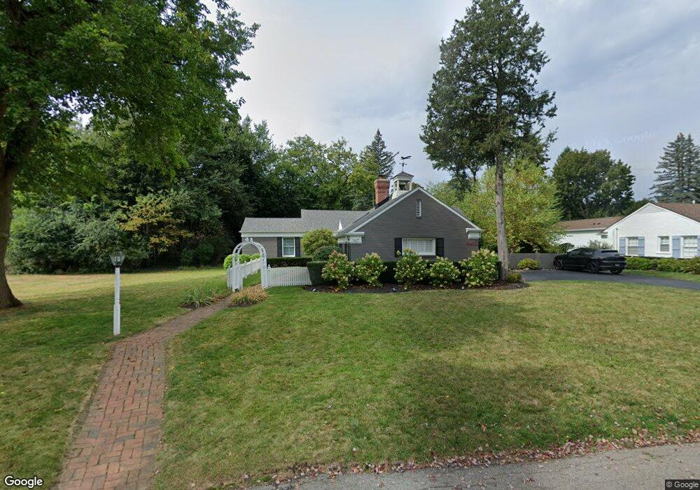
6400 W Surrey Rd Unit Bldg-Unit Bloomfield Hills, MI 48301
Estimated Value: $554,107 - $764,000
4
Beds
3
Baths
2,109
Sq Ft
$322/Sq Ft
Est. Value
About This Home
This home is located at 6400 W Surrey Rd Unit Bldg-Unit, Bloomfield Hills, MI 48301 and is currently estimated at $678,777, approximately $321 per square foot. 6400 W Surrey Rd Unit Bldg-Unit is a home located in Oakland County with nearby schools including Conant Elementary School, South Hills Middle School, and Bloomfield Hills High School.
Ownership History
Date
Name
Owned For
Owner Type
Purchase Details
Closed on
Aug 21, 2020
Sold by
Furlong Michael
Bought by
Robie Kyle and Robie Olivia
Current Estimated Value
Purchase Details
Closed on
Jan 19, 2018
Sold by
Graham Michael A and Graham Kimberly B
Bought by
Furlong Michael
Home Financials for this Owner
Home Financials are based on the most recent Mortgage that was taken out on this home.
Original Mortgage
$346,500
Interest Rate
3.94%
Mortgage Type
New Conventional
Create a Home Valuation Report for This Property
The Home Valuation Report is an in-depth analysis detailing your home's value as well as a comparison with similar homes in the area
Home Values in the Area
Average Home Value in this Area
Purchase History
| Date | Buyer | Sale Price | Title Company |
|---|---|---|---|
| Robie Kyle | $499,900 | Fnt | |
| Furlong Michael | $385,000 | Devon Title Agency |
Source: Public Records
Mortgage History
| Date | Status | Borrower | Loan Amount |
|---|---|---|---|
| Previous Owner | Furlong Michael | $346,500 |
Source: Public Records
Tax History Compared to Growth
Tax History
| Year | Tax Paid | Tax Assessment Tax Assessment Total Assessment is a certain percentage of the fair market value that is determined by local assessors to be the total taxable value of land and additions on the property. | Land | Improvement |
|---|---|---|---|---|
| 2024 | $3,547 | $212,400 | $0 | $0 |
| 2023 | $3,432 | $197,600 | $0 | $0 |
| 2022 | $6,450 | $173,800 | $0 | $0 |
| 2021 | $6,404 | $167,320 | $0 | $0 |
| 2020 | $3,160 | $166,090 | $0 | $0 |
| 2019 | $6,153 | $165,370 | $0 | $0 |
| 2018 | $4,418 | $151,210 | $0 | $0 |
| 2017 | $4,387 | $144,400 | $0 | $0 |
| 2016 | $4,395 | $140,120 | $0 | $0 |
| 2015 | -- | $136,910 | $0 | $0 |
| 2014 | -- | $115,310 | $0 | $0 |
| 2011 | -- | $104,450 | $0 | $0 |
Source: Public Records
Map
Nearby Homes
- 4200 Surrey Cross
- 750 Trailwood Path Unit B
- 450 Billingsgate Ct Unit C
- 1760 Trailwood Path
- 6572 Spruce Dr
- 6660 Woodbank Dr
- 6750 Wing Lake Rd
- 4456 W Maple Rd
- 6701 Franklin Rd
- 6952 Sandalwood Dr
- 7005 Cathedral Dr
- 6360 Hills Dr
- 4017 Hidden Woods Dr
- 6450 Gilbert Lake Rd
- 7100 Wing Lake Rd
- 5630 S Adams Way
- 7200 Telegraph Rd
- 6041 Eastmoor Rd
- 7303 Brookside Village Ct
- 4428 Old Trinity Ct
- 6400 W Surrey Rd
- 6390 W Surrey Rd
- 6425 Worlington Rd
- 6393 Worlington Rd
- 4220 Surrey Cross
- 6455 Worlington Rd
- 6370 W Surrey Rd
- 6375 W Surrey Rd
- 6363 Worlington Rd
- 6485 Worlington Rd
- 6420 Worlington Rd
- 6380 Worlington Rd
- 6340 W Surrey Rd
- 6450 Worlington Rd
- 6345 W Surrey Rd
- 6360 E Surrey Rd
- 6350 Worlington Rd
- 6480 Worlington Rd
- 6415 Thurber Rd
- 6320 W Surrey Rd