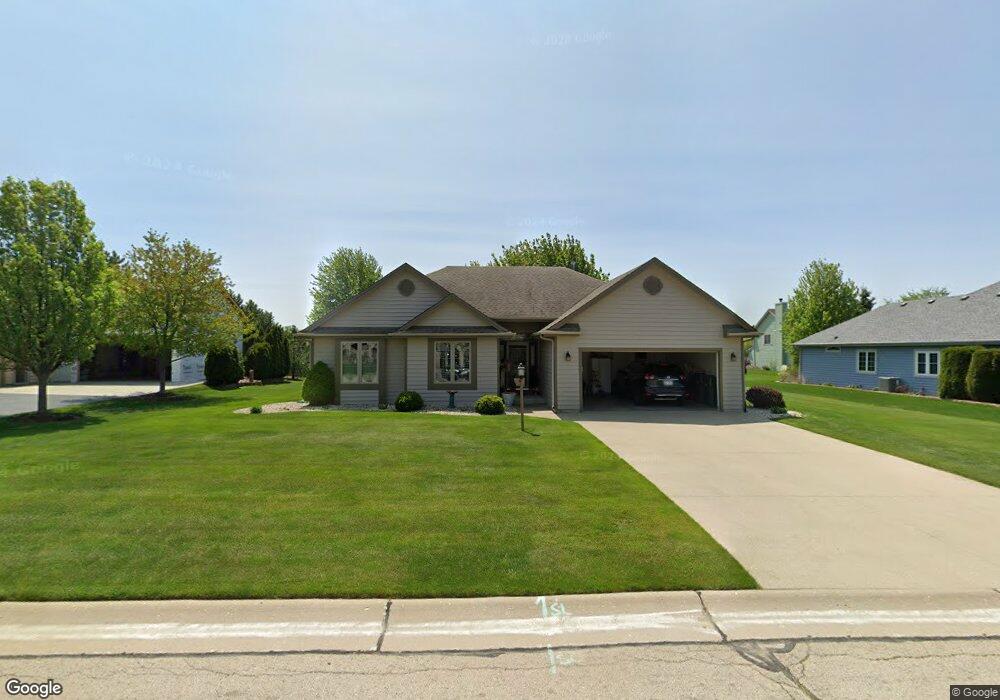
6401 Pheasant Creek Trail Mount Pleasant, WI 53406
Estimated Value: $442,211 - $520,000
3
Beds
2
Baths
1,757
Sq Ft
$274/Sq Ft
Est. Value
About This Home
This home is located at 6401 Pheasant Creek Trail, Mount Pleasant, WI 53406 and is currently estimated at $482,053, approximately $274 per square foot. 6401 Pheasant Creek Trail is a home located in Racine County with nearby schools including West Ridge Elementary School, Mitchell Middle School, and Case High School.
Ownership History
Date
Name
Owned For
Owner Type
Purchase Details
Closed on
Jun 22, 2020
Sold by
Lisiecki Donald J
Bought by
Poort Sherri L and Lisiecki Sherri L
Current Estimated Value
Home Financials for this Owner
Home Financials are based on the most recent Mortgage that was taken out on this home.
Original Mortgage
$126,200
Interest Rate
3.1%
Mortgage Type
New Conventional
Create a Home Valuation Report for This Property
The Home Valuation Report is an in-depth analysis detailing your home's value as well as a comparison with similar homes in the area
Home Values in the Area
Average Home Value in this Area
Purchase History
| Date | Buyer | Sale Price | Title Company |
|---|---|---|---|
| Poort Sherri L | -- | Knight Barry Title |
Source: Public Records
Mortgage History
| Date | Status | Borrower | Loan Amount |
|---|---|---|---|
| Closed | Poort Sherri L | $126,200 |
Source: Public Records
Tax History Compared to Growth
Tax History
| Year | Tax Paid | Tax Assessment Tax Assessment Total Assessment is a certain percentage of the fair market value that is determined by local assessors to be the total taxable value of land and additions on the property. | Land | Improvement |
|---|---|---|---|---|
| 2024 | $6,316 | $404,100 | $65,600 | $338,500 |
| 2023 | $5,844 | $364,500 | $61,300 | $303,200 |
| 2022 | $5,106 | $316,100 | $61,300 | $254,800 |
| 2021 | $5,216 | $288,100 | $55,700 | $232,400 |
| 2020 | $4,800 | $256,500 | $48,100 | $208,400 |
| 2019 | $4,575 | $256,500 | $48,100 | $208,400 |
| 2018 | $4,525 | $235,300 | $43,100 | $192,200 |
| 2017 | $4,232 | $216,200 | $43,100 | $173,100 |
| 2016 | $4,218 | $203,300 | $34,500 | $168,800 |
| 2015 | $4,177 | $203,300 | $34,500 | $168,800 |
| 2014 | $3,945 | $203,300 | $34,500 | $168,800 |
| 2013 | $4,184 | $203,300 | $34,500 | $168,800 |
Source: Public Records
Map
Nearby Homes
- 6343 Ptarmigan Rd
- 353 Quail Point Dr
- 6352 Kelsey Ct
- 6300 Bald Eagle Rd
- 1117 N Sunnyslope Dr Unit 204
- 6236 Bald Eagle Rd
- 6532 Kingsview Dr
- 6355 Kingsview Dr
- 38 S Emmertsen Rd
- 1208 N Sunnyslope Dr Unit 202
- 1231 N Sunnyslope Dr Unit 205
- 1315 N Sunnyslope Dr Unit 202
- 6510 Spring St Unit 17
- 6121 Spring St
- 6940 Mariner Dr Unit 101
- Cedar Point Plan at Christina Estates
- Lt0 Mariner Dr
- 6551 Mariner Dr Unit 5
- 586 Calvin Ln
- 6342 Kinzie Ave
- 6421 Pheasant Creek Trail
- 6341 Pheasant Creek Trail
- 6340 Ptarmigan Rd
- 6350 Ptarmigan Rd
- 6330 Ptarmigan Rd
- 6441 Pheasant Creek Trail
- 6400 Ptarmigan Rd
- 6321 Pheasant Creek Trail
- 6350 Pheasant Creek Trail
- 6430 Pheasant Creek Trail
- 6330 Pheasant Creek Trail
- 6410 Ptarmigan Rd
- 6455 Pheasant Creek Trail
- 6320 Pheasant Creek Trail
- 6450 Pheasant Creek Trail
- 6353 Ptarmigan Rd
- 6333 Ptarmigan Rd
- 6411 Lindsay Ln
- 6323 Ptarmigan Rd
- 6403 Ptarmigan Rd