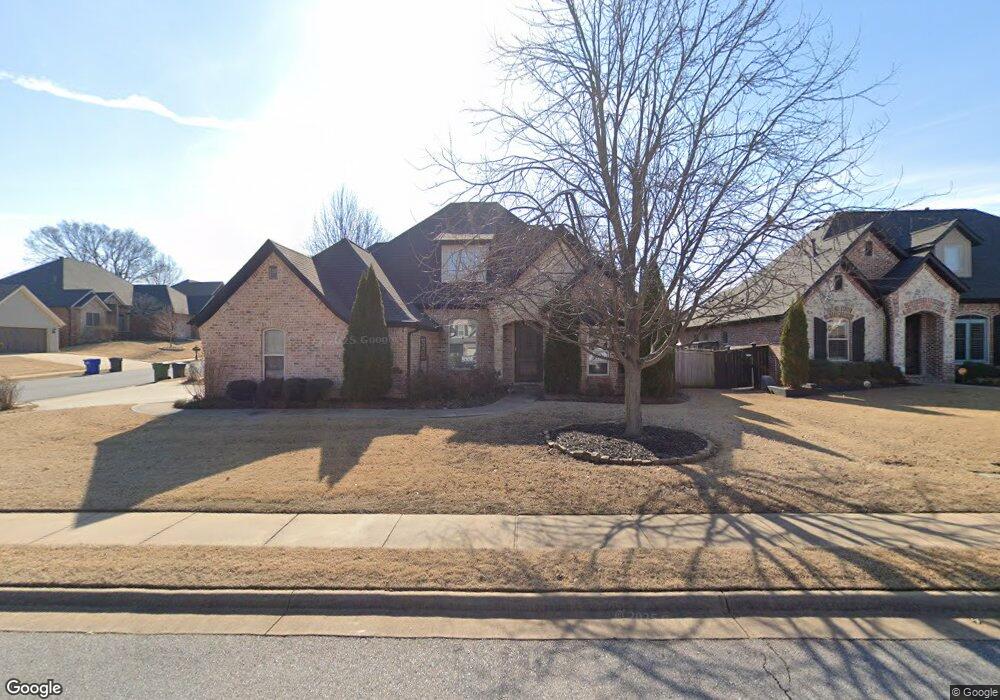
6401 S 44th St Rogers, AR 72758
Estimated Value: $623,000 - $673,000
4
Beds
4
Baths
2,900
Sq Ft
$227/Sq Ft
Est. Value
About This Home
This home is located at 6401 S 44th St, Rogers, AR 72758 and is currently estimated at $657,118, approximately $226 per square foot. 6401 S 44th St is a home located in Benton County with nearby schools including Fairview Elementary School, Elmwood Middle School, and Rogers High School.
Ownership History
Date
Name
Owned For
Owner Type
Purchase Details
Closed on
Dec 10, 2012
Sold by
Merritt James M and Flowers Celia Merritt
Bought by
Merritt James M and Flowers Celia Merritt
Current Estimated Value
Purchase Details
Closed on
Dec 10, 2007
Sold by
Bom Fayetteville Llc
Bought by
Merritt James M and Flowers Celia Merritt
Home Financials for this Owner
Home Financials are based on the most recent Mortgage that was taken out on this home.
Original Mortgage
$260,000
Interest Rate
6.3%
Create a Home Valuation Report for This Property
The Home Valuation Report is an in-depth analysis detailing your home's value as well as a comparison with similar homes in the area
Home Values in the Area
Average Home Value in this Area
Purchase History
| Date | Buyer | Sale Price | Title Company |
|---|---|---|---|
| Merritt James M | -- | None Available | |
| Merritt James M | $330,000 | Waco Title Company |
Source: Public Records
Mortgage History
| Date | Status | Borrower | Loan Amount |
|---|---|---|---|
| Previous Owner | Merritt James M | $260,000 |
Source: Public Records
Tax History
| Year | Tax Paid | Tax Assessment Tax Assessment Total Assessment is a certain percentage of the fair market value that is determined by local assessors to be the total taxable value of land and additions on the property. | Land | Improvement |
|---|---|---|---|---|
| 2025 | $3,429 | $110,618 | $20,000 | $90,618 |
| 2024 | $3,345 | $110,618 | $20,000 | $90,618 |
| 2023 | $3,345 | $72,720 | $15,000 | $57,720 |
| 2022 | $3,103 | $72,720 | $15,000 | $57,720 |
| 2021 | $3,094 | $72,720 | $15,000 | $57,720 |
| 2020 | $3,097 | $72,340 | $8,600 | $63,740 |
| 2019 | $3,097 | $72,340 | $8,600 | $63,740 |
| 2018 | $3,122 | $72,340 | $8,600 | $63,740 |
| 2017 | $2,932 | $72,340 | $8,600 | $63,740 |
| 2016 | $2,932 | $72,340 | $8,600 | $63,740 |
| 2015 | $3,300 | $62,390 | $8,400 | $53,990 |
| 2014 | $2,950 | $62,390 | $8,400 | $53,990 |
Source: Public Records
Map
Nearby Homes
- 6405 S 44th St
- 6412 S 44th St
- Single Family Portfo Group 2
- Single Family Portfo Group 1
- 4813 Willowridge Way
- 6507 S Timber Ridge Dr
- 4602 Willowridge Way
- 4403 W Murfield Dr
- 4123 Willowbend Dr
- 6099 S Pack Ln
- 626 Woodcreek Loop
- 4112 W Erin Dr
- 4107 W Murfield Dr
- 4105 W Murfield Dr
- 4114 W Erin Dr
- 4103 W Murfield Dr
- 4106 W Erin Dr
- 635 Woodcreek Loop
- 4104 W Erin Dr
- 507 Ashwood St
- 6403 S 44th St
- 6404 Timber Ridge Dr
- 6403 Timber Ridge Dr
- 6406 Timber Ridge Dr
- 6406 S Timber Ridge Dr
- 6405 Timber Ridge Dr
- 6402 S 44th St
- 6400 S 44th St
- 6407 Timber Ridge Dr
- 6407 S 44th St
- 6407 S Timber Ridge Dr
- 4307 W Candlewood Place
- 6404 S 44th St
- 4305 Willowbend
- 6408 Timber Ridge Dr
- 4305 W Candlewood Place
- 4300 W Candlewood Place
- 6409 S Timber Ridge Dr
- 6409 S 44th St
- 6406 S 44th St
Your Personal Tour Guide
Ask me questions while you tour the home.