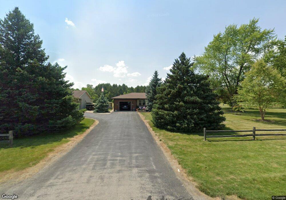
6404 County Road 139 Findlay, OH 45840
Estimated Value: $316,000 - $342,000
3
Beds
1
Bath
1,380
Sq Ft
$240/Sq Ft
Est. Value
About This Home
This home is located at 6404 County Road 139, Findlay, OH 45840 and is currently estimated at $331,793, approximately $240 per square foot. 6404 County Road 139 is a home located in Hancock County with nearby schools including Liberty-Benton Elementary School, Liberty-Benton Middle School, and Liberty-Benton High School.
Ownership History
Date
Name
Owned For
Owner Type
Purchase Details
Closed on
Jan 24, 2025
Sold by
Everly Rashay L
Bought by
Adams Roxie K and Adams Michael J
Current Estimated Value
Purchase Details
Closed on
Jan 23, 2025
Sold by
Adams Michael J
Bought by
Adams Michael J and Adams Roxie K
Purchase Details
Closed on
May 1, 1987
Bought by
Adams Michael J and Adams Dorothy
Create a Home Valuation Report for This Property
The Home Valuation Report is an in-depth analysis detailing your home's value as well as a comparison with similar homes in the area
Home Values in the Area
Average Home Value in this Area
Purchase History
| Date | Buyer | Sale Price | Title Company |
|---|---|---|---|
| Adams Roxie K | -- | -- | |
| Adams Michael J | -- | None Listed On Document | |
| Adams Michael J | -- | None Listed On Document | |
| Adams Michael J | $15,000 | -- |
Source: Public Records
Mortgage History
| Date | Status | Borrower | Loan Amount |
|---|---|---|---|
| Previous Owner | Adams Michael J | $150,000 | |
| Previous Owner | Adams Michael J | $92,000 | |
| Previous Owner | Adams Michael J | $54,500 | |
| Previous Owner | Adams Michael J | $134,500 | |
| Previous Owner | Adams Michael J | $50,000 |
Source: Public Records
Tax History Compared to Growth
Tax History
| Year | Tax Paid | Tax Assessment Tax Assessment Total Assessment is a certain percentage of the fair market value that is determined by local assessors to be the total taxable value of land and additions on the property. | Land | Improvement |
|---|---|---|---|---|
| 2024 | $2,996 | $90,120 | $17,280 | $72,840 |
| 2023 | $2,948 | $90,120 | $17,280 | $72,840 |
| 2022 | $2,934 | $90,120 | $17,280 | $72,840 |
| 2021 | $2,610 | $72,580 | $15,910 | $56,670 |
| 2020 | $2,632 | $72,580 | $15,910 | $56,670 |
| 2019 | $2,525 | $72,580 | $15,910 | $56,670 |
| 2018 | $2,026 | $65,220 | $13,260 | $51,960 |
| 2017 | $1,206 | $65,220 | $13,260 | $51,960 |
| 2016 | $2,344 | $65,220 | $13,260 | $51,960 |
| 2015 | $2,226 | $60,420 | $13,260 | $47,160 |
| 2014 | $2,246 | $60,420 | $13,260 | $47,160 |
| 2012 | $2,165 | $55,750 | $13,260 | $42,490 |
Source: Public Records
Map
Nearby Homes
- 8922 Township Road 94
- 0 County Road 95 Unit 6097574
- 0 County Road 140
- 0 Rock Candy Rd Unit Lot 159
- 0 Rock Candy Rd Unit Lot 170
- 0 Rock Candy Rd Unit Lot 172 206819
- 0 Rock Candy Rd Unit Lot 162
- 0 Rock Candy Rd Unit Lot 171
- 0 Rock Candy Rd Unit Lot 168
- 0 Rock Candy Rd Or Bushwillow Dr Unit Lot 173
- 0 Bearcat Way Or Rock Candy Rd Unit Lot 167
- 0 Bushwillow Dr Or Rock Candy Rd Unit Lot 157
- 6535 Silver Lake Dr
- 9960 W Us Route 224
- 1405 Cypress Lake
- 3106 Saddlebrook
- 3018 Gleneagle Dr
- 0 County Road 223
- 933 Laurel Ln
- 1310 Muirfield Dr
- 6408 County Road 139
- 6032 County Road 139
- 9038 Township Road 95
- 6263 County Road 139
- 9038 Trail 95
- 6243 County Road 139
- 9051 Township Road 95
- 8833 Township Road 95
- 8760 Township Road 95
- 6155 County Road 139
- 9089 Township Road 95
- 9157 Township Road 95
- 9180 Township Road 95
- 8765 Township Road 95
- 6671 County Road 139
- 8727 Township Road 95
- 9199 Township Road 95
- 8676 Township Road 95
- 9177 Township Road 95
- 8622 Township Road 95