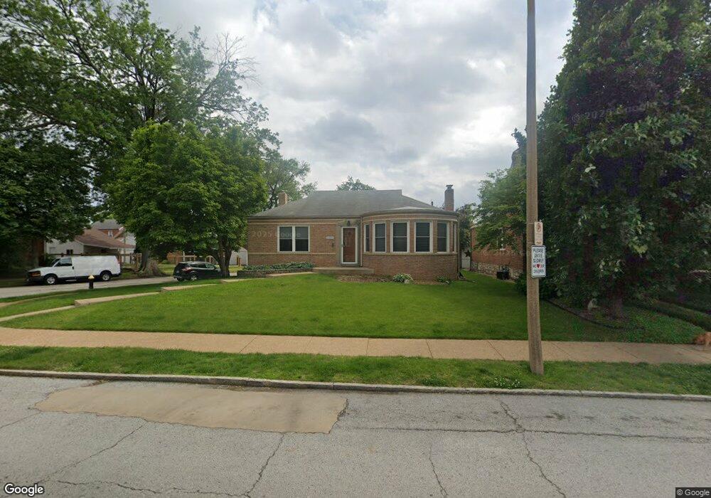
6404 Pernod Ave Saint Louis, MO 63139
Lindenwood Park NeighborhoodEstimated Value: $293,576 - $366,000
--
Bed
1
Bath
2,916
Sq Ft
$115/Sq Ft
Est. Value
About This Home
This home is located at 6404 Pernod Ave, Saint Louis, MO 63139 and is currently estimated at $335,394, approximately $115 per square foot. 6404 Pernod Ave is a home located in St. Louis City with nearby schools including Mason Elementary School, Long International Middle School, and Roosevelt High School.
Ownership History
Date
Name
Owned For
Owner Type
Purchase Details
Closed on
Jun 18, 2003
Sold by
Bess Vivienne and Bess Gary
Bought by
Brandon William J and Brandon Frances C
Current Estimated Value
Purchase Details
Closed on
Jan 17, 2003
Sold by
Bess Vivienne and Flatley Robert
Bought by
Brandon William J and Brandon Frances C
Home Financials for this Owner
Home Financials are based on the most recent Mortgage that was taken out on this home.
Original Mortgage
$72,000
Interest Rate
5.77%
Mortgage Type
Purchase Money Mortgage
Create a Home Valuation Report for This Property
The Home Valuation Report is an in-depth analysis detailing your home's value as well as a comparison with similar homes in the area
Home Values in the Area
Average Home Value in this Area
Purchase History
| Date | Buyer | Sale Price | Title Company |
|---|---|---|---|
| Brandon William J | -- | Nations Title Agency Inc | |
| Brandon William J | -- | Nations Title Agency Inc |
Source: Public Records
Mortgage History
| Date | Status | Borrower | Loan Amount |
|---|---|---|---|
| Previous Owner | Brandon William J | $72,000 |
Source: Public Records
Tax History Compared to Growth
Tax History
| Year | Tax Paid | Tax Assessment Tax Assessment Total Assessment is a certain percentage of the fair market value that is determined by local assessors to be the total taxable value of land and additions on the property. | Land | Improvement |
|---|---|---|---|---|
| 2025 | $3,733 | $52,350 | $3,820 | $48,530 |
| 2024 | $3,551 | $44,260 | $3,820 | $40,440 |
| 2023 | $3,551 | $44,260 | $3,820 | $40,440 |
| 2022 | $3,382 | $40,580 | $3,820 | $36,760 |
| 2021 | $3,378 | $40,580 | $3,820 | $36,760 |
| 2020 | $3,078 | $37,240 | $3,820 | $33,420 |
| 2019 | $3,067 | $37,240 | $3,820 | $33,420 |
| 2018 | $2,965 | $34,880 | $3,420 | $31,460 |
| 2017 | $2,915 | $34,880 | $3,420 | $31,460 |
| 2016 | $2,605 | $30,740 | $3,420 | $27,320 |
| 2015 | $2,361 | $30,740 | $3,420 | $27,320 |
| 2014 | $2,288 | $30,740 | $3,420 | $27,320 |
| 2013 | -- | $29,790 | $3,420 | $26,370 |
Source: Public Records
Map
Nearby Homes
- 6439 Mardel Ave
- 6214 Oleatha Ave
- 3905 Tamm Ave
- 6041 Tholozan Ave
- 6517 Tholozan Ave
- 6339 Marquette Ave
- 6325 Marquette Ave
- 6541 Lindenwood Place
- 6411 Hancock Ave
- 6437 Hancock Ave
- 6611 Pernod Ave
- 6409 Sutherland Ave
- 6621 Tholozan Ave
- 5743 Mardel Ave
- 6300 Fyler Ave
- 6631 Pernod Ave
- 6561 Bancroft Ave
- 5736 Lindenwood Ave
- 6625 Hancock Ave
- 5716 Pernod Ave
- 6408 Pernod Ave
- 6412 Pernod Ave
- 6344 Pernod Ave
- 6416 Pernod Ave
- 3615 Tamm Ave
- 6338 Pernod Ave
- 6345 Tholozan Ave
- 3619 Tamm Ave
- 6405 Pernod Ave
- 6407 Pernod Ave
- 6334 Pernod Ave
- 6401 Pernod Ave
- 6411 Pernod Ave
- 6424 Pernod Ave
- 6339 Tholozan Ave
- 6415 Pernod Ave
- 3623 Tamm Ave
- 6335 Tholozan Ave
- 6335 Pernod Ave
- 6330 Pernod Ave