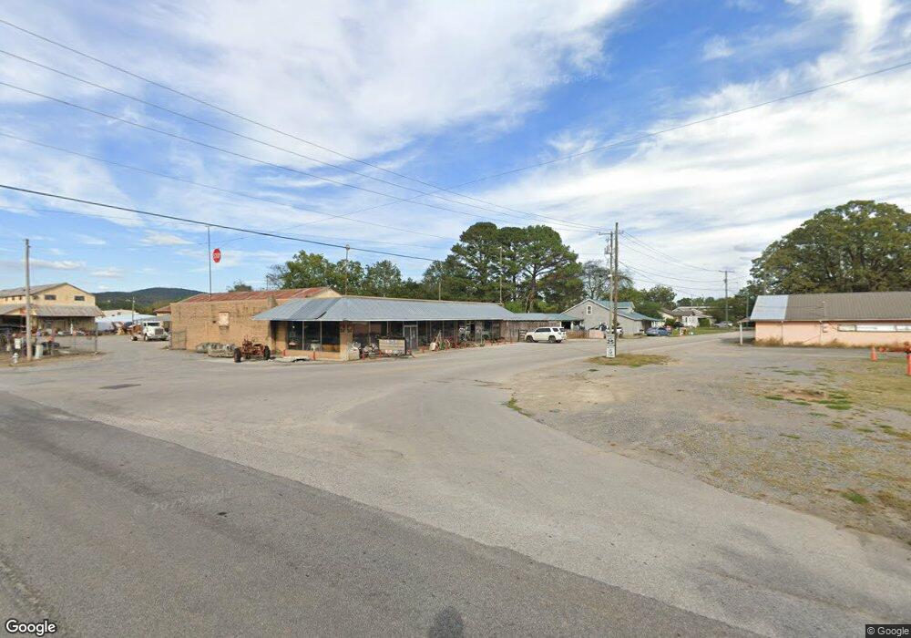
6407 Hwy 431 S Owens Cross Roads, AL 35763
Estimated Value: $1,041,217
--
Bed
1
Bath
2,000
Sq Ft
$521/Sq Ft
Est. Value
About This Home
This home is located at 6407 Hwy 431 S, Owens Cross Roads, AL 35763 and is currently estimated at $1,041,217, approximately $520 per square foot. 6407 Hwy 431 S is a home located in Madison County with nearby schools including Hampton Cove Elementary School, Hampton Cove Middle School, and Huntsville High School.
Ownership History
Date
Name
Owned For
Owner Type
Purchase Details
Closed on
May 3, 2023
Sold by
Leeland Llc
Bought by
Cove Retail Llc
Current Estimated Value
Home Financials for this Owner
Home Financials are based on the most recent Mortgage that was taken out on this home.
Original Mortgage
$750,000
Outstanding Balance
$729,259
Interest Rate
6.42%
Mortgage Type
Credit Line Revolving
Estimated Equity
$311,958
Purchase Details
Closed on
Oct 8, 2019
Sold by
Averbuch Scott and Averbuch Dana B
Bought by
Leeland Llc
Home Financials for this Owner
Home Financials are based on the most recent Mortgage that was taken out on this home.
Original Mortgage
$125,000
Interest Rate
3.5%
Mortgage Type
Future Advance Clause Open End Mortgage
Create a Home Valuation Report for This Property
The Home Valuation Report is an in-depth analysis detailing your home's value as well as a comparison with similar homes in the area
Home Values in the Area
Average Home Value in this Area
Purchase History
| Date | Buyer | Sale Price | Title Company |
|---|---|---|---|
| Cove Retail Llc | $250,000 | None Listed On Document | |
| Leeland Llc | $650,000 | None Available |
Source: Public Records
Mortgage History
| Date | Status | Borrower | Loan Amount |
|---|---|---|---|
| Open | Cove Retail Llc | $750,000 | |
| Previous Owner | Leeland Llc | $125,000 |
Source: Public Records
Tax History Compared to Growth
Tax History
| Year | Tax Paid | Tax Assessment Tax Assessment Total Assessment is a certain percentage of the fair market value that is determined by local assessors to be the total taxable value of land and additions on the property. | Land | Improvement |
|---|---|---|---|---|
| 2024 | $3,713 | $64,020 | $64,020 | $0 |
| 2023 | $3,713 | $32,420 | $32,420 | $0 |
| 2022 | $1,880 | $32,420 | $32,420 | $0 |
| 2021 | $1,880 | $32,420 | $32,420 | $0 |
| 2020 | $2,914 | $50,240 | $32,420 | $17,820 |
| 2019 | $2,914 | $50,240 | $32,420 | $17,820 |
| 2018 | $2,373 | $40,920 | $0 | $0 |
| 2017 | $2,373 | $40,920 | $0 | $0 |
| 2016 | $2,373 | $40,920 | $0 | $0 |
| 2015 | $2,373 | $40,920 | $0 | $0 |
| 2014 | $2,330 | $40,180 | $0 | $0 |
Source: Public Records
Map
Nearby Homes
- 205 Wyatt Henry Ln
- 133 Plainview Dr SE
- 2717 Deford Mill Rd SE
- 2637 Mountain Stream Way SE
- 2413 Habersham Dr SE
- 119 Ada Dr SE
- 3001 Watch Hill Dr SE
- 3030 Ginn Point Rd SE
- 381 Caldwell Ln SE
- 2702 Muir Woods Dr SE
- 3015 Ginn Point Rd SE
- 2.8 Andrew Rd
- 3.05 Andrew Rd
- 161 Hartside Rd SE
- 3 Miller Ln
- 2726 Treyburne Ln SE
- 2901 Honors Row SE
- 2808 Castle Pines Cir SE
- 3018 Crystal Creek Dr
- Lot 1 Wade Rd
- 6407 Highway 431 S
- 6407 U S 431
- 6388B Hwy 431 S Unit 4
- 6388B Hwy 431 S Unit 5
- 6388B Highway 431 S Unit 3
- 6388 U S 431 Unit 6
- 6388 U S 431 Unit 5
- 6388 U S 431
- 6388-B Hwy 431 S Unit 4
- 6388-B Us Hwy 431 Unit 2
- 3.86 Acres Highway 431 S
- 6388 B, #1, Hwy Us Hwy 431 S Unit 2
- 6446 Highway 431 S
- 6388 Highway 431 S Unit 2
- 6388 Highway 431 S Unit 4
- 6388 Highway 431 S Unit 2B
- 6388 Highway 431 S Unit 6
- 6388 Highway 431 S Unit 5
- 6388 Highway 431 S Unit 5
- 186 Plainview Dr SE