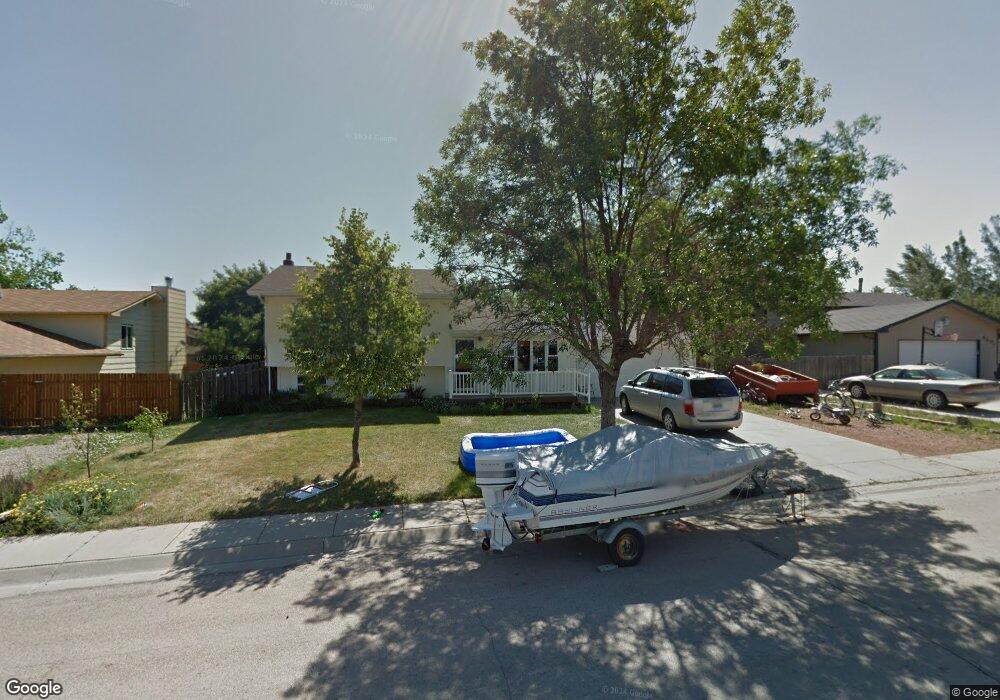
6409 Tassel Ave Gillette, WY 82718
Estimated Value: $296,000 - $369,000
3
Beds
2
Baths
2,048
Sq Ft
$156/Sq Ft
Est. Value
About This Home
This home is located at 6409 Tassel Ave, Gillette, WY 82718 and is currently estimated at $319,941, approximately $156 per square foot. 6409 Tassel Ave is a home located in Campbell County with nearby schools including Westwood High School, Conestoga Elementary School, and Sage Valley Junior High School.
Ownership History
Date
Name
Owned For
Owner Type
Purchase Details
Closed on
Nov 1, 2023
Sold by
Martens Seth L
Bought by
Tobin Jacob
Current Estimated Value
Home Financials for this Owner
Home Financials are based on the most recent Mortgage that was taken out on this home.
Original Mortgage
$284,747
Outstanding Balance
$279,478
Interest Rate
7.19%
Mortgage Type
FHA
Estimated Equity
$40,463
Purchase Details
Closed on
May 28, 2010
Sold by
Zabel Robert L and Zabel Bonnie
Bought by
Reichenbach Charles R
Home Financials for this Owner
Home Financials are based on the most recent Mortgage that was taken out on this home.
Original Mortgage
$211,100
Interest Rate
5.02%
Mortgage Type
New Conventional
Create a Home Valuation Report for This Property
The Home Valuation Report is an in-depth analysis detailing your home's value as well as a comparison with similar homes in the area
Home Values in the Area
Average Home Value in this Area
Purchase History
| Date | Buyer | Sale Price | Title Company |
|---|---|---|---|
| Tobin Jacob | -- | First American Title | |
| Reichenbach Charles R | -- | None Available |
Source: Public Records
Mortgage History
| Date | Status | Borrower | Loan Amount |
|---|---|---|---|
| Open | Tobin Jacob | $284,747 | |
| Previous Owner | Reichenbach Charles R | $211,100 |
Source: Public Records
Tax History Compared to Growth
Tax History
| Year | Tax Paid | Tax Assessment Tax Assessment Total Assessment is a certain percentage of the fair market value that is determined by local assessors to be the total taxable value of land and additions on the property. | Land | Improvement |
|---|---|---|---|---|
| 2025 | $2,007 | $21,058 | $3,377 | $17,681 |
| 2024 | $2,007 | $26,997 | $4,330 | $22,667 |
| 2023 | $1,854 | $24,521 | $4,009 | $20,512 |
| 2022 | $1,690 | $21,874 | $4,009 | $17,865 |
| 2021 | $1,582 | $20,779 | $4,009 | $16,770 |
| 2020 | $1,527 | $19,922 | $4,009 | $15,913 |
| 2019 | $1,516 | $19,783 | $4,009 | $15,774 |
| 2018 | $1,450 | $18,791 | $3,762 | $15,029 |
| 2017 | $1,482 | $19,569 | $3,762 | $15,807 |
| 2016 | $1,552 | $20,551 | $3,325 | $17,226 |
| 2015 | -- | $19,898 | $3,325 | $16,573 |
| 2014 | -- | $19,924 | $3,325 | $16,599 |
Source: Public Records
Map
Nearby Homes
- 5106 Zee Ct
- 2706 Needle Ct
- 2711 Rapid St
- 8280 Ptarmigan Ave
- 2501 Gallery View Dr
- 2210 Gallery View Dr
- 2560 Whitetail St
- 2201 Wolff Rd -
- 10627 Wyoming 59
- 10 Doe Ct
- 6 Doe Ct
- 10621 Wy-59
- 4504 Tong Ln
- 5512 S Winland Dr
- 4953 S Garner Lake Rd
- 4402 Daylight Ct
- 2400 Daybreak Ct
- 1922-1931 Harvest Moon
- 2003 Mint Ave
- 3806 Triton Ave
- 6501 Tassel Ave
- 6407 Tassel Ave
- 6410 Hudson Ave
- 6500 Hudson Ave
- 5404 Raven St
- 5305 Tarry St
- 6503 Tassel Ave
- 6406 Tassel Ave
- 6504 Hudson Ave
- 5303 Tarry St
- 5302 Raven St
- 5306 Tarry St
- 6505 Tassel Ave
- 6506 Hudson Ave
- 5403 Raven St
- 6409 Hudson Ave
- 6501 Hudson Ave
- 5405 Raven St
- 6407 Hudson Ave
- 5305 Raven St