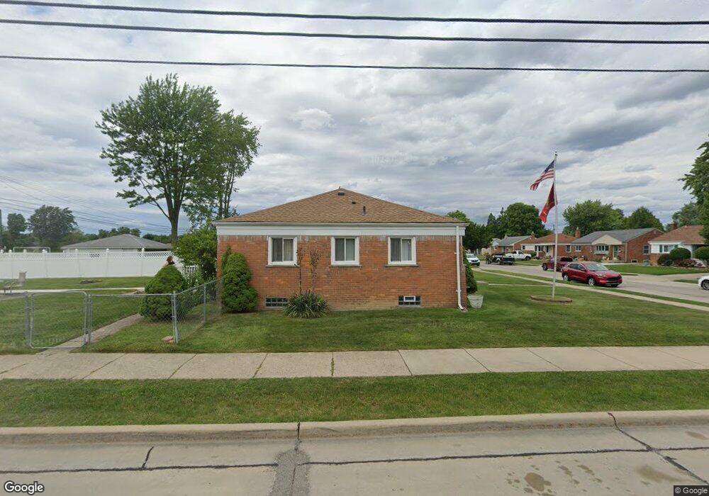
6409 Whitby St Garden City, MI 48135
Estimated Value: $193,000 - $232,000
--
Bed
--
Bath
1,051
Sq Ft
$203/Sq Ft
Est. Value
About This Home
This home is located at 6409 Whitby St, Garden City, MI 48135 and is currently estimated at $212,932, approximately $202 per square foot. 6409 Whitby St is a home located in Wayne County with nearby schools including Douglas Elementary 3-4 Campus, Memorial Elementary 1-2 Campus, and Garden City Middle School.
Ownership History
Date
Name
Owned For
Owner Type
Purchase Details
Closed on
May 24, 2024
Sold by
Grzebyk Joseph and Grzebyk Joseph
Bought by
Rutherford Donald
Current Estimated Value
Home Financials for this Owner
Home Financials are based on the most recent Mortgage that was taken out on this home.
Original Mortgage
$165,000
Outstanding Balance
$162,782
Interest Rate
7.1%
Mortgage Type
VA
Estimated Equity
$50,150
Purchase Details
Closed on
Apr 8, 2009
Sold by
Estate Of Deloris A Lohn
Bought by
Grzebyk Joseph
Create a Home Valuation Report for This Property
The Home Valuation Report is an in-depth analysis detailing your home's value as well as a comparison with similar homes in the area
Home Values in the Area
Average Home Value in this Area
Purchase History
| Date | Buyer | Sale Price | Title Company |
|---|---|---|---|
| Rutherford Donald | $165,000 | Devon Title | |
| Grzebyk Joseph | $55,000 | Minnesota Title Agency |
Source: Public Records
Mortgage History
| Date | Status | Borrower | Loan Amount |
|---|---|---|---|
| Open | Rutherford Donald | $165,000 |
Source: Public Records
Tax History Compared to Growth
Tax History
| Year | Tax Paid | Tax Assessment Tax Assessment Total Assessment is a certain percentage of the fair market value that is determined by local assessors to be the total taxable value of land and additions on the property. | Land | Improvement |
|---|---|---|---|---|
| 2025 | $2,555 | $105,900 | $0 | $0 |
| 2024 | $2,555 | $98,800 | $0 | $0 |
| 2023 | $2,849 | $85,900 | $0 | $0 |
| 2022 | $3,525 | $73,100 | $0 | $0 |
| 2021 | $3,440 | $69,500 | $0 | $0 |
| 2020 | $3,438 | $64,700 | $0 | $0 |
| 2019 | $2,572 | $59,500 | $0 | $0 |
| 2018 | $2,321 | $51,100 | $0 | $0 |
| 2017 | $1,353 | $49,000 | $0 | $0 |
| 2016 | $2,934 | $47,800 | $0 | $0 |
| 2015 | $3,933 | $43,800 | $0 | $0 |
| 2013 | $3,810 | $39,400 | $0 | $0 |
| 2012 | $2,777 | $40,200 | $14,300 | $25,900 |
Source: Public Records
Map
Nearby Homes
- 6649 Burnly St
- 6705 Whitby St
- 6747 Burnly St
- 29801 Bridge St
- 29825 Dawson Ave
- 29825 Dawson St
- 29498 Bridge St
- 6727 Hawthorne St
- 30436 Beechwood St
- 5689 Brandt St
- 6439 Huntleigh St
- 6557 Huntleigh St
- 29878 Malvern St
- 28912 Cambridge St
- 28843 Balmoral St
- 28832 Block St
- 31022 Birchlawn St Unit 20
- 31208 Windsor St
- 7505 Donna St
- 157 Middlebelt Rd
- 6421 Whitby St
- 6433 Whitby St
- 6445 Whitby St
- 6408 Whitby St
- 6420 Whitby St
- 30083 Maplewood St
- 30055 Maplewood St
- 30095 Maplewood St
- 6432 Whitby St
- 30035 Maplewood St
- 6457 Whitby St
- 6444 Whitby St
- 30017 Maplewood St
- 30115 Maplewood St
- 6505 Whitby St
- 6421 Burnly St
- 6456 Whitby St
- 30131 Maplewood St
- 6409 Burnly St
- 6433 Burnly St