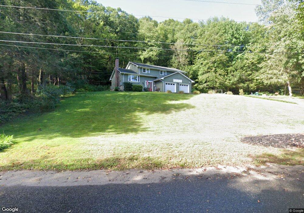
641 Brigham Tavern Rd Coventry, CT 06238
Estimated Value: $456,009 - $502,000
5
Beds
3
Baths
2,195
Sq Ft
$219/Sq Ft
Est. Value
About This Home
This home is located at 641 Brigham Tavern Rd, Coventry, CT 06238 and is currently estimated at $480,752, approximately $219 per square foot. 641 Brigham Tavern Rd is a home located in Tolland County with nearby schools including Coventry Grammar School, George Hersey Robertson School, and Capt. Nathan Hale School.
Ownership History
Date
Name
Owned For
Owner Type
Purchase Details
Closed on
Jul 30, 1997
Sold by
Gomez Henry and Gomez Josephine
Bought by
Beaulieu Robert and Beaulieu Johanna
Current Estimated Value
Home Financials for this Owner
Home Financials are based on the most recent Mortgage that was taken out on this home.
Original Mortgage
$147,600
Outstanding Balance
$22,143
Interest Rate
7.55%
Mortgage Type
Unknown
Estimated Equity
$458,609
Create a Home Valuation Report for This Property
The Home Valuation Report is an in-depth analysis detailing your home's value as well as a comparison with similar homes in the area
Home Values in the Area
Average Home Value in this Area
Purchase History
| Date | Buyer | Sale Price | Title Company |
|---|---|---|---|
| Beaulieu Robert | $150,000 | -- | |
| Beaulieu Robert | $150,000 | -- |
Source: Public Records
Mortgage History
| Date | Status | Borrower | Loan Amount |
|---|---|---|---|
| Open | Beaulieu Robert | $147,600 | |
| Closed | Beaulieu Robert | $147,600 |
Source: Public Records
Tax History
| Year | Tax Paid | Tax Assessment Tax Assessment Total Assessment is a certain percentage of the fair market value that is determined by local assessors to be the total taxable value of land and additions on the property. | Land | Improvement |
|---|---|---|---|---|
| 2025 | $6,767 | $284,800 | $60,800 | $224,000 |
| 2024 | $6,216 | $186,600 | $50,200 | $136,400 |
| 2023 | $5,923 | $186,600 | $50,200 | $136,400 |
| 2022 | $5,813 | $186,600 | $50,200 | $136,400 |
| 2021 | $5,813 | $186,600 | $50,200 | $136,400 |
| 2020 | $5,816 | $186,600 | $50,200 | $136,400 |
| 2019 | $6,009 | $186,600 | $50,200 | $136,400 |
| 2018 | $5,345 | $166,000 | $50,200 | $115,800 |
| 2017 | $5,312 | $166,000 | $50,200 | $115,800 |
| 2016 | $5,179 | $166,000 | $50,200 | $115,800 |
| 2015 | $5,179 | $166,000 | $50,200 | $115,800 |
| 2014 | $5,415 | $190,200 | $61,200 | $129,000 |
Source: Public Records
Map
Nearby Homes
- 499 Woodmont Dr
- 0 Merrow Rd Unit 24141193
- 20 Barlow Dr
- 106 David Dr
- 1728 Stafford Rd
- 167 Baxter Rd
- 864 Boston Turnpike
- 16 Westgate Ln
- 0 Daly Rd Unit 24146464
- 2478 Main St
- 42 Grandview Cir
- 0 Middle Turnpike
- 152 Cheney Ln
- 21 Hillpond Dr
- 535 Merrow Rd
- 498 Root Rd
- 149 Hillyndale Rd
- 8 Walbridge Hill Rd
- 55 Whites Hill Rd
- 124 River Rd
- 625 Brigham Tavern Rd
- 643 Brigham Tavern Rd
- 673 Brigham Tavern Rd
- 29 Antrim Rd
- 683 Brigham Tavern Rd
- 694 Brigham Tavern Rd
- 45 Antrim Rd
- 127 Lancaster Rd
- 99 Lancaster Rd
- 133 Lancaster Rd
- 714 Brigham Tavern Rd
- 711 Brigham Tavern Rd
- 48 Antrim Rd
- 134 Lancaster Rd
- 153 Lancaster Rd
- 61 Antrim Rd
- 102 Lancaster Rd
- 154 Lancaster Rd
- 145 Lancaster Rd
- 75 Antrim Rd
Your Personal Tour Guide
Ask me questions while you tour the home.