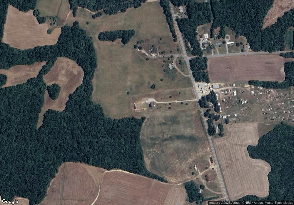
641 Manson Drewry Rd Manson, NC 27553
Estimated Value: $200,000 - $425,000
3
Beds
2
Baths
2,016
Sq Ft
$134/Sq Ft
Est. Value
About This Home
This home is located at 641 Manson Drewry Rd, Manson, NC 27553 and is currently estimated at $270,170, approximately $134 per square foot. 641 Manson Drewry Rd is a home located in Warren County with nearby schools including Westcare N. Carolina Girls School.
Ownership History
Date
Name
Owned For
Owner Type
Purchase Details
Closed on
Apr 9, 2024
Sold by
Hill Alex and Hill Jesse Dianne
Bought by
Hill Alex and Hill Jesse Dianne
Current Estimated Value
Home Financials for this Owner
Home Financials are based on the most recent Mortgage that was taken out on this home.
Original Mortgage
$215,000
Outstanding Balance
$213,914
Interest Rate
6.94%
Mortgage Type
New Conventional
Estimated Equity
$118,179
Purchase Details
Closed on
May 3, 2019
Sold by
Fhlm
Bought by
Hill Alex
Purchase Details
Closed on
Oct 27, 1994
Bought by
Mcqueen Effie V Durham
Create a Home Valuation Report for This Property
The Home Valuation Report is an in-depth analysis detailing your home's value as well as a comparison with similar homes in the area
Home Values in the Area
Average Home Value in this Area
Purchase History
| Date | Buyer | Sale Price | Title Company |
|---|---|---|---|
| Hill Alex | -- | None Listed On Document | |
| Hill Alex | -- | -- | |
| Mcqueen Effie V Durham | -- | -- |
Source: Public Records
Mortgage History
| Date | Status | Borrower | Loan Amount |
|---|---|---|---|
| Open | Hill Alex | $215,000 |
Source: Public Records
Tax History Compared to Growth
Tax History
| Year | Tax Paid | Tax Assessment Tax Assessment Total Assessment is a certain percentage of the fair market value that is determined by local assessors to be the total taxable value of land and additions on the property. | Land | Improvement |
|---|---|---|---|---|
| 2024 | $1,267 | $126,947 | $0 | $0 |
| 2023 | $1,267 | $126,947 | $0 | $0 |
| 2022 | $1,117 | $126,947 | $0 | $0 |
| 2021 | $1,267 | $126,947 | $0 | $0 |
| 2020 | $1,267 | $126,947 | $10,412 | $116,535 |
| 2019 | $1,416 | $126,947 | $10,412 | $116,535 |
| 2018 | $1,204 | $126,947 | $10,412 | $116,535 |
| 2017 | $1,204 | $126,947 | $10,412 | $116,535 |
| 2016 | $1,279 | $147,002 | $10,572 | $136,430 |
| 2015 | -- | $147,002 | $0 | $0 |
| 2014 | -- | $147,002 | $0 | $0 |
| 2010 | -- | $147,002 | $10,572 | $136,430 |
Source: Public Records
Map
Nearby Homes
- 4715 Jacksontown Rd
- 212 Ellington's Path
- 15 Wild Fox Run
- 00 Bullocksville Park Rd
- 420 Spring Ln
- 71 George H Bullock Ln
- 1855 Bullocksville Park Rd
- 00 Frank Bullock Rd
- 0 Collins Road Lot 3 Rd Unit 10097236
- 0 Collins Rd
- 946 Jacksontown Rd
- Lot 2 John Edwards Rd
- 96 Holly Cir
- 89 Mount Pleasant Ln
- 109 Macon Cir
- 1159 Flemingtown Rd
- 675 Anderson Creek Rd
- 0 Burchette Rd Unit 10106236
- 01 Burchette Rd
- 127 Nutbush Creek Ln
- 641 Manson Drewry Rd
- 667 Manson Drewry Rd
- 636 Manson Drewry Rd
- 624 Manson Drewry Rd
- 111 Weldon Capps Rd
- 117 Weldon Capps Rd
- 593 Manson Drewry Rd
- 684 Manson Drewry Rd
- 688 Manson Drewry Rd
- 129 Weldon Capps Rd
- 106 Alvin Ln
- 118 Manning Ln
- 585 Manson-Drewry Rd
- 585 Manson Drewry Rd
- 115 Manning Ln
- 706 Manson Drewry Rd
- 706 Manson-Drewry Rd
- 580 Manson Drewry Rd
- 716 Manson Drewry Rd
- 723 Manson Drewry Rd
