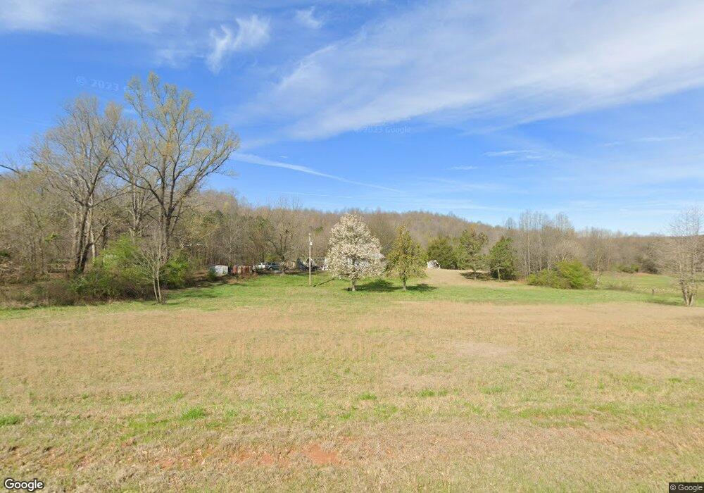
641 McFarlin Bridge Rd Carnesville, GA 30521
Estimated Value: $242,000 - $857,322
1
Bed
1
Bath
816
Sq Ft
$674/Sq Ft
Est. Value
About This Home
This home is located at 641 McFarlin Bridge Rd, Carnesville, GA 30521 and is currently estimated at $549,661, approximately $673 per square foot. 641 McFarlin Bridge Rd is a home located in Franklin County with nearby schools including Franklin County High School.
Ownership History
Date
Name
Owned For
Owner Type
Purchase Details
Closed on
Apr 22, 2011
Sold by
Thomason Michael V
Bought by
Thomason Michael
Current Estimated Value
Purchase Details
Closed on
Aug 25, 2010
Sold by
Thomason Michael V
Bought by
Thomason Michael
Purchase Details
Closed on
Aug 20, 2010
Sold by
Batson Chester
Bought by
Thomason Michael
Purchase Details
Closed on
Aug 17, 2010
Sold by
Thomason James R
Bought by
Cole Bonnie Jean Powell Thomas
Purchase Details
Closed on
Sep 6, 1940
Bought by
Thomason A B
Create a Home Valuation Report for This Property
The Home Valuation Report is an in-depth analysis detailing your home's value as well as a comparison with similar homes in the area
Home Values in the Area
Average Home Value in this Area
Purchase History
| Date | Buyer | Sale Price | Title Company |
|---|---|---|---|
| Thomason Michael | -- | -- | |
| Thomason Michael | -- | -- | |
| Thomason Michael | -- | -- | |
| Thomason Michael | $86,129 | -- | |
| Thomason Michael | $2,555 | -- | |
| Thomason Michael | $116,174 | -- | |
| Cole Bonnie Jean Powell Thomas | -- | -- | |
| Hill Marvin | -- | -- | |
| Hill Fred | -- | -- | |
| Thomason James R | -- | -- | |
| Thomason Curtis | -- | -- | |
| Thomason Vonice | -- | -- | |
| Thomason Howard | -- | -- | |
| Batson Chester | -- | -- | |
| Thomason Mike | -- | -- | |
| Thomason A B | -- | -- |
Source: Public Records
Tax History Compared to Growth
Tax History
| Year | Tax Paid | Tax Assessment Tax Assessment Total Assessment is a certain percentage of the fair market value that is determined by local assessors to be the total taxable value of land and additions on the property. | Land | Improvement |
|---|---|---|---|---|
| 2024 | $1,269 | $268,284 | $263,690 | $4,594 |
| 2023 | $1,325 | $243,895 | $239,719 | $4,176 |
| 2022 | $1,270 | $189,796 | $186,004 | $3,792 |
| 2021 | $1,306 | $189,306 | $186,004 | $3,302 |
| 2020 | $974 | $134,640 | $134,640 | $0 |
| 2019 | $945 | $134,640 | $134,640 | $0 |
| 2018 | $917 | $97,938 | $97,938 | $0 |
| 2017 | $927 | $97,938 | $97,938 | $0 |
| 2016 | $941 | $97,938 | $97,938 | $0 |
| 2015 | -- | $97,938 | $97,938 | $0 |
| 2014 | -- | $97,939 | $97,938 | $0 |
| 2013 | -- | $97,938 | $97,938 | $0 |
Source: Public Records
Map
Nearby Homes
- 0 Banks Academy Rd Unit 10636762
- 340 Mcfarlin Blvd
- 2526 Prospect Rd
- 2630 Prospect Rd
- 125 Lewis Crump Rd
- 6060 Highway 320
- 6343 Georgia 198
- LOT 10 Bent Tree Rd
- 4001 Highway 198
- 83 Henry Williams Rd
- 150 Garrison Rd
- 0 Poplar Mountain Ln
- 262 Garrison Rd
- 14 Kristy Ln
- 0 Falcon Ln Unit 10495019
- 0 Falcon Ln Unit 1024877
- 4638 Highway 63
- 2845 Hunters Creek Rd
- 1035 McFarlin Bridge Rd
- 0 Red Hill Rd Unit 10564928
- 241 McFarlin Bridge Rd
- 310 McFarlin Bridge Rd
- 999 McFarlin Bridge Rd
- 1006 McFarlin Bridge Rd
- 1212 Banks Rd
- 1003 Banks Rd
- 1215 Prospect Rd
- 61 McFarlin Bridge Rd
- 183 Ledford Dr
- 1363 McFarlin Bridge Rd
- 0 McFarlin Bridge Rd
- 0 McFarlin Bridge Rd Unit 7628286
- 0 McFarlin Bridge Rd Unit 3269836
- 0 McFarlin Bridge Rd Unit 3107495
- 0 McFarlin Bridge Rd Unit 7105601
- 0 McFarlin Bridge Rd Unit 7104840
- 0 McFarlin Bridge Rd Unit 7388822
- 0 McFarlin Bridge Rd Unit 7234709
- 0 McFarlin Bridge Rd Unit 7027504
- 0 McFarlin Bridge Rd Unit 8979902
