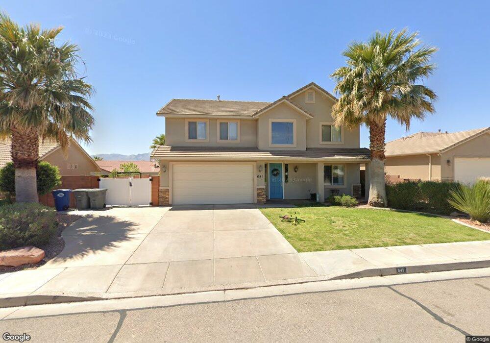
641 N 1620 W St. George, UT 84770
Estimated Value: $458,000 - $653,521
4
Beds
3
Baths
3,031
Sq Ft
$199/Sq Ft
Est. Value
About This Home
This home is located at 641 N 1620 W, St. George, UT 84770 and is currently estimated at $602,380, approximately $198 per square foot. 641 N 1620 W is a home located in Washington County with nearby schools including Sunset School, Snow Canyon Middle School, and Lava Ridge Intermediate School.
Ownership History
Date
Name
Owned For
Owner Type
Purchase Details
Closed on
Oct 9, 2024
Sold by
Winsor Wesley and Winsor Lindsay
Bought by
Wealth Builder Trust and Winsor
Current Estimated Value
Purchase Details
Closed on
Sep 30, 2020
Sold by
Vanbulkley Matthew Van and Bulkley Jolynn
Bought by
Winsor Wesley and Winsor Lindsay
Home Financials for this Owner
Home Financials are based on the most recent Mortgage that was taken out on this home.
Original Mortgage
$340,470
Interest Rate
2.9%
Mortgage Type
New Conventional
Purchase Details
Closed on
May 4, 2016
Sold by
Bulkley Matthew V and Bulkley Jolynn
Bought by
Vanvanbulkley Matthew Van and Bulkley Jolynn
Create a Home Valuation Report for This Property
The Home Valuation Report is an in-depth analysis detailing your home's value as well as a comparison with similar homes in the area
Home Values in the Area
Average Home Value in this Area
Purchase History
| Date | Buyer | Sale Price | Title Company |
|---|---|---|---|
| Wealth Builder Trust | -- | None Listed On Document | |
| Winsor Wesley | -- | First Amer St George Main | |
| Vanvanbulkley Matthew Van | -- | None Available |
Source: Public Records
Mortgage History
| Date | Status | Borrower | Loan Amount |
|---|---|---|---|
| Previous Owner | Winsor Wesley | $340,470 |
Source: Public Records
Tax History Compared to Growth
Tax History
| Year | Tax Paid | Tax Assessment Tax Assessment Total Assessment is a certain percentage of the fair market value that is determined by local assessors to be the total taxable value of land and additions on the property. | Land | Improvement |
|---|---|---|---|---|
| 2025 | $2,276 | $345,895 | $46,750 | $299,145 |
| 2023 | $2,483 | $370,975 | $35,750 | $335,225 |
| 2022 | $2,285 | $321,035 | $35,750 | $285,285 |
| 2021 | $2,105 | $441,100 | $45,000 | $396,100 |
| 2020 | $1,920 | $378,900 | $45,000 | $333,900 |
| 2019 | $1,892 | $364,700 | $50,000 | $314,700 |
| 2018 | $1,767 | $175,890 | $0 | $0 |
| 2017 | $1,646 | $159,060 | $0 | $0 |
| 2016 | $1,710 | $152,845 | $0 | $0 |
| 2015 | $1,618 | $138,765 | $0 | $0 |
| 2014 | $1,750 | $151,030 | $0 | $0 |
Source: Public Records
Map
Nearby Homes
- 1732 N 540 W Unit 120
- 1732 W 540 N Unit 120
- 1732 W 540 N Unit 13
- 1732 W 540 N Unit 68
- 1732 W 540 N Unit 17
- 1732 W 540 N Unit 92
- 1735 W 540 N Unit 1006
- 1735 W 540 N Unit 2302
- 1735 W 540 N Unit 2302
- 1735 W 540 N Unit 1202
- 1735 W 540 N Unit 1001
- 1385 W 625 N
- 1385 W 625 North St
- 954 N 1725 W Unit 32
- 1793 W 950 N Unit 3
- 695 N Daybreak Dr
- 727 N 1275 W
- 1244 W 620 Cir N
- 1708 W 1020 N Unit 146
- 1742 W 1020 N Unit 123
- 641 N 1620 West Cir
- 653 N 1620 West Cir
- 627 N 1620 West Cir
- 0 1620 St W
- 0 1620 St W
- 0 1620 St W
- 615 N 1620 W
- 667 N 1620 West Cir
- 615 N 1620 West Cir
- 667 N 1620 W
- 1611 W 650 N
- 626 N 1620 West Cir
- 668 N 1620 West Cir
- 668 N 1620 Cir W
- 612 N 1620 W
- 612 N 1620 West Cir
- 681 N 1620 W
- 681 N 1620 West Cir
- 599 N 1620 West Cir
- 599 N 1620 W Unit 25