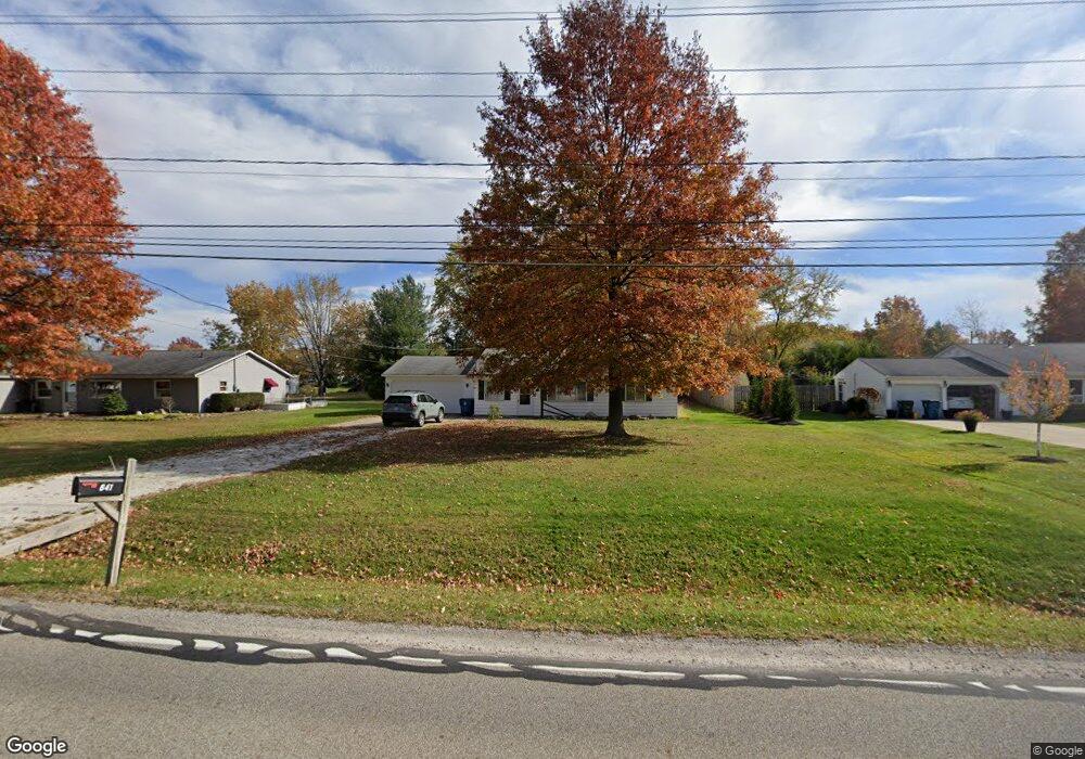
641 Substation Rd Brunswick, OH 44212
Estimated Value: $187,000 - $276,000
3
Beds
2
Baths
1,280
Sq Ft
$183/Sq Ft
Est. Value
About This Home
This home is located at 641 Substation Rd, Brunswick, OH 44212 and is currently estimated at $233,698, approximately $182 per square foot. 641 Substation Rd is a home located in Medina County with nearby schools including Hickory Ridge Elementary School, Willets Middle School, and Brunswick High School.
Ownership History
Date
Name
Owned For
Owner Type
Purchase Details
Closed on
Mar 24, 2023
Sold by
Simon Michael A and Simon Rosemary
Bought by
Simon Jacob M and Simon Jamie C
Current Estimated Value
Home Financials for this Owner
Home Financials are based on the most recent Mortgage that was taken out on this home.
Original Mortgage
$120,000
Outstanding Balance
$116,226
Interest Rate
6.12%
Mortgage Type
New Conventional
Estimated Equity
$117,472
Purchase Details
Closed on
Sep 3, 2021
Sold by
Eschen Debra and Beran Susan
Bought by
Simon Michael A and Simon Rosemary
Create a Home Valuation Report for This Property
The Home Valuation Report is an in-depth analysis detailing your home's value as well as a comparison with similar homes in the area
Home Values in the Area
Average Home Value in this Area
Purchase History
| Date | Buyer | Sale Price | Title Company |
|---|---|---|---|
| Simon Jacob M | $160,000 | -- | |
| Simon Michael A | $140,000 | Revere Title |
Source: Public Records
Mortgage History
| Date | Status | Borrower | Loan Amount |
|---|---|---|---|
| Open | Simon Jacob M | $120,000 |
Source: Public Records
Tax History
| Year | Tax Paid | Tax Assessment Tax Assessment Total Assessment is a certain percentage of the fair market value that is determined by local assessors to be the total taxable value of land and additions on the property. | Land | Improvement |
|---|---|---|---|---|
| 2024 | $3,292 | $54,190 | $25,090 | $29,100 |
| 2023 | $3,123 | $53,720 | $25,090 | $28,630 |
| 2022 | $2,945 | $53,720 | $25,090 | $28,630 |
| 2021 | $2,023 | $41,970 | $19,600 | $22,370 |
| 2020 | $1,838 | $41,970 | $19,600 | $22,370 |
| 2019 | $1,838 | $41,970 | $19,600 | $22,370 |
| 2018 | $1,673 | $37,840 | $17,810 | $20,030 |
| 2017 | $1,675 | $37,840 | $17,810 | $20,030 |
| 2016 | $1,674 | $37,840 | $17,810 | $20,030 |
| 2015 | $1,544 | $35,700 | $16,800 | $18,900 |
| 2014 | $1,541 | $35,700 | $16,800 | $18,900 |
| 2013 | $1,544 | $35,700 | $16,800 | $18,900 |
Source: Public Records
Map
Nearby Homes
- 708 Montgomery Dr
- 803 Substation Rd
- 4936 Chablis Cir
- 5087 Grafton Rd
- 4751 Ruby Ln
- 452 Brambleside Dr
- 4580 Grafton Rd
- 652 Marsh Way
- 5116 Creekside Blvd
- 4571 Elm Ave
- 4776 Aspen Oval
- 298 Substation Rd
- 991 Sugar Maple Ln
- 718 Northfork Way
- 5221 Spruce Pointe Ln
- 455 Edge Park Ln
- 5279 Creekside Blvd Unit T34
- 5279 Creekside Blvd Unit V43
- 5277 Spruce Pointe Ln
- 968 Slate Dr
- 651 Substation Rd
- 629 Substation Rd
- 4819 Aldersyde Cir
- 659 Substation Rd
- 619 Substation Rd
- 4815 Aldersyde Cir
- 4816 Aldersyde Cir
- 638 Substation Rd
- 644 Substation Rd
- 4807 Aldersyde Cir
- 669 Substation Rd
- 630 Substation Rd
- 611 Substation Rd
- 4810 Aldersyde Cir
- 4804 Aldersyde Cir
- 679 Substation Rd
- 601 Substation Rd
- 4799 Aldersyde Cir
- 610 Substation Rd
- 4886 Orchard Dr
Your Personal Tour Guide
Ask me questions while you tour the home.