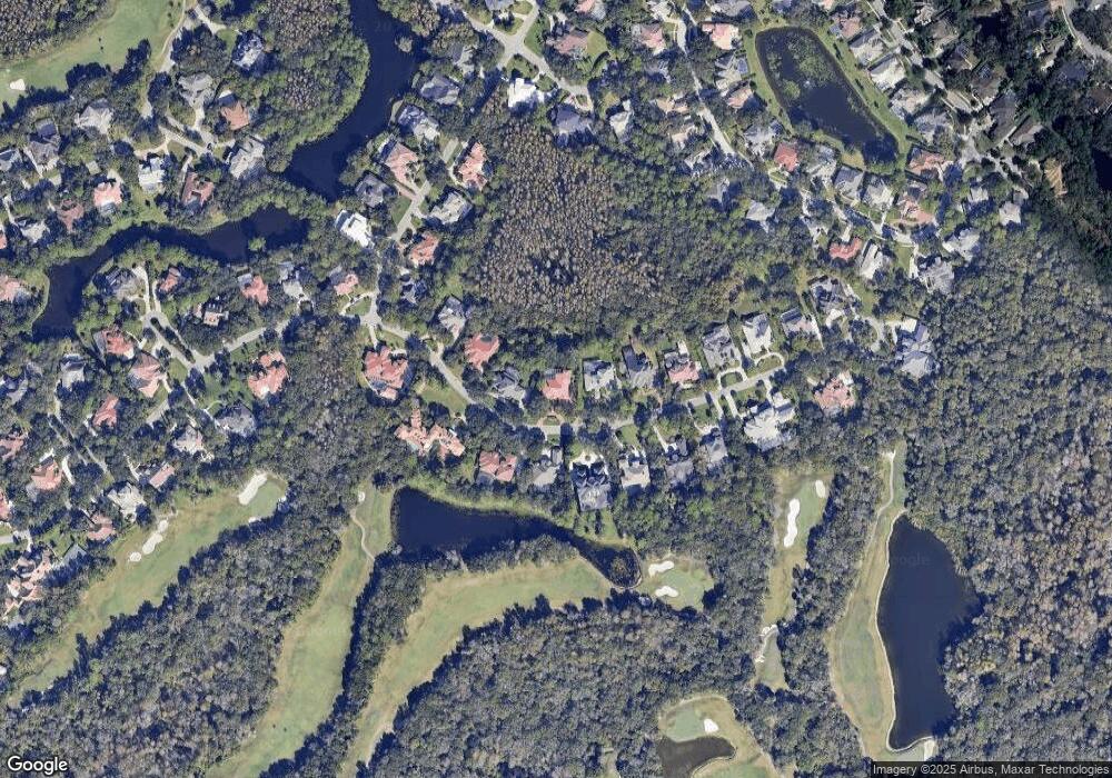
6410 E MacLaurin Dr Unit 2B2 Tampa, FL 33647
Tampa Palms NeighborhoodEstimated Value: $1,262,000 - $1,804,000
5
Beds
5
Baths
4,838
Sq Ft
$317/Sq Ft
Est. Value
About This Home
This home is located at 6410 E MacLaurin Dr Unit 2B2, Tampa, FL 33647 and is currently estimated at $1,533,778, approximately $317 per square foot. 6410 E MacLaurin Dr Unit 2B2 is a home located in Hillsborough County with nearby schools including Tampa Palms Elementary School, Liberty Middle School, and Freedom High School.
Ownership History
Date
Name
Owned For
Owner Type
Purchase Details
Closed on
Jul 8, 2022
Sold by
Newbury Francene M
Bought by
Francene Marie Newbury Trust
Current Estimated Value
Purchase Details
Closed on
Jun 28, 2021
Sold by
Newbury Francene M and Estate Of Edward Michael Newbu
Bought by
Newbury Francene M
Purchase Details
Closed on
Jul 7, 2003
Sold by
Rawlinson John R and Rawlinson Jane
Bought by
Newbury Edward M and Newbury Francene M
Home Financials for this Owner
Home Financials are based on the most recent Mortgage that was taken out on this home.
Original Mortgage
$500,000
Interest Rate
3.25%
Mortgage Type
Unknown
Create a Home Valuation Report for This Property
The Home Valuation Report is an in-depth analysis detailing your home's value as well as a comparison with similar homes in the area
Home Values in the Area
Average Home Value in this Area
Purchase History
| Date | Buyer | Sale Price | Title Company |
|---|---|---|---|
| Francene Marie Newbury Trust | -- | None Listed On Document | |
| Newbury Francene M | -- | None Available | |
| Newbury Edward M | $875,000 | Brokers Title Of New Tampa |
Source: Public Records
Mortgage History
| Date | Status | Borrower | Loan Amount |
|---|---|---|---|
| Previous Owner | Newbury Edward M | $500,000 |
Source: Public Records
Tax History
| Year | Tax Paid | Tax Assessment Tax Assessment Total Assessment is a certain percentage of the fair market value that is determined by local assessors to be the total taxable value of land and additions on the property. | Land | Improvement |
|---|---|---|---|---|
| 2025 | $17,371 | $837,238 | -- | -- |
| 2024 | $17,371 | $813,642 | -- | -- |
| 2023 | $16,922 | $789,944 | $0 | $0 |
| 2022 | $16,323 | $766,936 | $0 | $0 |
| 2021 | $16,077 | $744,598 | $0 | $0 |
| 2020 | $15,912 | $734,318 | $0 | $0 |
| 2019 | $15,654 | $717,808 | $0 | $0 |
| 2018 | $15,544 | $704,424 | $0 | $0 |
| 2017 | $15,351 | $862,722 | $0 | $0 |
| 2016 | $14,943 | $675,744 | $0 | $0 |
| 2015 | $15,041 | $671,047 | $0 | $0 |
| 2014 | $14,986 | $665,721 | $0 | $0 |
| 2013 | -- | $655,883 | $0 | $0 |
Source: Public Records
Map
Nearby Homes
- 6434 Renwick Cir Unit 2C/2D
- 6368 W MacLaurin Dr
- 6324 W MacLaurin Dr
- 6329 W MacLaurin Dr
- 15905 Wainwright Ct
- 15811 Sanctuary Dr
- 6222 Greenwich Dr
- 16036 Bella Woods Dr
- 15818 Fairchild Dr
- 16105 Cambria Ct Unit 2
- 7710 Tuscany Woods Dr
- 15906 Benton Ct
- 16125 Ancroft Ct
- 7878 Tuscany Woods Dr
- 16161 Colchester
- 7309 Yardley Way
- 5100 Burchette Rd Unit 202
- 5100 Burchette Rd Unit 4102
- 5100 Burchette Rd Unit 300
- 5100 Burchette Rd Unit 2701
- 6408 E MacLaurin Dr
- 6412 E MacLaurin Dr
- 6406 E MacLaurin Dr
- 6414 E MacLaurin Dr
- 6409 E MacLaurin Dr
- 6407 E MacLaurin Dr
- 6404 E MacLaurin Dr Unit 2B6
- 6411 E MacLaurin Dr
- 6416 E MacLaurin Dr
- 6413 E MacLaurin Dr
- 6405 E MacLaurin Dr
- 15601 Cochester Rd
- 6415 E MacLaurin Dr
- 6418 E MacLaurin Dr
- 6401 E MacLaurin Dr
- 15603 Cochester Rd
- 6417 E MacLaurin Dr
- 15605 Cochester Rd
- 6420 E MacLaurin Dr
- 15607 Cochester Rd
