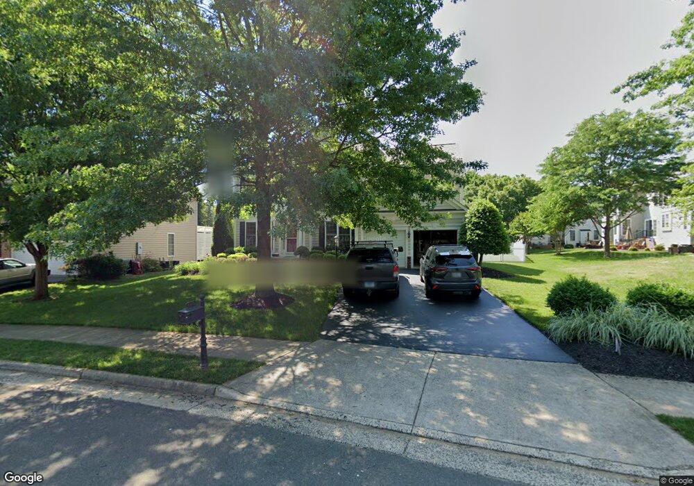
6411 Cedar Brook Ln Warrenton, VA 20187
Estimated Value: $728,779 - $801,000
4
Beds
4
Baths
2,782
Sq Ft
$276/Sq Ft
Est. Value
About This Home
This home is located at 6411 Cedar Brook Ln, Warrenton, VA 20187 and is currently estimated at $766,695, approximately $275 per square foot. 6411 Cedar Brook Ln is a home located in Fauquier County with nearby schools including P.B. Smith Elementary School, Kettle Run High School, and Saint James' Episcopal School.
Ownership History
Date
Name
Owned For
Owner Type
Purchase Details
Closed on
Jul 26, 2005
Sold by
Pulte Home Corp
Bought by
Rhodes Michael D
Current Estimated Value
Home Financials for this Owner
Home Financials are based on the most recent Mortgage that was taken out on this home.
Original Mortgage
$360,000
Outstanding Balance
$189,234
Interest Rate
5.67%
Mortgage Type
New Conventional
Estimated Equity
$577,461
Create a Home Valuation Report for This Property
The Home Valuation Report is an in-depth analysis detailing your home's value as well as a comparison with similar homes in the area
Home Values in the Area
Average Home Value in this Area
Purchase History
| Date | Buyer | Sale Price | Title Company |
|---|---|---|---|
| Rhodes Michael D | $472,000 | -- |
Source: Public Records
Mortgage History
| Date | Status | Borrower | Loan Amount |
|---|---|---|---|
| Open | Rhodes Michael D | $360,000 | |
| Closed | Rhodes Michael D | $59,083 |
Source: Public Records
Tax History Compared to Growth
Tax History
| Year | Tax Paid | Tax Assessment Tax Assessment Total Assessment is a certain percentage of the fair market value that is determined by local assessors to be the total taxable value of land and additions on the property. | Land | Improvement |
|---|---|---|---|---|
| 2025 | $5,380 | $556,400 | $120,000 | $436,400 |
| 2024 | $5,260 | $556,400 | $120,000 | $436,400 |
| 2023 | $5,038 | $556,400 | $120,000 | $436,400 |
| 2022 | $5,038 | $556,400 | $120,000 | $436,400 |
| 2021 | $4,600 | $461,400 | $120,000 | $341,400 |
| 2020 | $4,611 | $462,500 | $120,000 | $342,500 |
| 2019 | $4,611 | $462,500 | $120,000 | $342,500 |
| 2018 | $4,555 | $462,500 | $120,000 | $342,500 |
| 2016 | $4,084 | $391,800 | $120,000 | $271,800 |
| 2015 | -- | $391,800 | $120,000 | $271,800 |
| 2014 | -- | $391,800 | $120,000 | $271,800 |
Source: Public Records
Map
Nearby Homes
- 8183 Major Watters Ct
- 7785 Millfield Dr
- 2 Millfield Dr
- 6288 Redwinged Blackbird Dr
- 0 Walker Dr Unit A-112 VAFQ2015996
- 0 Walker Dr Unit A-113 VAFQ2015994
- 0 Walker Dr Unit A-104 VAFQ2015992
- 0 Walker Dr Unit A-103 VAFQ2015990
- 0 Walker Dr Unit A-102 VAFQ2015988
- 0 Walker Dr Unit A-101 VAFQ2015948
- 252 Onyx Way
- 315 Winterset Ln
- 312 Winterset Ln
- 0 Winterset Ln Unit VAFQ2013748
- 7736 Warrenton Chase Dr
- 156 Lapis Ct Unit 23
- 541 Highland Towne Ln
- 6529 Bob White Dr
- 6589 Bob White Dr
- 173 Autumn Wind Ct
- 6407 Cedar Brook Ln
- 7585 Sweetgum Ct
- 7589 Sweetgum Ct
- 6478 Whites Mill Ln
- 6474 Whites Mill Ln
- 6403 Cedar Brook Ln
- 6410 Cedar Brook Ln
- 6482 Whites Mill Ln
- 6468 Whites Mill Ln
- 6406 Cedar Brook Ln
- 6399 Cedar Brook Ln
- 7584 Sweetgum Ct
- 7586 Sweetgum Ct
- 7578 Sweetgum Ct
- 6466 Whites Mill Ln
- 6400 Cedar Brook Ln
- 7590 Sweetgum Ct
- 6477 Whites Mill Ln
- 7576 Sweetgum Ct
- 6473 Whites Mill Ln