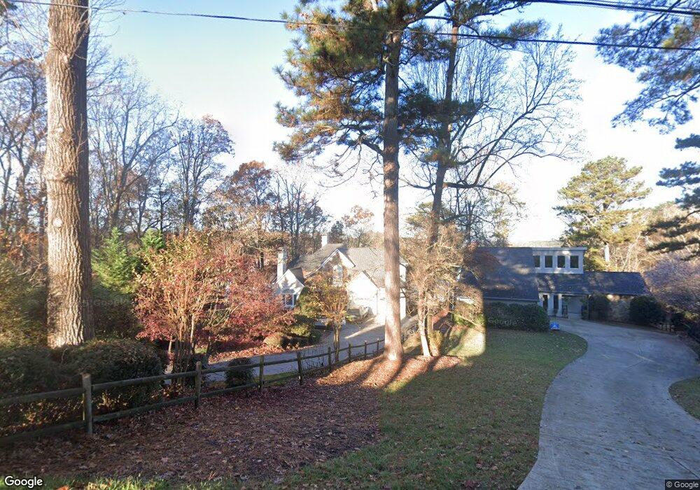
6411 Lakeview Dr Buford, GA 30518
Estimated Value: $1,238,862 - $2,330,000
4
Beds
6
Baths
2,612
Sq Ft
$657/Sq Ft
Est. Value
About This Home
This home is located at 6411 Lakeview Dr, Buford, GA 30518 and is currently estimated at $1,716,621, approximately $657 per square foot. 6411 Lakeview Dr is a home located in Hall County with nearby schools including White Oak Elementary School, Lanier Middle School, and Lanier High School.
Ownership History
Date
Name
Owned For
Owner Type
Purchase Details
Closed on
Oct 26, 2012
Sold by
Swindall Margaret S
Bought by
Erhardt Mark
Current Estimated Value
Purchase Details
Closed on
Jun 16, 2003
Sold by
King Steven C
Bought by
Swindall Margaret S
Home Financials for this Owner
Home Financials are based on the most recent Mortgage that was taken out on this home.
Original Mortgage
$322,700
Interest Rate
5.29%
Mortgage Type
New Conventional
Create a Home Valuation Report for This Property
The Home Valuation Report is an in-depth analysis detailing your home's value as well as a comparison with similar homes in the area
Home Values in the Area
Average Home Value in this Area
Purchase History
| Date | Buyer | Sale Price | Title Company |
|---|---|---|---|
| Erhardt Mark | $560,000 | -- | |
| Swindall Margaret S | $775,000 | -- |
Source: Public Records
Mortgage History
| Date | Status | Borrower | Loan Amount |
|---|---|---|---|
| Previous Owner | Swindall Margaret S | $322,700 |
Source: Public Records
Tax History
| Year | Tax Paid | Tax Assessment Tax Assessment Total Assessment is a certain percentage of the fair market value that is determined by local assessors to be the total taxable value of land and additions on the property. | Land | Improvement |
|---|---|---|---|---|
| 2025 | $3,381 | $451,480 | $236,480 | $215,000 |
| 2024 | $3,617 | $443,120 | $234,320 | $208,800 |
| 2023 | $3,360 | $424,680 | $234,320 | $190,360 |
| 2022 | $2,976 | $334,320 | $168,720 | $165,600 |
| 2021 | $3,095 | $329,320 | $168,720 | $160,600 |
| 2020 | $3,108 | $323,160 | $168,720 | $154,440 |
| 2019 | $3,123 | $316,640 | $168,720 | $147,920 |
| 2018 | $3,160 | $312,000 | $171,000 | $141,000 |
| 2017 | $2,542 | $265,880 | $133,000 | $132,880 |
| 2016 | $2,057 | $238,880 | $106,000 | $132,880 |
| 2015 | $6,618 | $238,880 | $106,000 | $132,880 |
| 2014 | $6,618 | $238,880 | $106,000 | $132,880 |
Source: Public Records
Map
Nearby Homes
- 6381 Lakeview Dr
- 6402 Lakeview Dr
- 6219 Woodlake Dr
- 2210 Lanier Harbor Pointe
- 2079 Lanier Harbor Pointe
- 2075 Pine Tree Dr Unit B2
- 6708 Bass Cir
- 5920 Branden Hill Ln
- 5984 Dolvin Ln
- 6594 Garrett Rd
- 1930 Marina Way
- 2045 Buford Dam Rd
- 5820 Elm Tree Dr Unit 1
- 5995 Lake Windsor Pkwy Unit 1
- 2019 Lanier Harbor Point
- 5904 Basswood Cove
- 2416 Sterling Manor Dr
- 6265 Lake Windsor Pkwy
- 6030 Chimney Springs Rd
- 5561 Shadburn Ferry Rd
- 6413 Lakeview Dr
- 6409 Lakeview Dr
- 6407 Lakeview Dr
- 0 Lakeview Dr Unit 3887758
- 0 Lakeview Dr Unit 3985877
- 6398 Lakeview Dr
- 6384 Lakeview Dr
- 6405 Lakeview Dr
- 6382 Lakeview Dr
- 6391 Lakeview Dr
- 6395 Lakeview Dr
- 6399 Lakeview Dr
- 6378 Lakeview Dr
- 6400 Lakeview Dr
- 6379 Lakeview Dr
- 6404 Lakeview Dr
- 6377 Lakeview Dr
- 6401 Lakeview Dr
- 6376 Lakeview Dr
- 6375 Lakeview Dr
Your Personal Tour Guide
Ask me questions while you tour the home.