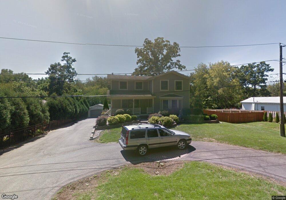
6411 N Shore Ave Spring Grove, IL 60081
Northwest Fox Lake NeighborhoodEstimated Value: $196,236 - $302,000
--
Bed
1
Bath
1,907
Sq Ft
$134/Sq Ft
Est. Value
About This Home
This home is located at 6411 N Shore Ave, Spring Grove, IL 60081 and is currently estimated at $255,059, approximately $133 per square foot. 6411 N Shore Ave is a home located in McHenry County with nearby schools including Spring Grove Elementary School, Nippersink Middle School, and Richmond-Burton High School.
Ownership History
Date
Name
Owned For
Owner Type
Purchase Details
Closed on
Dec 22, 1995
Sold by
Strausbaugh Dan and Gillette Nancy
Bought by
Strausbaugh Dan
Current Estimated Value
Purchase Details
Closed on
Jun 8, 1995
Sold by
Strausbaugh Dan
Bought by
Strausbaugh Dan and Gillette Nancy
Purchase Details
Closed on
Jan 25, 1995
Sold by
Harris Bank Barrington
Bought by
Strausbaugh Dan
Home Financials for this Owner
Home Financials are based on the most recent Mortgage that was taken out on this home.
Original Mortgage
$97,850
Interest Rate
9.28%
Mortgage Type
Purchase Money Mortgage
Create a Home Valuation Report for This Property
The Home Valuation Report is an in-depth analysis detailing your home's value as well as a comparison with similar homes in the area
Home Values in the Area
Average Home Value in this Area
Purchase History
| Date | Buyer | Sale Price | Title Company |
|---|---|---|---|
| Strausbaugh Dan | -- | -- | |
| Strausbaugh Dan | -- | -- | |
| Strausbaugh Dan | $103,000 | -- |
Source: Public Records
Mortgage History
| Date | Status | Borrower | Loan Amount |
|---|---|---|---|
| Closed | Strausbaugh Dan | $97,850 |
Source: Public Records
Tax History Compared to Growth
Tax History
| Year | Tax Paid | Tax Assessment Tax Assessment Total Assessment is a certain percentage of the fair market value that is determined by local assessors to be the total taxable value of land and additions on the property. | Land | Improvement |
|---|---|---|---|---|
| 2024 | $2,907 | $48,445 | $4,901 | $43,544 |
| 2023 | $2,862 | $45,183 | $4,571 | $40,612 |
| 2022 | $2,754 | $39,746 | $4,021 | $35,725 |
| 2021 | $2,598 | $37,468 | $3,791 | $33,677 |
| 2020 | $2,525 | $35,817 | $3,624 | $32,193 |
| 2019 | $2,539 | $35,260 | $3,568 | $31,692 |
| 2018 | $2,582 | $34,170 | $3,458 | $30,712 |
| 2017 | $2,525 | $32,087 | $3,247 | $28,840 |
| 2016 | $2,518 | $30,644 | $3,101 | $27,543 |
| 2013 | -- | $31,376 | $4,089 | $27,287 |
Source: Public Records
Map
Nearby Homes
- 6415 N Shore Ave
- 38265 N State Park Rd
- 38073 N Nippersink Dr
- 38236 N Lee Ave
- 57 Vail Colony Unit 7
- 37902 N West St
- 45 Nassau Colony Unit 4
- 1330 Nippersink Dr
- 59 Vail Colony Unit 3
- 40 Bermuda Colony Unit 7
- 58 Vail Colony Unit 11
- 52 Oak Hill Colony Unit 4
- 56 Vail Colony Unit 5
- 1326 Nippersink Dr
- 7220 State Park Rd
- 37822 N Watts Ave
- 28624 W Kendall Ave
- 37925 N Lake Vista Terrace
- 7003 Bogie Ln
- 37714 N Nippersink Place
- 6405 N Shore Ave
- 6405 N Shore Ave
- LOT 3 N Shore Ave
- 6419 N Shore Ave
- 6417 Muriel Rd
- 6415 Blaine Place
- 6417 Blaine Place
- 6331 N Shore Ave
- 6331 N Shore Ave
- 6416 Blaine Place
- 6416 Blaine Place Unit 3
- 209 Muriel Rd
- 6427 N Shore Ave
- 6422 Blaine Place
- 6412 Maple Ave
- 6412 Maple Ave
- 6325 N Shore Ave
- 6503 Blaine Place
- 6431 N Shore Ave
- 6401 Maple Ave