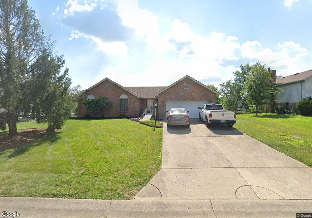
6411 Sharps Ridge Ct Liberty Township, OH 45011
Estimated Value: $324,000 - $361,000
3
Beds
2
Baths
1,720
Sq Ft
$197/Sq Ft
Est. Value
About This Home
This home is located at 6411 Sharps Ridge Ct, Liberty Township, OH 45011 and is currently estimated at $339,516, approximately $197 per square foot. 6411 Sharps Ridge Ct is a home located in Butler County with nearby schools including Heritage Early Childhood School, Cherokee Elementary School, and Lakota Plains Junior School.
Ownership History
Date
Name
Owned For
Owner Type
Purchase Details
Closed on
Jan 2, 1997
Sold by
Young Glen M
Bought by
Mastalski Ed and Mastalski Marie
Current Estimated Value
Home Financials for this Owner
Home Financials are based on the most recent Mortgage that was taken out on this home.
Original Mortgage
$110,400
Interest Rate
7.6%
Mortgage Type
New Conventional
Purchase Details
Closed on
Jun 21, 1994
Sold by
Smith William G
Bought by
Young Glen M and Young Michele
Home Financials for this Owner
Home Financials are based on the most recent Mortgage that was taken out on this home.
Original Mortgage
$108,750
Interest Rate
8.58%
Mortgage Type
New Conventional
Purchase Details
Closed on
Jul 1, 1993
Purchase Details
Closed on
Aug 1, 1991
Create a Home Valuation Report for This Property
The Home Valuation Report is an in-depth analysis detailing your home's value as well as a comparison with similar homes in the area
Home Values in the Area
Average Home Value in this Area
Purchase History
| Date | Buyer | Sale Price | Title Company |
|---|---|---|---|
| Mastalski Ed | $138,000 | -- | |
| Young Glen M | $145,000 | -- | |
| -- | $135,000 | -- | |
| -- | $24,900 | -- |
Source: Public Records
Mortgage History
| Date | Status | Borrower | Loan Amount |
|---|---|---|---|
| Previous Owner | Mastalski Ed | $110,400 | |
| Previous Owner | Young Glen M | $108,750 |
Source: Public Records
Tax History Compared to Growth
Tax History
| Year | Tax Paid | Tax Assessment Tax Assessment Total Assessment is a certain percentage of the fair market value that is determined by local assessors to be the total taxable value of land and additions on the property. | Land | Improvement |
|---|---|---|---|---|
| 2024 | $3,030 | $87,080 | $13,590 | $73,490 |
| 2023 | $3,005 | $87,080 | $13,590 | $73,490 |
| 2022 | $2,801 | $67,040 | $13,590 | $53,450 |
| 2021 | $2,854 | $67,040 | $13,590 | $53,450 |
| 2020 | $2,928 | $67,040 | $13,590 | $53,450 |
| 2019 | $5,669 | $58,850 | $13,560 | $45,290 |
| 2018 | $2,839 | $58,850 | $13,560 | $45,290 |
| 2017 | $2,893 | $58,850 | $13,560 | $45,290 |
| 2016 | $2,763 | $56,300 | $13,560 | $42,740 |
| 2015 | $2,733 | $56,300 | $13,560 | $42,740 |
| 2014 | $2,733 | $56,300 | $13,560 | $42,740 |
| 2013 | $2,733 | $54,650 | $13,560 | $41,090 |
Source: Public Records
Map
Nearby Homes
- 4296 Moselle Dr
- 1 Princeton Rd
- 4628 Beech Knoll Ln
- 4600 Snowbird Dr
- 6406 Whippoorwill Dr
- 4085 Alsace Ln
- 4354 Cody Brook Dr
- 7626 Bridgewater Ln
- 6093 Griffin Ct
- 6077 Snow Hill Dr
- 4077 Bramble Ct
- 4925 Fescue Dr
- 4377 Stone Creek Dr
- 4520 Logsdons Meadow Dr
- 6961 Maple Crest Ct
- 4871 Imperial Dr
- 4004 Bayberry Dr
- 4970 Fescue Dr
- 4983 Fescue Dr
- 4824 Aspen Dr
- 6419 Sharps Ridge Ct
- 6401 Sharps Ridge Ct
- 6418 Chablis Dr
- 6410 Chablis Dr
- 6391 Sharps Ridge Ct
- 6429 Sharps Ridge Ct
- 6428 Chablis Dr
- 6404 Sharps Ridge Ct
- 6402 Chablis Dr
- 6414 Sharps Ridge Ct
- 6394 Sharps Ridge Ct
- 6381 Sharps Ridge Ct
- 6422 Sharps Ridge Ct
- 6438 Chablis Dr
- 6394 Chablis Dr
- 6441 Sharps Ridge Ct
- 6384 Sharps Ridge Ct
- 6432 Sharps Ridge Ct
- 6371 Sharps Ridge Ct
- 6448 Chablis Dr