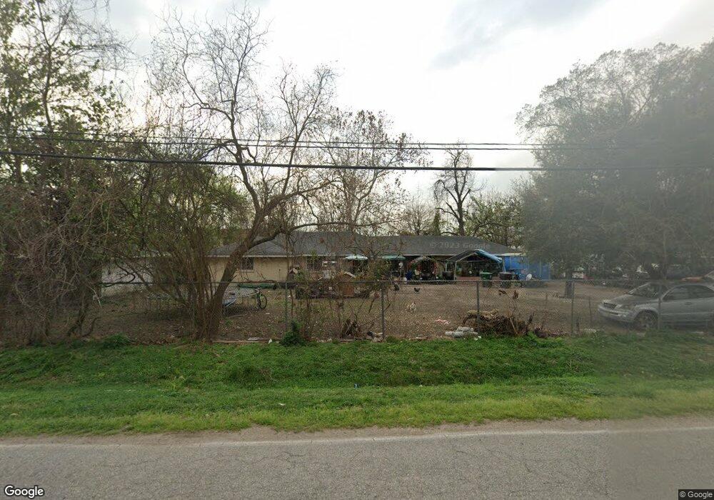
6411 Stuebner Airline Rd Houston, TX 77091
Northside-Northline NeighborhoodEstimated Value: $254,977 - $316,000
3
Beds
2
Baths
1,822
Sq Ft
$158/Sq Ft
Est. Value
About This Home
This home is located at 6411 Stuebner Airline Rd, Houston, TX 77091 and is currently estimated at $287,744, approximately $157 per square foot. 6411 Stuebner Airline Rd is a home located in Harris County with nearby schools including Wesley Elementary School, Williams Middle, and Booker T Washington Sr High.
Ownership History
Date
Name
Owned For
Owner Type
Purchase Details
Closed on
Sep 1, 2004
Sold by
Riles Gloria J and Walker Willie
Bought by
Alvarez Bernardo S and Alvarez Elena H
Current Estimated Value
Home Financials for this Owner
Home Financials are based on the most recent Mortgage that was taken out on this home.
Original Mortgage
$80,800
Outstanding Balance
$39,704
Interest Rate
5.97%
Mortgage Type
Purchase Money Mortgage
Estimated Equity
$248,040
Purchase Details
Closed on
May 18, 2001
Sold by
Bailey Marguerite F
Bought by
Riles Gloria J
Home Financials for this Owner
Home Financials are based on the most recent Mortgage that was taken out on this home.
Original Mortgage
$63,600
Interest Rate
6.99%
Purchase Details
Closed on
Mar 9, 1997
Sold by
Rittenhouse Baptist Church
Bought by
Bailey Marguerite
Create a Home Valuation Report for This Property
The Home Valuation Report is an in-depth analysis detailing your home's value as well as a comparison with similar homes in the area
Home Values in the Area
Average Home Value in this Area
Purchase History
| Date | Buyer | Sale Price | Title Company |
|---|---|---|---|
| Alvarez Bernardo S | -- | First American Title | |
| Riles Gloria J | -- | First American Title | |
| Bailey Marguerite | -- | -- |
Source: Public Records
Mortgage History
| Date | Status | Borrower | Loan Amount |
|---|---|---|---|
| Open | Alvarez Bernardo S | $80,800 | |
| Previous Owner | Riles Gloria J | $63,600 |
Source: Public Records
Tax History Compared to Growth
Tax History
| Year | Tax Paid | Tax Assessment Tax Assessment Total Assessment is a certain percentage of the fair market value that is determined by local assessors to be the total taxable value of land and additions on the property. | Land | Improvement |
|---|---|---|---|---|
| 2025 | $5,141 | $261,000 | $176,400 | $84,600 |
| 2024 | $5,141 | $245,725 | $147,000 | $98,725 |
| 2023 | $5,141 | $245,725 | $147,000 | $98,725 |
| 2022 | $4,440 | $201,625 | $102,900 | $98,725 |
| 2021 | $2,960 | $126,981 | $44,100 | $82,881 |
| 2020 | $2,517 | $103,958 | $29,400 | $74,558 |
| 2019 | $2,631 | $103,958 | $29,400 | $74,558 |
| 2018 | $2,631 | $103,958 | $29,400 | $74,558 |
| 2017 | $2,629 | $103,958 | $29,400 | $74,558 |
| 2016 | $2,629 | $103,958 | $29,400 | $74,558 |
| 2015 | $2,046 | $96,274 | $29,400 | $66,874 |
| 2014 | $2,046 | $79,574 | $29,400 | $50,174 |
Source: Public Records
Map
Nearby Homes
- 609 W Parker Rd
- 0 Pickering St
- 6315 N Shepherd Dr
- 5736 Stuebner Airline Rd
- 6100 Stuebner Airline Rd
- 778 Pickering St
- 422 Surratt Dr
- 522 Surratt Dr
- 434 Yale Oaks Ln
- 824 W Rittenhouse St
- 422 Yale Oaks Ln
- 715 W Rittenhouse Rd
- 6057 Yale St
- 427 Yale Oaks Ln
- 410 Yale Oaks Ln
- 406 Red Ripple Rd
- 6105 Morrow St
- 6610 Morrow St
- 0 Brinkman Unit 54849680
- 334 Yale Oaks Ln
- 6407 Stuebner Airline Rd
- 6415 Stuebner Airline Rd
- 6403 Stuebner Airline Rd
- 6416 Stuebner Airline Rd
- 610 Pickering St
- 6433 Stuebner Airline Rd
- 6420 Stuebner Airline Rd
- 634 Pickering St
- 615 W Parker Rd
- 516 Pickering St
- 6318 Stuebner Airline Rd
- 629 W Parker Rd
- 512 Pickering St
- 517 Pickering St
- 610 W Parker Rd
- 618 W Parker Rd
- 510 Pickering St
- 509 Pickering St
- 622 W Parker Rd
- 626 W Parker Rd