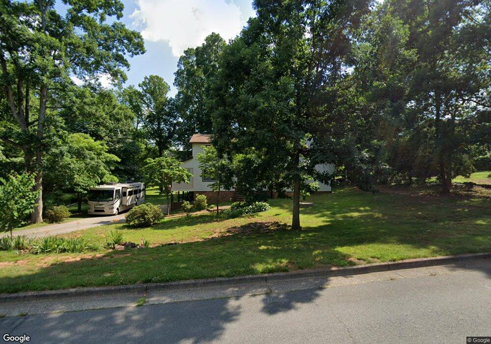
6412 Littlewood Rd Kernersville, NC 27284
Woodbridge NeighborhoodEstimated Value: $400,000 - $412,000
4
Beds
3
Baths
2,733
Sq Ft
$148/Sq Ft
Est. Value
About This Home
This home is located at 6412 Littlewood Rd, Kernersville, NC 27284 and is currently estimated at $405,314, approximately $148 per square foot. 6412 Littlewood Rd is a home located in Forsyth County with nearby schools including Cash Elementary, East Forsyth Middle, and East Forsyth High School.
Ownership History
Date
Name
Owned For
Owner Type
Purchase Details
Closed on
Apr 23, 2002
Sold by
Crump Patrick R
Bought by
Wills Roger Dale and Wills Judith Hayden
Current Estimated Value
Home Financials for this Owner
Home Financials are based on the most recent Mortgage that was taken out on this home.
Original Mortgage
$168,625
Outstanding Balance
$71,199
Interest Rate
7.07%
Estimated Equity
$334,115
Purchase Details
Closed on
Jun 1, 1999
Sold by
Landers Thomas F
Bought by
Crump Patrick R
Home Financials for this Owner
Home Financials are based on the most recent Mortgage that was taken out on this home.
Original Mortgage
$127,200
Interest Rate
6.84%
Create a Home Valuation Report for This Property
The Home Valuation Report is an in-depth analysis detailing your home's value as well as a comparison with similar homes in the area
Home Values in the Area
Average Home Value in this Area
Purchase History
| Date | Buyer | Sale Price | Title Company |
|---|---|---|---|
| Wills Roger Dale | $177,500 | -- | |
| Crump Patrick R | $159,000 | -- |
Source: Public Records
Mortgage History
| Date | Status | Borrower | Loan Amount |
|---|---|---|---|
| Open | Wills Roger Dale | $168,625 | |
| Previous Owner | Crump Patrick R | $127,200 |
Source: Public Records
Tax History Compared to Growth
Tax History
| Year | Tax Paid | Tax Assessment Tax Assessment Total Assessment is a certain percentage of the fair market value that is determined by local assessors to be the total taxable value of land and additions on the property. | Land | Improvement |
|---|---|---|---|---|
| 2025 | $2,944 | $349,600 | $50,000 | $299,600 |
| 2024 | $2,887 | $225,200 | $44,500 | $180,700 |
| 2023 | $2,887 | $225,200 | $44,500 | $180,700 |
| 2022 | $2,877 | $225,200 | $44,500 | $180,700 |
| 2021 | $2,877 | $225,200 | $44,500 | $180,700 |
| 2020 | $2,402 | $175,900 | $33,000 | $142,900 |
| 2019 | $2,402 | $174,600 | $33,000 | $141,600 |
| 2018 | $2,350 | $174,600 | $33,000 | $141,600 |
| 2016 | $2,422 | $180,596 | $38,000 | $142,596 |
| 2015 | $2,372 | $180,596 | $38,000 | $142,596 |
| 2014 | $27 | $180,596 | $38,000 | $142,596 |
Source: Public Records
Map
Nearby Homes
- 6400 Rains Davis Dr
- 203 Christi Ln
- 6416 Lamshire Rd
- 6455 Littlewood Rd
- 6433 Lamshire Rd
- 1505 Cabot Place
- 1504 Cabot Place
- 912 Wimberly Way Ct
- 395 Bent Creek Trail
- 429 Drayton Park Dr
- 503 Bluff School Rd
- 5985 Woodfield Dr
- 5928 Woodfield Dr
- 410 Savannah Ln
- 479 Hopkins Rd
- 113 Finborough Ct
- 5736 Brightington Ct
- 0 Eastcrest Dr
- 221 Oakmont Park Ct
- 6017 Woods Edge Ln
- 6408 Littlewood Rd
- 6423 Rains Davis Dr
- 6415 Rains Davis Rd
- 6404 Littlewood Rd
- 6415 Littlewood Rd
- 6424 Littlewood Rd
- 6423 Rains Davis Rd
- 6411 Littlewood Rd
- 6420 Rains Davis Dr
- 6416 Rains Davis Dr
- 6407 Littlewood Rd
- 6412 Rains Davis Rd
- 6412 Rains Davis Dr
- 6400 Littlewood Rd
- 6425 Littlewood Rd
- 280 Cathi Ln
- 6401 Rains Davis Dr
- 270 Cathi Ln
- 6401 Rains Davis Rd
- 290 Cathi Ln