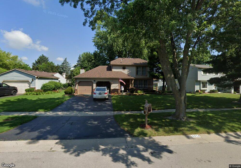
6414 Millbrook Rd Maumee, OH 43537
Estimated Value: $256,000 - $283,000
3
Beds
3
Baths
1,610
Sq Ft
$167/Sq Ft
Est. Value
About This Home
This home is located at 6414 Millbrook Rd, Maumee, OH 43537 and is currently estimated at $269,101, approximately $167 per square foot. 6414 Millbrook Rd is a home located in Lucas County with nearby schools including Holloway Elementary School, Springfield Middle School, and Springfield High School.
Ownership History
Date
Name
Owned For
Owner Type
Purchase Details
Closed on
Jul 13, 2005
Sold by
Luppino John J and Luppino Beth A
Bought by
Luppino John S and Luppino Beth A
Current Estimated Value
Purchase Details
Closed on
Jun 17, 1996
Sold by
Rosquin David R
Bought by
Luppino John S and Luppino Beth A
Home Financials for this Owner
Home Financials are based on the most recent Mortgage that was taken out on this home.
Original Mortgage
$129,500
Interest Rate
8.05%
Mortgage Type
VA
Purchase Details
Closed on
Sep 1, 1994
Sold by
Hepler Clay W
Bought by
Rosquin David R
Home Financials for this Owner
Home Financials are based on the most recent Mortgage that was taken out on this home.
Original Mortgage
$48,500
Interest Rate
4.99%
Mortgage Type
New Conventional
Purchase Details
Closed on
Jun 21, 1989
Sold by
Geyer Michael R and Geyer Beverly
Purchase Details
Closed on
Apr 25, 1988
Sold by
Leek Alan W and Leek June P
Create a Home Valuation Report for This Property
The Home Valuation Report is an in-depth analysis detailing your home's value as well as a comparison with similar homes in the area
Home Values in the Area
Average Home Value in this Area
Purchase History
| Date | Buyer | Sale Price | Title Company |
|---|---|---|---|
| Luppino John S | -- | -- | |
| Luppino Beth A | -- | -- | |
| Luppino John S | $127,000 | -- | |
| Rosquin David R | $120,500 | -- | |
| -- | $106,000 | -- | |
| -- | $95,000 | -- |
Source: Public Records
Mortgage History
| Date | Status | Borrower | Loan Amount |
|---|---|---|---|
| Closed | Luppino John S | $129,500 | |
| Previous Owner | Rosquin David R | $48,500 |
Source: Public Records
Tax History
| Year | Tax Paid | Tax Assessment Tax Assessment Total Assessment is a certain percentage of the fair market value that is determined by local assessors to be the total taxable value of land and additions on the property. | Land | Improvement |
|---|---|---|---|---|
| 2025 | -- | $84,490 | $12,810 | $71,680 |
| 2024 | $2,551 | $84,490 | $12,810 | $71,680 |
| 2023 | $4,167 | $60,235 | $9,415 | $50,820 |
| 2022 | $4,165 | $60,235 | $9,415 | $50,820 |
| 2021 | $3,915 | $60,235 | $9,415 | $50,820 |
| 2020 | $3,730 | $52,045 | $7,875 | $44,170 |
| 2019 | $3,643 | $52,045 | $7,875 | $44,170 |
| 2018 | $3,436 | $52,045 | $7,875 | $44,170 |
| 2017 | $3,259 | $43,365 | $10,220 | $33,145 |
| 2016 | $3,289 | $123,900 | $29,200 | $94,700 |
| 2015 | $3,283 | $123,900 | $29,200 | $94,700 |
| 2014 | $2,929 | $41,730 | $9,840 | $31,890 |
| 2013 | $2,929 | $41,730 | $9,840 | $31,890 |
Source: Public Records
Map
Nearby Homes
- 6418 Scarsdale Rd
- 2001 Perrysburg Holland Rd
- 2165 Glenacres Ct
- 6655 Garden Rd Unit 6655
- 2024 Inglewood Rd
- 6652 Sue Ln
- 6705 Garden Rd Unit 6705
- 6731 Garden Rd Unit 6731
- 6856 Morningdew Blvd
- 36 Wolf Ridge Dr
- 2437 Knights Hill Ln
- 7009 Shadowcreek Dr
- 38 Walnut Creek Dr
- 5741 Heatherbank Rd
- 8939 Airport Hwy
- 5637 Swan Creek Dr
- 2822 Pleasant Hill Rd
- 6640 Salisbury Rd
- 2161 Winterset Dr Unit 2161
- 2324 Mill Race Ct
- 6422 Millbrook Rd
- 6408 Millbrook Rd
- 6439 Scarsdale Rd
- 6433 Scarsdale Rd
- 6428 Millbrook Rd
- 6400 Millbrook Rd
- 6445 Scarsdale Rd
- 6429 Scarsdale Rd
- 6368 Millbrook Rd
- 6451 Scarsdale Rd
- 6421 Scarsdale Rd
- 6403 Millbrook Rd
- 6369 Millbrook Rd
- 6444 Millbrook Rd
- 6360 Millbrook Rd
- 6415 Scarsdale Rd
- 6436 Scarsdale Rd
- 6444 Scarsdale Rd
- 6428 Scarsdale Rd
- 6452 Scarsdale Rd
Your Personal Tour Guide
Ask me questions while you tour the home.