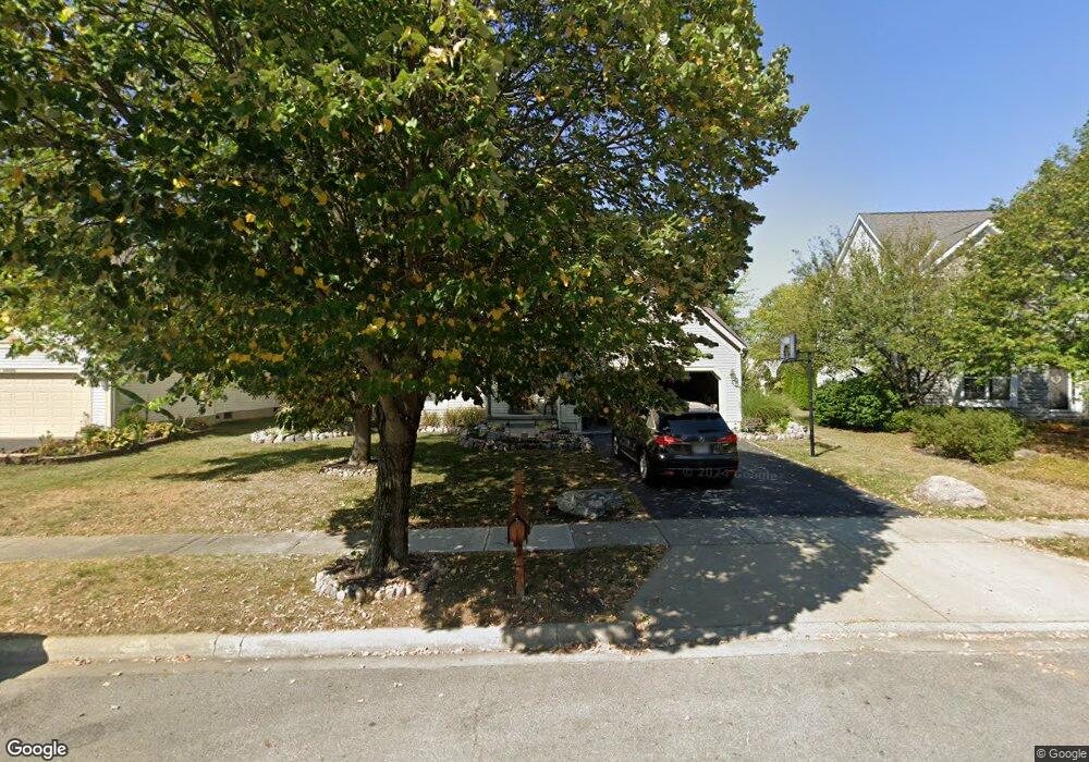
6414 Rossmore Ln Canal Winchester, OH 43110
Estimated Value: $410,032 - $477,000
4
Beds
3
Baths
2,367
Sq Ft
$184/Sq Ft
Est. Value
About This Home
This home is located at 6414 Rossmore Ln, Canal Winchester, OH 43110 and is currently estimated at $436,258, approximately $184 per square foot. 6414 Rossmore Ln is a home located in Franklin County with nearby schools including Winchester Trail Elementary School, Indian Trail Elementary School, and Canal Winchester Middle School.
Ownership History
Date
Name
Owned For
Owner Type
Purchase Details
Closed on
Jul 22, 1997
Sold by
M & I Schottenstein Homes Inc
Bought by
Jeffries Gregory K and Jeffries Alicia K
Current Estimated Value
Home Financials for this Owner
Home Financials are based on the most recent Mortgage that was taken out on this home.
Original Mortgage
$167,200
Interest Rate
7.81%
Mortgage Type
Balloon
Purchase Details
Closed on
Feb 24, 1997
Sold by
Eastside Properties Ptns
Bought by
M/I Schottenstein Homes Inc
Create a Home Valuation Report for This Property
The Home Valuation Report is an in-depth analysis detailing your home's value as well as a comparison with similar homes in the area
Home Values in the Area
Average Home Value in this Area
Purchase History
| Date | Buyer | Sale Price | Title Company |
|---|---|---|---|
| Jeffries Gregory K | $186,900 | Transohio Residential Title | |
| M/I Schottenstein Homes Inc | $34,000 | -- |
Source: Public Records
Mortgage History
| Date | Status | Borrower | Loan Amount |
|---|---|---|---|
| Closed | Jeffries Gregory K | $167,200 |
Source: Public Records
Tax History Compared to Growth
Tax History
| Year | Tax Paid | Tax Assessment Tax Assessment Total Assessment is a certain percentage of the fair market value that is determined by local assessors to be the total taxable value of land and additions on the property. | Land | Improvement |
|---|---|---|---|---|
| 2024 | $6,329 | $113,540 | $34,510 | $79,030 |
| 2023 | $6,293 | $113,540 | $34,510 | $79,030 |
| 2022 | $5,400 | $82,150 | $12,600 | $69,550 |
| 2021 | $5,457 | $82,150 | $12,600 | $69,550 |
| 2020 | $5,444 | $82,150 | $12,600 | $69,550 |
| 2019 | $5,376 | $69,270 | $10,500 | $58,770 |
| 2018 | $5,047 | $69,270 | $10,500 | $58,770 |
| 2017 | $5,047 | $69,270 | $10,500 | $58,770 |
| 2016 | $4,816 | $58,520 | $9,590 | $48,930 |
| 2015 | $4,829 | $58,520 | $9,590 | $48,930 |
| 2014 | $4,520 | $58,520 | $9,590 | $48,930 |
| 2013 | $2,351 | $61,600 | $10,080 | $51,520 |
Source: Public Records
Map
Nearby Homes
- 6430 Rossmore Ln
- 6469 Tallman Ct
- 6185 Dietz Dr
- 6571 Hemmingford Dr
- 6558 Hemmingford Dr
- 6535 Hemmingford Dr
- 7191 Rosemount Way
- 7250 Old Creek Ln
- 6216 Meriden Ct
- 0 Groveport Rd
- 7362 Bromfield Dr
- 7265 Bromfield Dr
- 7288 Bromfield Dr
- 525 Gender Rd
- 7412 Connor Ct
- 963 Groveport Rd
- 180 Woodsview Dr
- 6910 Canal St
- 185 Groveport Pike Unit 11A
- 185 Groveport Pike Unit 14D
- 6406 Rossmore Ln
- 6422 Rossmore Ln
- 6482 Tallman Ct
- 6398 Rossmore Ln
- 6478 Tallman Ct
- 6409 Rossmore Ln
- 6423 Rossmore Ln
- 6390 Rossmore Ln
- 6401 Rossmore Ln
- 6477 Tallman Ct
- 6951 Pearce Ln
- 6391 Rossmore Ln
- 6380 Rossmore Ln
- 6474 Tallman Ct
- 6473 Tallman Ct
- 6965 Pearce Ln
- 6383 Rossmore Ln
- 6956 Pearce Ln
- 6969 Pearce Ln
- 6975 Pearce Ln