Estimated Value: $126,000 - $151,000
Studio
--
Bath
864
Sq Ft
$167/Sq Ft
Est. Value
About This Home
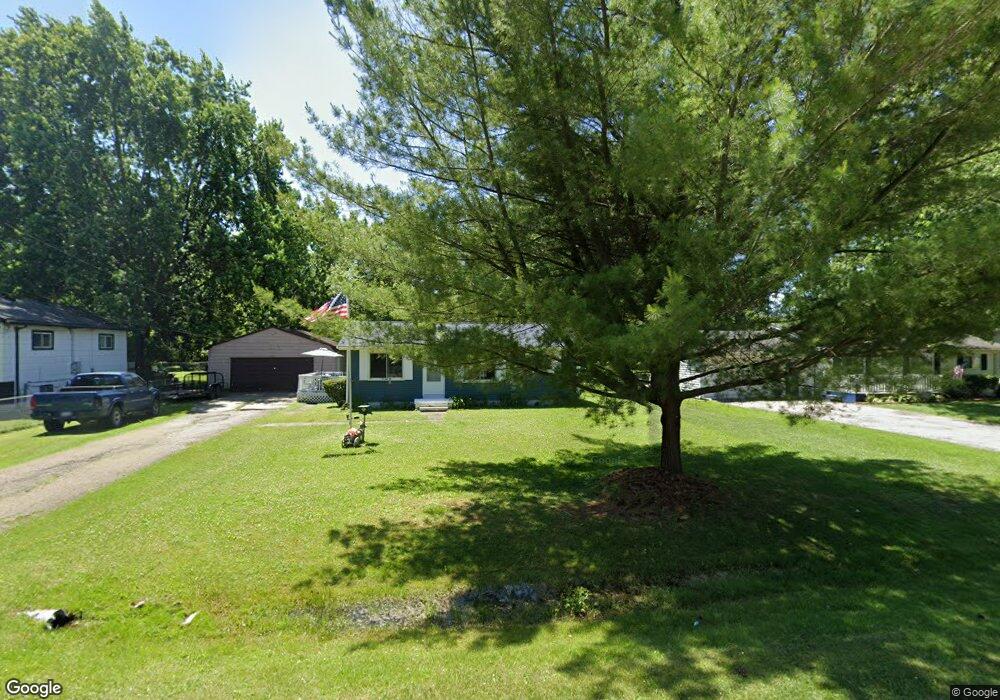
This home is located at 6414 Webb Dr, Flint, MI 48506 and is currently estimated at $144,122, approximately $166 per square foot. 6414 Webb Dr is a home located in Genesee County with nearby schools including Weston Elementary School, Leota Fiedler Elementary School, and Kate Dowdall Elementary School.
Ownership History
Date
Name
Owned For
Owner Type
Purchase Details
Closed on
Mar 1, 2006
Sold by
Mckenzie Francis A and Mckenzie Alan J
Bought by
Simpson Kathy A
Current Estimated Value
Purchase Details
Closed on
Jul 19, 1999
Sold by
Mckenzie Francis A and Mckenzie Jack M
Bought by
Mckenzie Francis A and Mckenzie Alan J
Create a Home Valuation Report for This Property
The Home Valuation Report is an in-depth analysis detailing your home's value as well as a comparison with similar homes in the area
Home Values in the Area
Average Home Value in this Area
Purchase History
| Date | Buyer | Sale Price | Title Company |
|---|---|---|---|
| Simpson Kathy A | $74,400 | Metropolitan Title Company | |
| Mckenzie Francis A | -- | -- |
Source: Public Records
Tax History
| Year | Tax Paid | Tax Assessment Tax Assessment Total Assessment is a certain percentage of the fair market value that is determined by local assessors to be the total taxable value of land and additions on the property. | Land | Improvement |
|---|---|---|---|---|
| 2025 | $1,756 | $53,800 | $0 | $0 |
| 2024 | $313 | $49,600 | $0 | $0 |
| 2023 | $299 | $44,500 | $0 | $0 |
| 2022 | $1,457 | $41,800 | $0 | $0 |
| 2021 | $1,449 | $37,900 | $0 | $0 |
| 2020 | $273 | $34,900 | $0 | $0 |
| 2019 | $269 | $31,000 | $0 | $0 |
| 2018 | $1,401 | $28,200 | $0 | $0 |
| 2017 | $1,364 | $27,300 | $0 | $0 |
| 2016 | $1,357 | $26,300 | $0 | $0 |
| 2015 | $743 | $24,900 | $0 | $0 |
| 2014 | $248 | $22,300 | $0 | $0 |
| 2012 | -- | $22,400 | $22,400 | $0 |
Source: Public Records
Map
Nearby Homes
- 6363 Bluejay Dr
- 6161 Finch Ln
- 6076 E Carpenter Rd
- 3485 N Vassar Rd
- 6443 Richfield Rd
- 4062 N Belsay Rd
- 6054 E Pierson Rd
- 5165 N Irish Rd
- 5177 N Irish Rd
- 1240 N Irish Rd
- 3365 Eastdale Dr
- 5131 E Carpenter Rd
- 5067 Paro Dr
- 329 Hidden Pine Rd
- 4455 N Genesee Rd
- 3296 Mills Acres St
- 312 Black Oak Ct
- 4452 Muriel Dr
- 4465 Market Place
- 3179 Gehring Dr
Your Personal Tour Guide
Ask me questions while you tour the home.