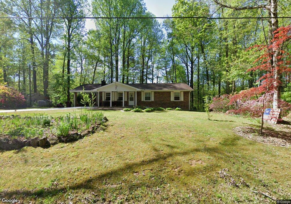
6415 Forsyth Dr Cumming, GA 30028
Estimated Value: $359,000 - $381,324
3
Beds
1
Bath
1,251
Sq Ft
$299/Sq Ft
Est. Value
About This Home
This home is located at 6415 Forsyth Dr, Cumming, GA 30028 and is currently estimated at $373,775, approximately $298 per square foot. 6415 Forsyth Dr is a home located in Forsyth County with nearby schools including Silver City Elementary School, North Forsyth Middle School, and North Forsyth High School.
Ownership History
Date
Name
Owned For
Owner Type
Purchase Details
Closed on
Nov 10, 2003
Sold by
Payne James L
Bought by
Payne James L and Payne Sue
Current Estimated Value
Home Financials for this Owner
Home Financials are based on the most recent Mortgage that was taken out on this home.
Original Mortgage
$120,000
Outstanding Balance
$67,550
Interest Rate
9.2%
Mortgage Type
New Conventional
Estimated Equity
$306,225
Create a Home Valuation Report for This Property
The Home Valuation Report is an in-depth analysis detailing your home's value as well as a comparison with similar homes in the area
Home Values in the Area
Average Home Value in this Area
Purchase History
| Date | Buyer | Sale Price | Title Company |
|---|---|---|---|
| Payne James L | -- | -- |
Source: Public Records
Mortgage History
| Date | Status | Borrower | Loan Amount |
|---|---|---|---|
| Open | Payne James L | $120,000 |
Source: Public Records
Tax History Compared to Growth
Tax History
| Year | Tax Paid | Tax Assessment Tax Assessment Total Assessment is a certain percentage of the fair market value that is determined by local assessors to be the total taxable value of land and additions on the property. | Land | Improvement |
|---|---|---|---|---|
| 2025 | $286 | $137,120 | $77,896 | $59,224 |
| 2024 | $286 | $145,460 | $64,200 | $81,260 |
| 2023 | $185 | $130,100 | $59,920 | $70,180 |
| 2022 | $289 | $85,812 | $42,800 | $43,012 |
| 2021 | $269 | $85,812 | $42,800 | $43,012 |
| 2020 | $260 | $76,012 | $34,240 | $41,772 |
| 2019 | $247 | $71,136 | $34,240 | $36,896 |
| 2018 | $246 | $58,296 | $34,240 | $24,056 |
| 2017 | $248 | $55,260 | $29,960 | $25,300 |
| 2016 | $238 | $48,700 | $25,680 | $23,020 |
| 2015 | $238 | $48,700 | $25,680 | $23,020 |
| 2014 | $211 | $42,660 | $21,400 | $21,260 |
Source: Public Records
Map
Nearby Homes
- 8450 Forsyth Dr
- 6485 Forsyth Dr
- 6820 Lacebark Dr
- 7840 Silversmith Ct
- 7055 Concord Brook Ln
- 8020 Estee Dr
- 7920 Silversmith Dr
- 5950 Clover Terrace
- Shelby Plan at Acacia
- Canton II Plan at Acacia
- Tucker II Plan at Acacia
- Riverside Plan at Acacia
- 6910 Concord Brook Ln
- 7185 Carruthers Way
- 7185 Carruthers Way Unit LOT 26
- 7215 Carruthers Way
- 7225 Carruthers Way
- 7215 Carruthers Way Unit LOT 24
- 7195 Carruthers Way Unit LOT 25
- 7225 Carruthers Way Unit LOT 23
- 0 Forsyth Dr Unit 8550357
- 0 Forsyth Dr Unit 8026491
- 0 Forsyth Dr
- 6425 Blue Ridge Ave
- 6450 Forsyth Dr
- 6365 Forsyth Dr
- 6495 Forsyth Dr
- 6360 Forsyth Dr
- 6465 Forsyth Dr
- 6505 Silver Dr
- 6460 Forsyth Dr
- 6545 Silver Dr
- 6470 Blue Ridge Ave
- 6355 Forsyth Dr
- 6350 Forsyth Dr
- 6475 Forsyth Dr Unit 17-18
- 6475 Forsyth Dr
- 6471 Forsyth Dr
- 6565 Silver Dr
- 6515 Blue Ridge Ave