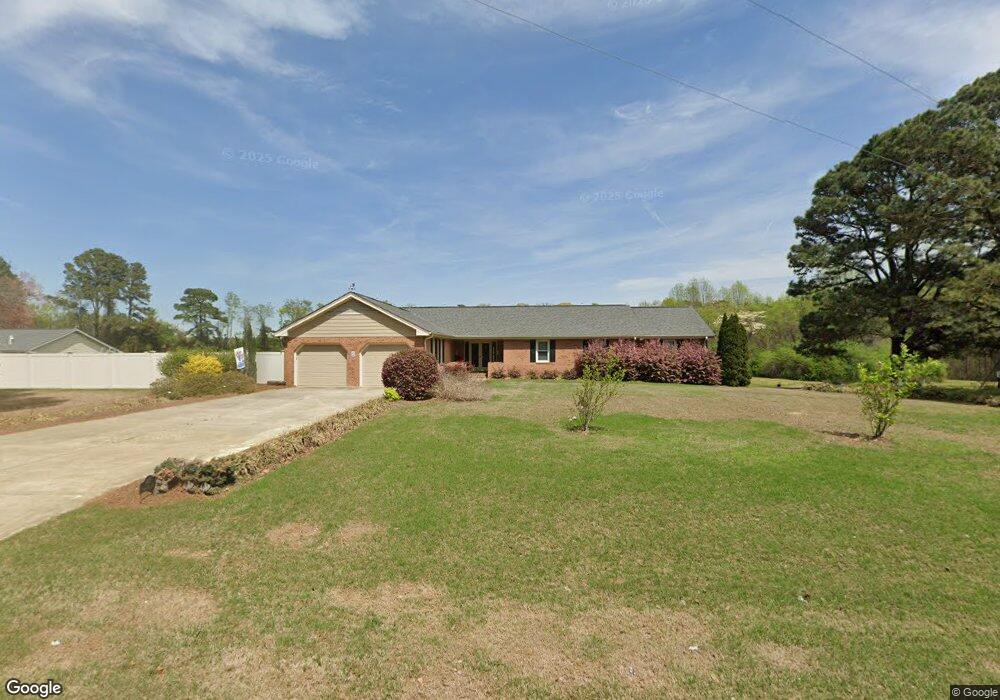
6415 Zacks Mill Rd Angier, NC 27501
Pleasant Grove NeighborhoodEstimated Value: $522,000 - $734,000
3
Beds
3
Baths
2,284
Sq Ft
$279/Sq Ft
Est. Value
About This Home
This home is located at 6415 Zacks Mill Rd, Angier, NC 27501 and is currently estimated at $636,710, approximately $278 per square foot. 6415 Zacks Mill Rd is a home located in Johnston County with nearby schools including McGee's Crossroads Elementary School, McGee's Crossroads Middle School, and West Johnston High School.
Ownership History
Date
Name
Owned For
Owner Type
Purchase Details
Closed on
Aug 2, 2018
Sold by
Perry Gregory Jackson and Perry Diane
Bought by
Mott John C and Mott Arline
Current Estimated Value
Purchase Details
Closed on
Nov 2, 2004
Sold by
Perry Gregory Jackson
Bought by
Mclamb Connie F
Purchase Details
Closed on
Apr 21, 2004
Sold by
Mclamb Connie F
Bought by
Mclamb Larry Dean
Create a Home Valuation Report for This Property
The Home Valuation Report is an in-depth analysis detailing your home's value as well as a comparison with similar homes in the area
Home Values in the Area
Average Home Value in this Area
Purchase History
| Date | Buyer | Sale Price | Title Company |
|---|---|---|---|
| Mott John C | $439,000 | None Available | |
| Mclamb Connie F | $290,000 | -- | |
| Mclamb Larry Dean | -- | -- |
Source: Public Records
Tax History
| Year | Tax Paid | Tax Assessment Tax Assessment Total Assessment is a certain percentage of the fair market value that is determined by local assessors to be the total taxable value of land and additions on the property. | Land | Improvement |
|---|---|---|---|---|
| 2025 | $4,155 | $654,270 | $309,520 | $344,750 |
| 2024 | $2,800 | $345,580 | $116,320 | $229,260 |
| 2023 | $2,252 | $286,820 | $57,560 | $229,260 |
| 2022 | $2,324 | $286,820 | $57,560 | $229,260 |
| 2021 | $2,324 | $286,820 | $57,560 | $229,260 |
| 2020 | $2,410 | $286,820 | $57,560 | $229,260 |
| 2019 | $2,320 | $282,890 | $53,630 | $229,260 |
| 2018 | $0 | $251,350 | $45,440 | $205,910 |
| 2017 | $2,124 | $251,350 | $45,440 | $205,910 |
| 2016 | $2,128 | $251,350 | $45,440 | $205,910 |
| 2015 | $2,131 | $251,350 | $45,440 | $205,910 |
| 2014 | -- | $251,350 | $45,440 | $205,910 |
Source: Public Records
Map
Nearby Homes
- 3361 Old Fairground Rd
- 264 Harbor Cove Dr
- 131 Regal Pond Dr
- Davidson Plan at Cedar Ridge
- Cypress Plan at Cedar Ridge
- McDowell Plan at Cedar Ridge
- Hamilton Plan at Cedar Ridge
- Colfax Plan at Cedar Ridge
- Edgefield Plan at Cedar Ridge
- Cooper Plan at Cedar Ridge
- Wescott Plan at Cedar Ridge
- 2821 Old Fairground Rd
- 506 Harbor Cove Dr
- 139 Bounty Cir
- 179 Camden Dr
- 197 Silverside Dr
- 105 Pinecrest Dr
- 16 Keystone Ct
- 810 | 850 Wiggins Rd
- 232 Burrage Dr
- 6434 Zacks Mill Rd
- 3225 Old Fairground Rd
- 6390 Zacks Mill Rd
- 3155 Old Fairground Rd
- 6324 Zacks Mill Rd
- 6337 Zack's Mill Rd
- 3317 Old Fairground Rd
- 1300 Greenleaf Rd
- 6277 Wilson McGee Zacks Pond
- 3068 Old Fairground Rd
- 3375 Old Fairground Rd
- 1230 Greenleaf Rd
- 6239 Zacks Mill Rd
- 6337 Zacks Mill Rd
- 1338 Greenleaf Rd
- 1318 Greenleaf Rd
- 6203 Zacks Mill Rd
- 1156 Greenleaf Rd
- 1220 Greenleaf Rd
- 2973 Old Fairground Rd