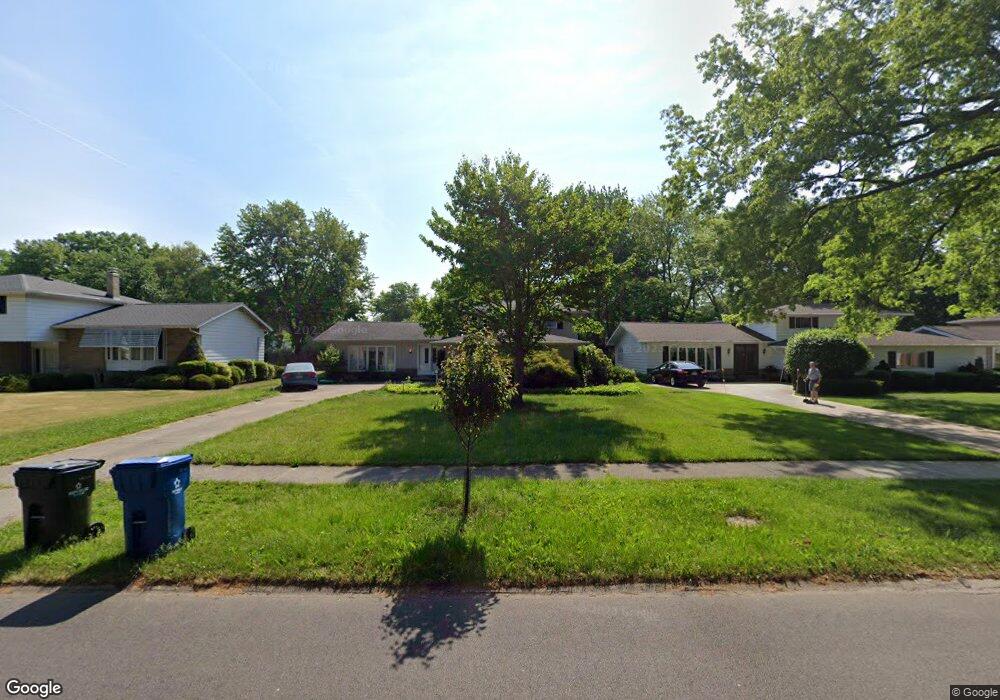
6417 Christman Dr North Olmsted, OH 44070
Estimated Value: $333,722 - $366,000
3
Beds
2
Baths
2,610
Sq Ft
$134/Sq Ft
Est. Value
About This Home
This home is located at 6417 Christman Dr, North Olmsted, OH 44070 and is currently estimated at $349,431, approximately $133 per square foot. 6417 Christman Dr is a home located in Cuyahoga County with nearby schools including Chestnut Intermediate Elementary School, Pine Intermediate School, and North Olmsted Middle School.
Ownership History
Date
Name
Owned For
Owner Type
Purchase Details
Closed on
Feb 16, 2001
Sold by
Musiel Russell J
Bought by
Larson Michael S and Larson Julie A
Current Estimated Value
Home Financials for this Owner
Home Financials are based on the most recent Mortgage that was taken out on this home.
Original Mortgage
$75,000
Outstanding Balance
$27,051
Interest Rate
7.06%
Estimated Equity
$322,381
Purchase Details
Closed on
Sep 12, 1986
Sold by
Christopher John
Bought by
Musiel Russell J
Purchase Details
Closed on
Feb 29, 1980
Sold by
Kandrac Stephen C
Bought by
Christopher John
Purchase Details
Closed on
Feb 25, 1977
Sold by
Hurd-Gibson-Mikolay Inc
Bought by
Kandrac Stephen C
Purchase Details
Closed on
Nov 19, 1976
Sold by
Johnson Allen B and Johnson Anita L
Bought by
Hurd-Gibson-Mikolay Inc
Purchase Details
Closed on
Jan 1, 1975
Bought by
Johnson Allen B and Johnson Anita L
Create a Home Valuation Report for This Property
The Home Valuation Report is an in-depth analysis detailing your home's value as well as a comparison with similar homes in the area
Home Values in the Area
Average Home Value in this Area
Purchase History
| Date | Buyer | Sale Price | Title Company |
|---|---|---|---|
| Larson Michael S | $174,000 | Insignia Title Agency Ltd | |
| Musiel Russell J | $81,000 | -- | |
| Christopher John | $77,000 | -- | |
| Kandrac Stephen C | $58,000 | -- | |
| Hurd-Gibson-Mikolay Inc | $59,000 | -- | |
| Johnson Allen B | -- | -- |
Source: Public Records
Mortgage History
| Date | Status | Borrower | Loan Amount |
|---|---|---|---|
| Open | Larson Michael S | $75,000 |
Source: Public Records
Tax History Compared to Growth
Tax History
| Year | Tax Paid | Tax Assessment Tax Assessment Total Assessment is a certain percentage of the fair market value that is determined by local assessors to be the total taxable value of land and additions on the property. | Land | Improvement |
|---|---|---|---|---|
| 2024 | $6,325 | $92,295 | $18,865 | $73,430 |
| 2023 | $6,263 | $76,685 | $14,840 | $61,845 |
| 2022 | $6,230 | $76,690 | $14,840 | $61,850 |
| 2021 | $5,638 | $76,690 | $14,840 | $61,850 |
| 2020 | $5,439 | $65,520 | $12,670 | $52,850 |
| 2019 | $5,293 | $187,200 | $36,200 | $151,000 |
| 2018 | $5,187 | $65,520 | $12,670 | $52,850 |
| 2017 | $5,091 | $57,200 | $11,030 | $46,170 |
| 2016 | $5,046 | $57,200 | $11,030 | $46,170 |
| 2015 | $4,925 | $57,200 | $11,030 | $46,170 |
| 2014 | $4,925 | $55,510 | $10,710 | $44,800 |
Source: Public Records
Map
Nearby Homes
- 29667 Bretton Ridge Dr
- 6723 Warrington Dr
- 6305 Christman Dr
- 6321 Brighton Dr
- 6617 Sutton Dr
- 6281 Christman Dr
- 0 Stearns Rd
- 29861 Wellington Dr
- 6580 Barton Rd
- 30247 Lorain Rd
- 29408 Stewart Dr
- 30630 Lorain Rd
- 28628 Aspen Dr
- 28625 Elder Dr
- 7100 Barton Rd
- 5833 Stearns Rd
- 5920 Sherwood Dr
- 6427 Mackenzie Rd
- 28130 Angela Dr
- 30241 Sugar Sand Ln Unit 14B
- 6474 Christman Dr
- 6487 Surrey Dr
- 6462 Christman Dr
- 6475 Surrey Dr
- 6501 Surrey Dr
- 29723 Sutton Dr
- 29755 Sutton Dr
- 6463 Surrey Dr
- 29787 Sutton Dr
- 6450 Christman Dr
- 29663 Sutton Dr
- 6461 Christman Dr
- 29819 Sutton Dr
- 6451 Surrey Dr
- 6438 Christman Dr
- 6449 Christman Dr
- 29851 Sutton Dr
- 6439 Surrey Dr
- 29599 Sutton Dr
- 6426 Christman Dr